Pernes British Cemetery
- Country France
- Total identified casualties 1098 Find these casualties
- Region Pas de Calais
- Identified casualties from First & Second World War
- GPS Coordinates Latitude: 50.48333, Longitude: 2.3958
Location information
Pernes-en-Artois is a small town on the main road from Lillers to St. Pol. The British Cemetery is nearly one kilometre west of the town on the road to Sains-les-Pernes.
Visiting information
ARRIVAL
The cemetery is signposted.
PARKING
There is a paved car park with space for up to 3 vehicles on the eastern side of the cemetery, at the end of a dead-end road. There is a footpath leading from the parking area to the front of the cemetery entrance. The footpath is compacted gravel.
There is no parking along the front of the cemetery along the main road (D70)
There is a similar car park on the western side of the cemetery, at the far end of the cemetery along the paved farm track. This can be used when requiring step-free access.
ACCESS LAYOUT AND MAIN ENTRANCE
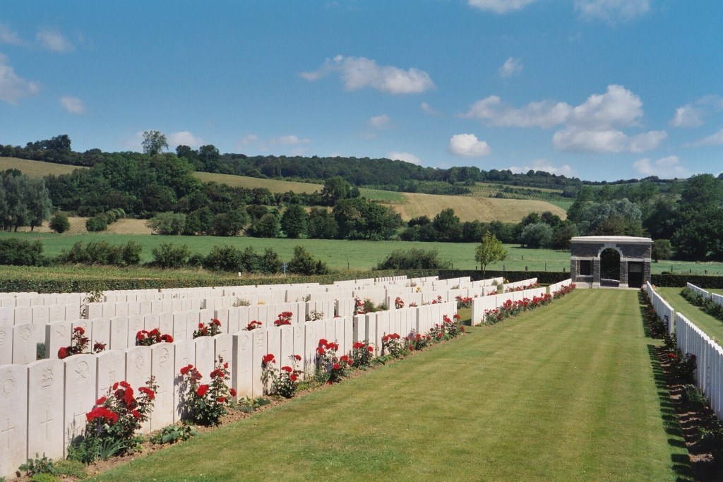
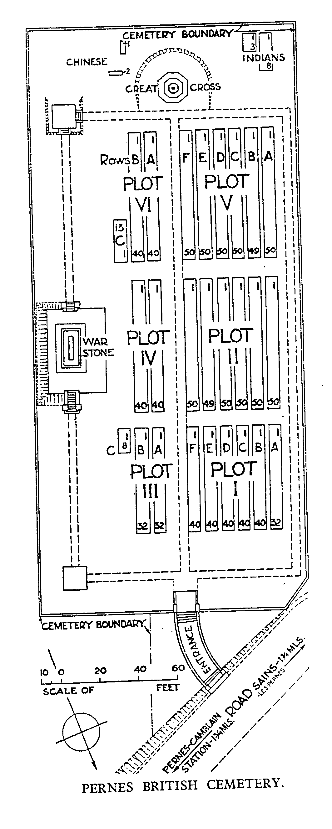
The cemetery is rectangular shaped with a gravel pathway leading from the car park on the eastern side, along the front of the cemetery to a paved agricultural track on the west side of the cemetery,
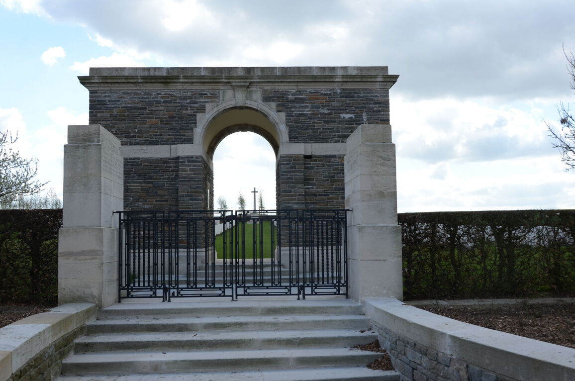
There is a short, three metre wide, compacted red gravel ramp leading from the gravel path along the front of the cemetery up to the entrance building. The gradient is shallow and leads to five steps in front of the entrance building.
At the top of the steps is a mid-level (thigh height), two metre wide black, two leaf metal gate. The right-side section is opened with a lever handle at the top of the gate. The left-side section can be opened lifting a vertical latch at the bottom of the gate. Both sections open inwards. An additional three steps lead up into the central arch leading into the cemetery.
The Register Box is on the left side of the entrance archway.
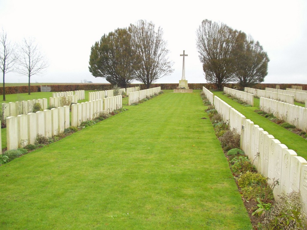
A single step down from the archway leads to the grass burial area.
There is a stone bench seating area inside the chapel on the right side of the archway viewed from inside the cemetery.
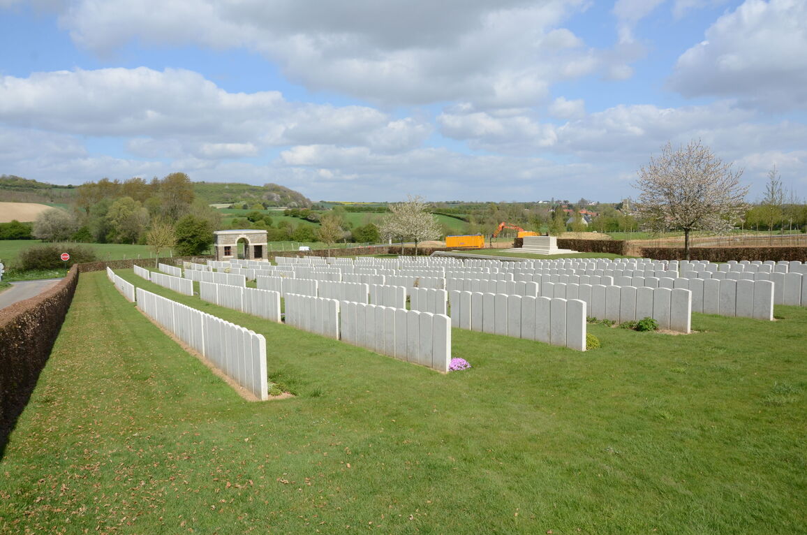
The Cross of Sacrifice is located at the far end of the cemetery, in line with the entrance building.
The Stone of Remembrance is on the left side of the cemetery on a raised platform. Eight steps lead up on the side closet to the entrance to a level grass platform, and a sloped grass area on the opposite side offers step-free access. The ground drops down up to one metre along the front of the platform down into the burial area.
The cemetery is on a steady slope that runs uphill from the main entrance to the Cross of Sacrifice at the rear of the cemetery.
ALTERNATIVE ACCESS
Follow the farm track on the right side of the cemetery from the main entrance, a distance of approximately 100 metres from the main road. There is a paved parking area to the rear of the cemetery. Ten metres from the parking is a 2-metre-wide gap in the hedge, in line with the Cross of Sacrifice. Compacted gravel with a ramped stone paving slab leads directly onto grass.
ADDITIONAL INFORMATION
The cemetery is permanently open.
History information
The cemetery was not begun until April 1918 when the 1st and 4th Canadian Casualty Clearing Stations came to Pernes, driven back by the German advance. In May, the 6th and 22nd Clearing Stations arrived and in August, they were joined by the 13th. Almost all the burials were made by these units, but a few of the graves were brought into the cemetery after the Armistice (Graves 2 to 13 in Plot VI, Row C, were brought from the small British Cemeteries of Anvin and Wavrans).
There are now 1,078 First World War burials in this cemetery and 18 graves from the Second World War, all of the latter dating from 3-4 September 1944. There are also 3 non Commonwealth burials here.
The cemetery was designed by Sir Edwin Lutyens.