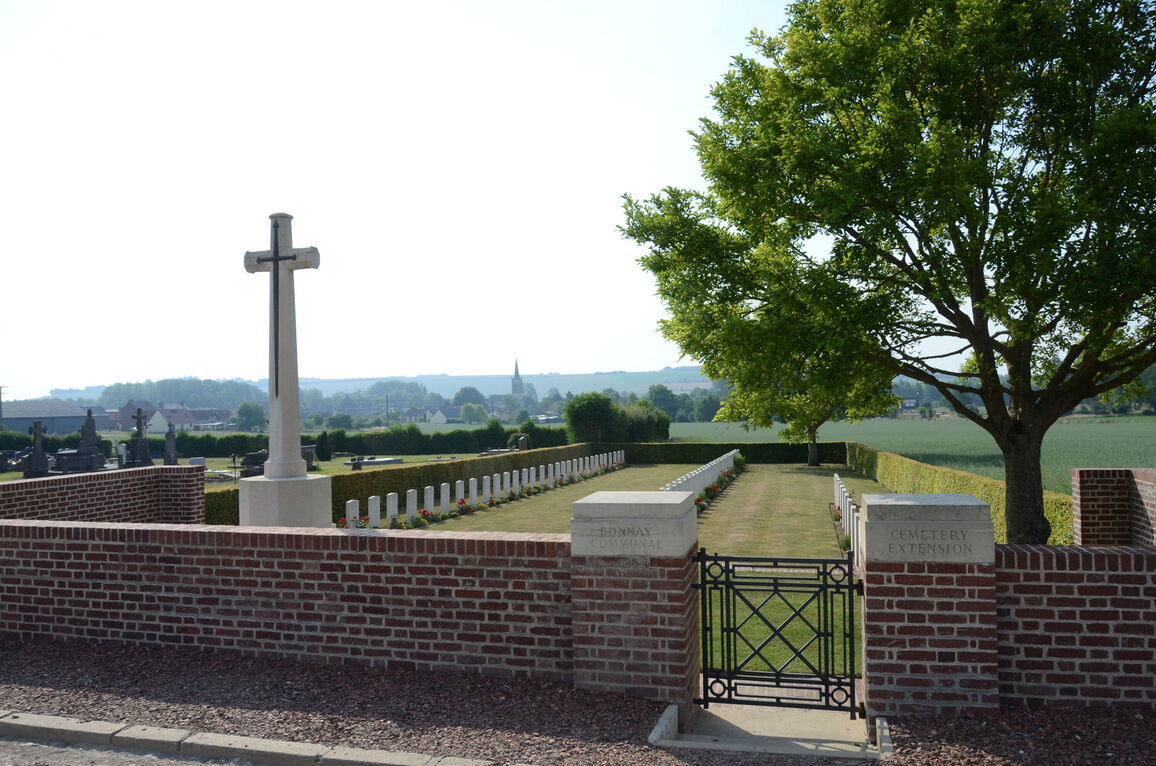
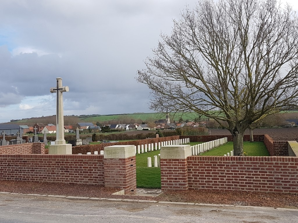
Bonnay Communal Cemetery Extension
- Country France
- Total identified casualties 106 Find these casualties
- Region Somme
- Identified casualties from First World War
- GPS Coordinates Latitude: 49.93734, Longitude: 2.50437
Location information
Bonnay is a village and commune in the Department of the Somme, on the north-west bank of the River Ancre, 3 kilometres north of Corbie.
Leave Corbie heading north on the D1 to Bray-sur-Somme, then turn left on the D23 in the direction of Bonnay - Acheux-en-Amiens, heading north-west. Travel through the village of Bonnay (D23) towards Doullens and 0.3 kilometres after exiting Bonnay, turn left at the first CWGC signpost. Carry on for another 0.3 kilometres and Bonnay Communal Cemetery Extension is on the left hand side of the small road.
Visiting information
ARRIVAL
The cemetery is signposted.
PARKING
It is possible to park along the front of the cemetery at the side of the approach road, Chemin de Franvillers, next to the hedge, within 1 metre of the entrance to the civilian cemetery and 10 metres from the entrance to the CWGC extension.
The ground is flat and firm with a tarmac surface.
ACCESS LAYOUT AND MAIN ENTRANCE
There are two stone steps down from the level of the main road to the main gate; care should be taken stepping down. There is paving under the entrance gate.
The main gate is a mid-level, thigh height, black metal gate with an up and down latch on the top left corner. The gate is approximately 900 mm wide and opens into the cemetery. There is a brick paved area inside the gate, approximately 600 mm wide level with the grass in the cemetery.
The main gate opens onto flat and firm grass.
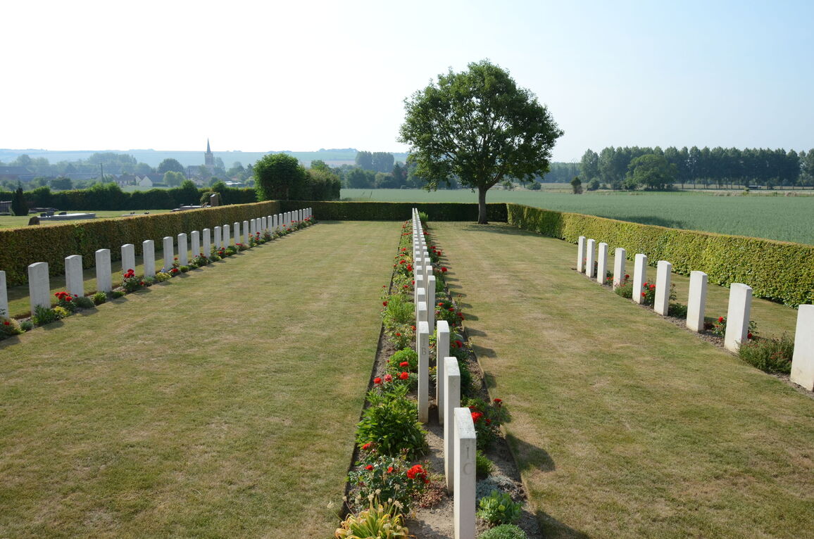
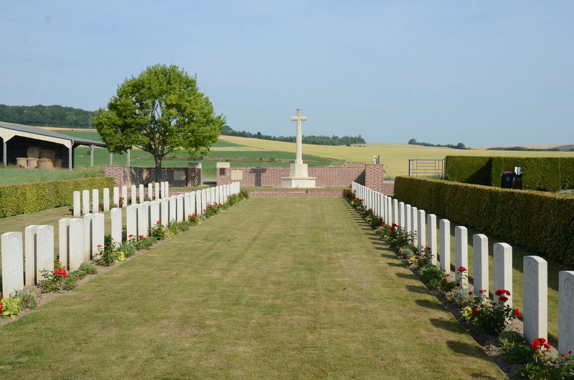
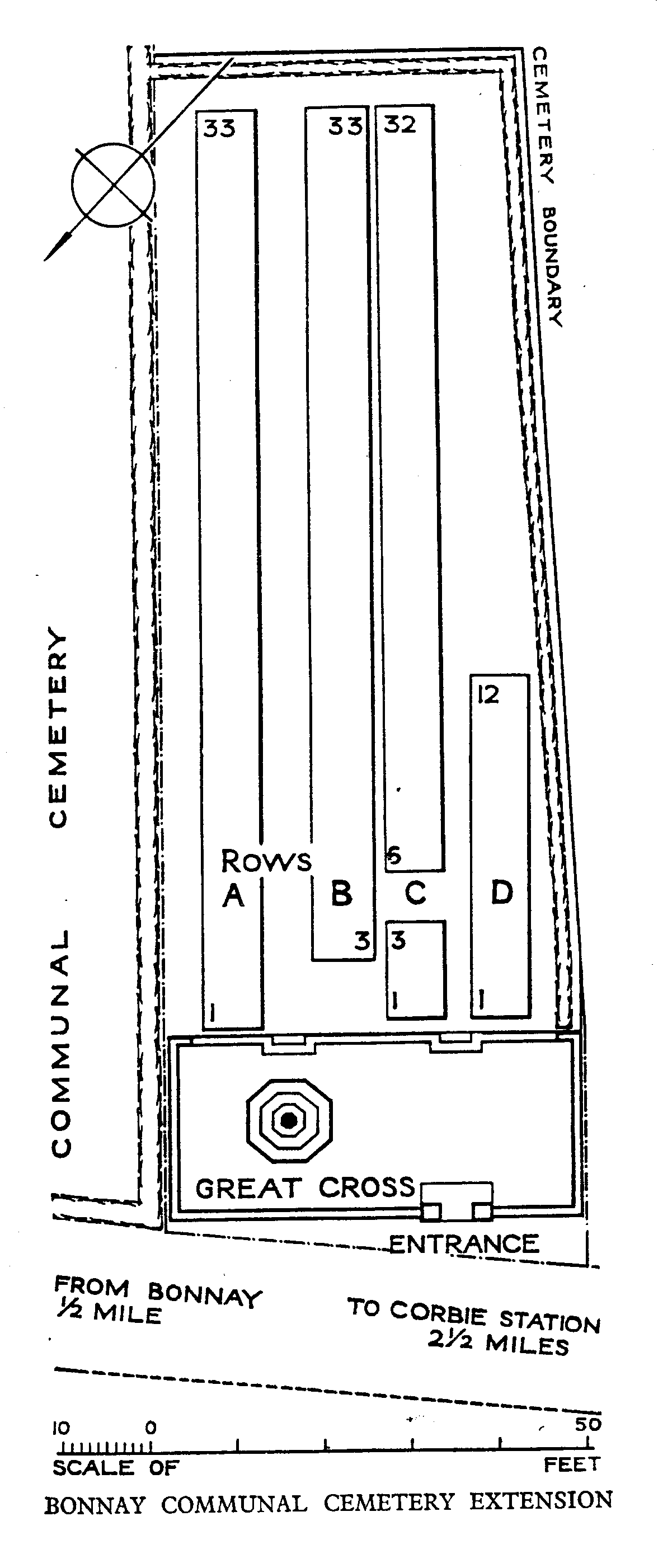
The Cross of Sacrifice is located to the left of the entrance gate. The Cross and surrounding grass is bound along the width of the cemetery by a low brick wall level with the grass on the upper level. Two steps built into the brick wall lead down in two locations; in line with the entrance and in front of the Cross.
The Register Box is built into the left entrance gate pillar on the inside of the cemetery.
Internal paths are grass, ground is flat and firm.
ALTERNATIVE ACCESS
To the left of the main entrance a 3-metre-wide grey metal gate, opening into the communal cemetery. Five metres to the right of the gate is a gap of 1.50 metres between a wall and hedge, allowing step-free access into the lower CWGC section.
In the middle of the gate, at the bottom are up-down latch handles. The gate is pushed forward to open.
The alternative entrance has flat and firm ground with a combination of loose gravel and grass surfaces.
ADDITIONAL INFORMATION
The cemetery is permanently open.
History information
Bonnay Communal Cemetery Extension was used from 1 April to 24 August 1918. The earlier burials are connected with the actions of Villers-Bretonneux, when the line was re-established by the 4th and 5th Australian and 18th Divisions after the German advance, and then later with the Battle of Amiens.
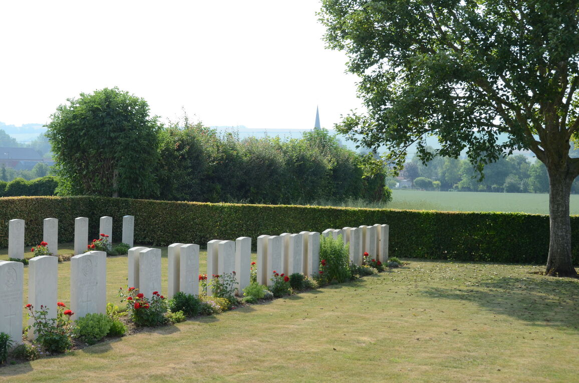
The extension contains 106 Commonwealth burials of the First World War.
The extension was designed by W H Cowlishaw. The Cross of Sacrifice was unveiled by the Prime Minister of Australia in August 1921.