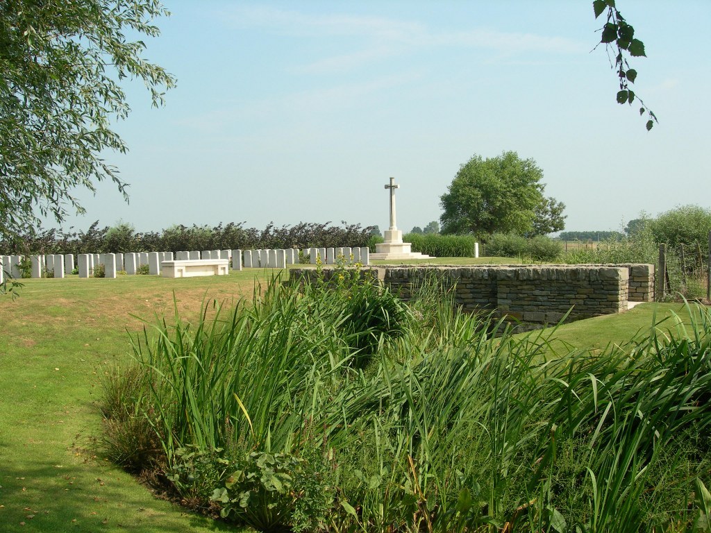
Grootebeek British Cemetery
- Country Belgium
- Total identified casualties 109 Find these casualties
- Region West-Vlaanderen
- Identified casualties from First & Second World War
- GPS Coordinates Latitude: 50.8259, Longitude: 2.78227
Location information
Grootebeek British Cemetery is located 8 km west of Ieper town centre on the Bellestraat, a road leading from the N308 connecting Ieper to Poperinge via Vlamertinge.
From Ieper town centre the Poperingseweg (N308), is reached via Elverdingsestraat then directly over two small roundabouts in the J. Capronstraat. The Poperingseweg is a continuation of the J. Capronstraat and begins after a prominent railway level crossing.
On reaching the village of Vlamertinge take the left hand turning onto the Bellestraat, after crossing the N38 Ieper Poperinge road the cemetery lies a further 5 km along the Bellestraat which changes its name to Vlamertingseweg. The site is on the right hand side of the road in the hamlet of Ouderdom.
Visiting information
ARRIVAL
The cemetery is in agricultural fields 150 metres from the main road and parking area. The cemetery is signposted at the end of the track leading to the cemetery.
There is a mid-level (chest height) barbed-wire fence on either side of the track.
The path surface is grass, the ground is flat and firm.
PARKING
It is possible to park at the side of the main road in the nearest residential area, where there is room for 3 vehicles.
The ground is firm with a cobblestone footpath and tarmac road adjacent. There is a curved recessed cobble rain gully between the footpath and the road.
The distance from the parking area to the main gate is over 150 metres, following a mowed grass track.
ACCESS LAYOUT AND MAIN ENTRANCE
The grass track from the road splits into 2 legs approximately 100 metres from the road.
The left-hand leg crosses a ditch with a grass surface and leads to an upward-sloped area that leads into the cemetery. The right-hand leg leads to a cobbled stone bridge. The bridge crosses a ditch running along the front of the cemetery. The bridge is 150 centimetres wide and 8 metres long. The bridge surface is a combination of smooth paving and cobbles leading to 3 white stone steps on the far side of the bridge. The steps lead up to the burial area.
The Cross of Sacrifice is to the right of the bridge, at the top end of the cemetery.
There is a stone bench between the bridge and the burial area.
The Register Box is mounted into a low-level wall along the left side of the bridge.
All the internal cemetery paths are grass, the ground is firm. The ground surface is undulating and bumpy with a few grass mounds and banks.
ALTERNATIVE ACCESS
The left-hand track follows a straight and direct path on grass into the cemetery and provides unrestricted access, though the ground is undulating and climbs to the burial area.
ADITIONAL INFORMATION
The cemetery is in agricultural fields. There is a ditch around the perimeter of the cemetery. The ditch is deep and can be obscured by weeds during the summer months. The water can be quite deep during periods of rain.
The cemetery is permanently open.
History information
The village of Reninghelst was in Allied hands from the autumn of 1914 to the end of the First World War. From March 1915, Commonwealth burials were made in the Churchyard, the Churchyard Extension and the New Military Cemetery, but in April 1918, during the Battles of the Lys, a new cemetery was made by field ambulances and fighting units near the hamlet of Ouderdom, on the Poperinghe-Wytschaete road. It was originally called OUDERDOM MILITARY CEMETERY, but later renamed Grootebeek British Cemetery, from the stream (Grootebeek, or Groote Kemmelbeek) which runs beside it. It was used at intervals until the end of September 1918 and it absorbed a small Indian cemetery made on the spot in April 1915.
The cemetery contains 109 Commonwealth burials and commemorations of the First World War. One grave destroyed by shell fire is now represented by a special memorial, and another special memorial records the name of Pte J. Lynn, VC, who was buried in Vlamertinghe Churchyard but whose grave was similarly destroyed. The two Second World War burials date from May 1940 and the withdrawal of the British Expeditionary Force ahead of the German advance.
The cemetery was designed by W.H. Cowlishaw.


