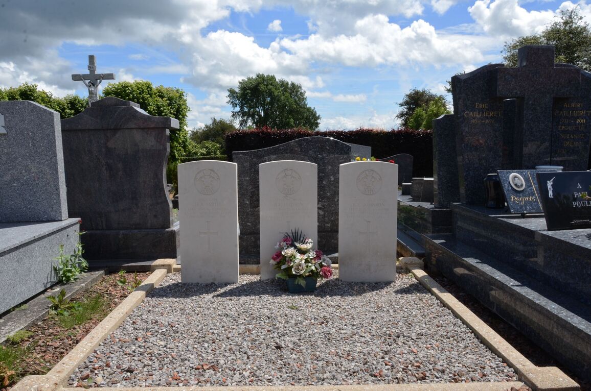
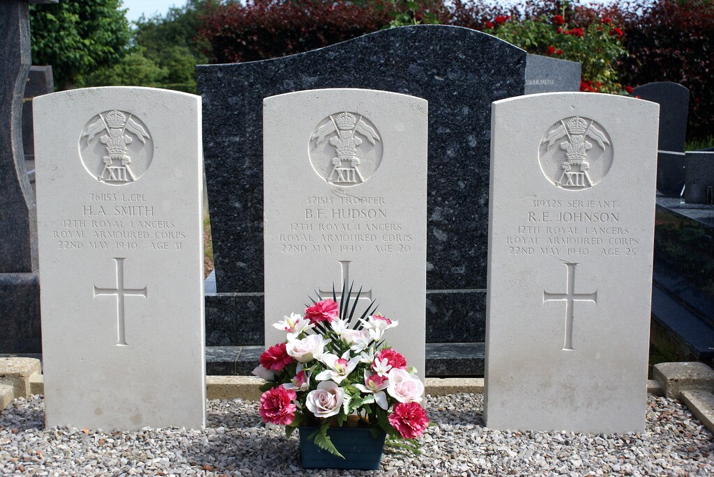
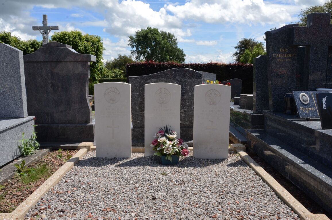
Camblain L'abbe Communal Cemetery
- Country France
- Total identified casualties 3 Find these casualties
- Region Pas de Calais
- Identified casualties from Second World War
- GPS Coordinates Latitude: 50.37094, Longitude: 2.63538
Location information
Camblain-L'Abbe is a village and commune about 8 miles (13 kilometres) north-west of Arras, on the N.341 road to Boulogne. The nearest railway station is about 2 miles (3 kilometres) to the south-west, at Aubigny-en-Artois on the Arras-Boulogne line, where taxis are available. The Arras-Bruay bus route goes through the village. The communal cemetery is on the southern side of the village in a third class road leading to the neighbouring village of Capelle-Fermont. In the southern part, about 36 yards south-west of the Calvary, are the graves of three soldiers from the United Kingdom.