Ranville War Cemetery
- Country France
- Total identified casualties 2418 Find these casualties
- Region Calvados
- Identified casualties from Second World War
- GPS Coordinates Latitude: 49.23113, Longitude: -0.25776


Go on a virtual visit to Ranville War Cemetery
Ranville War Cemetery has For Evermore tours available using the FREE app for mobile phones and tablets. The tours cover different aspects of the site and the Commonwealth servicemen and women we commemorate within the grounds.
The app can be used remotely or, If you are visiting the cemetery, you can use the tour to follow a path around it, reading the stories along the route. There is also a scan function allowing the user to scan a headstone and bring up the related casualty information throughout the cemetery.
The For Evermore app can be downloaded from the links below.
Access the Ranville virtual tour via the For Evermore app, available on IOS and Android.
Download FREE app for iOS Download FREE app for Android
SHARE THE STORIES OF D-DAY AND NORMANDY
If you'd like to know more about who we commemorate, visit For Evermore: Stories of the Fallen, the CWGC online commemorative resource. Here you can read and share the fascinating stories from some of the people who took part in D-Day and Normandy Campaign.
Location information
Ranville is best reached by taking the D513 north-eastwards out of Caen, and after about 9 kilometres turning left at Herouvillette. Go north for one kilometre and then turn left into Ranville village. The War Cemetery is on rue du Comte Louis de Rohan Chabot.
Visiting information
ARRIVAL
The route to the Cemetery is signposted.
PARKING
It is possible to park in front of the main entrance in a lay-by at the side of the road or in a large car park across the road from the cemetery (behind a stone windmill), approximately 60 metres from the entrance.
There are two accessible parking bays located at the far end of the cemetery at the junction of the main road (Rue du Compte Louis de Rohan Chabot and Rue Abbe Brunnin), immediately in front of an opening in the hedge leading into the cemetery.
There is also parking close to the village church, 75 metres north of the entrance.
There is a pedestrian road crossing two metres from the main entrance. This can be used to cross the main road from the car park, on Rue de la Brigade Piron.
ACCESS LAYOUT AND MAIN ENTRANCE
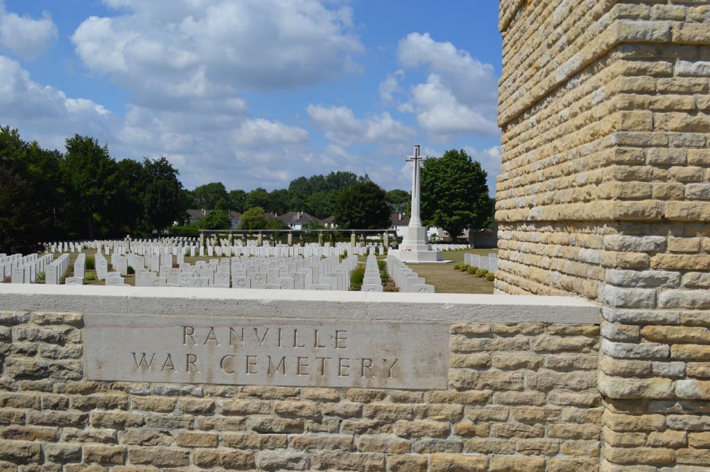
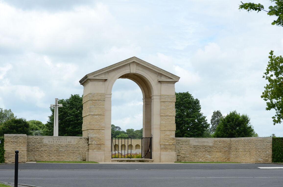
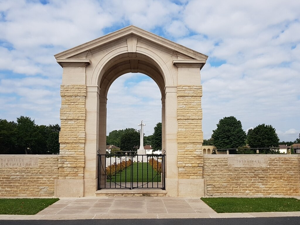
The main entrance is marked by a large stone archway. There is single stone step leading up from the paving in front of the entrance to the main gate. A two-section gate, 1.5 metres wide opens inwards into the cemetery, with the right leaf opened with a latch located on the top of the gate.
The Register Box is located inside the Entrance Arch, along with stone benches on either side.
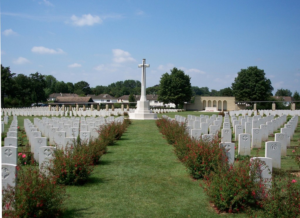
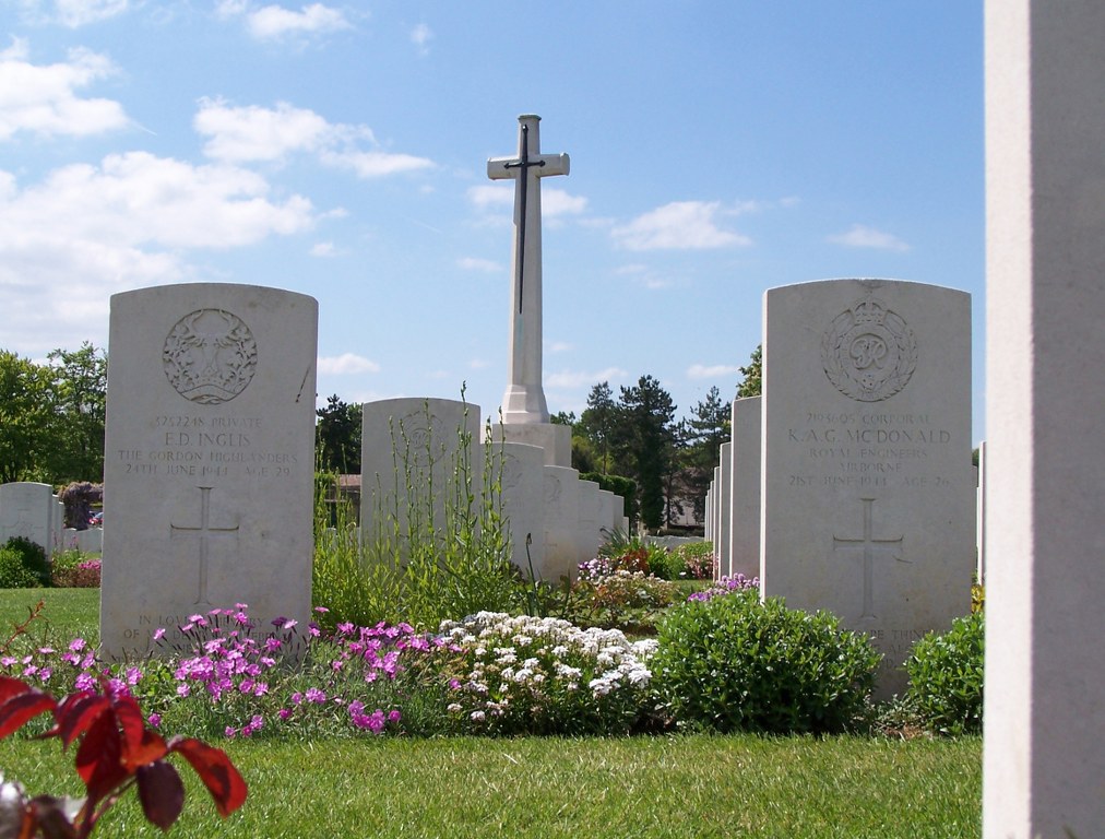
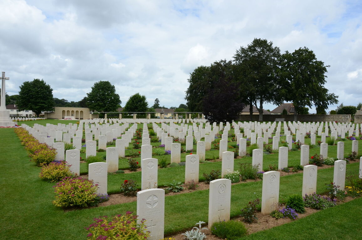
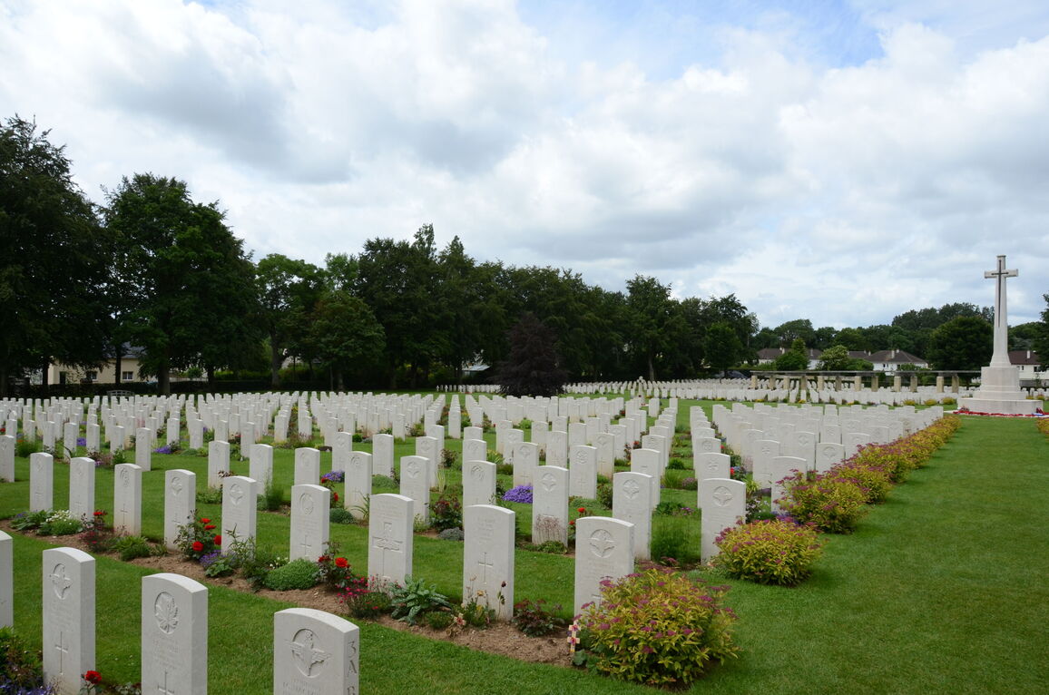
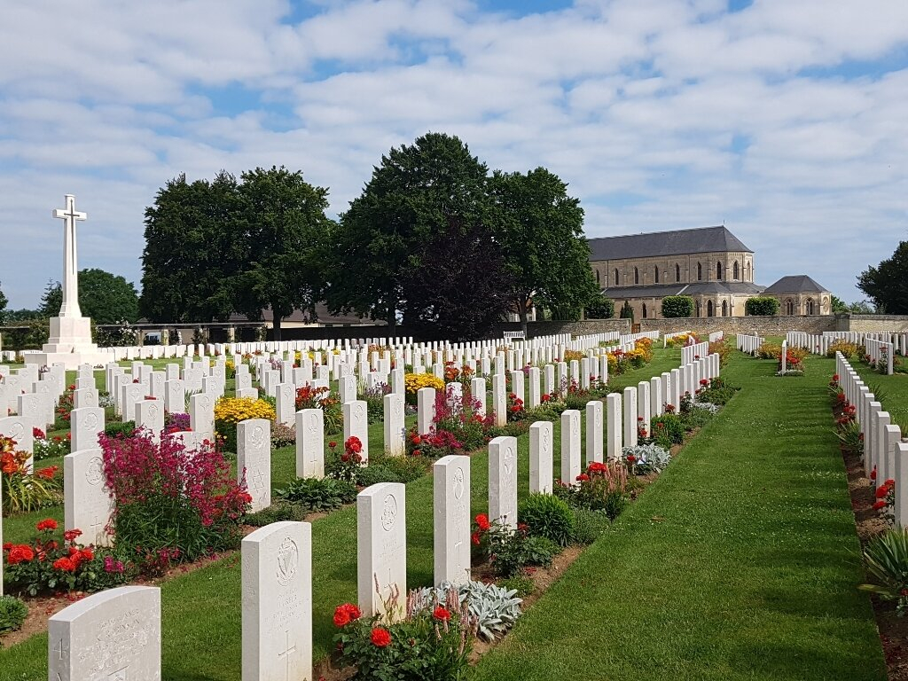
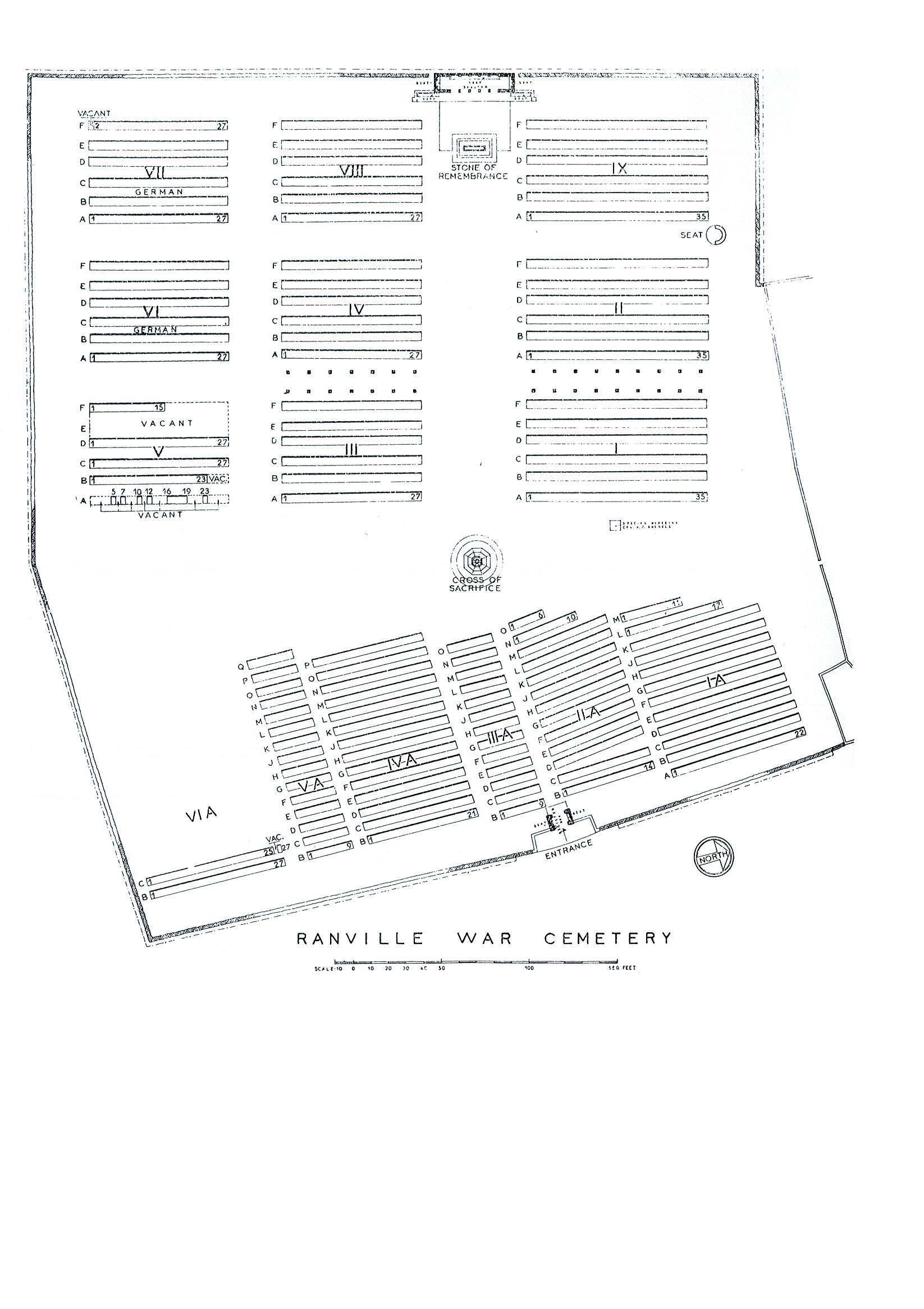
The Cross of Sacrifice is in the centre of the cemetery.
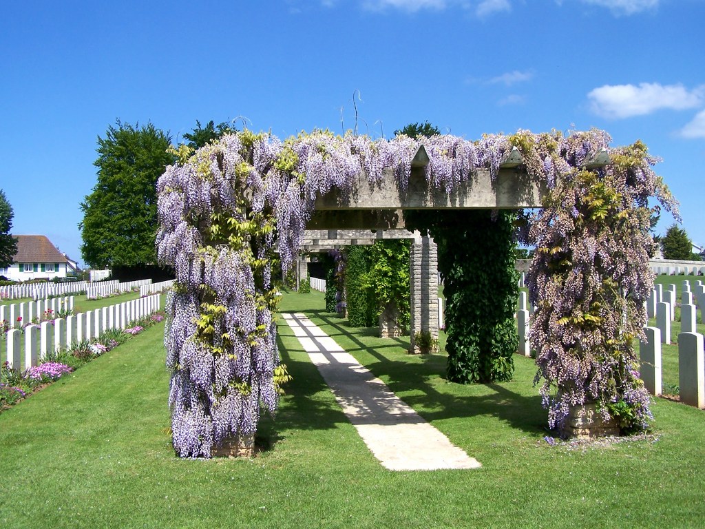
A long pergola covered with flowers and plants runs across the middle of the cemetery, with stone pathways running the entire length.
All the internal paths are grass, the ground surface is flat and firm.
There is a shelter at the rear of the cemetery, behind the Stone of Remembrance, with internal seating, as well as external seating on either side facing into the cemetery.
There is a stone seating area located on the right side of the cemetery, along the boundary wall, towards the rear of the cemetery. There are timber benches located along the inside boundary wall adjacent to the communal cemetery and along the inside of the front boundary wall.
ALTERNATIVE ACCESS
There is an alternative entrance into the cemetery on the left-hand side, approximately 70 metres south of the main entrance.
For access through the alternative entrance, follow a grass path along the hedge line to the far end of the of the cemetery. The ground is flat and firm.
Access is through a wide gap of approximately 2 metres, between a green mesh fence and a mid-height (Chest height) hedge. The ground surface is grass and is firm and level.
There is also an opening in the wall, approximately 1.5 metres wide, leading into the cemetery from the adjacent Ranville Civil Cemetery on the northern boundary wall.
ADDITIONAL INFORMATION
The cemetery is permanently open.
History information
The Allied offensive in north-western Europe began with the Normandy landings of 6 June 1944.
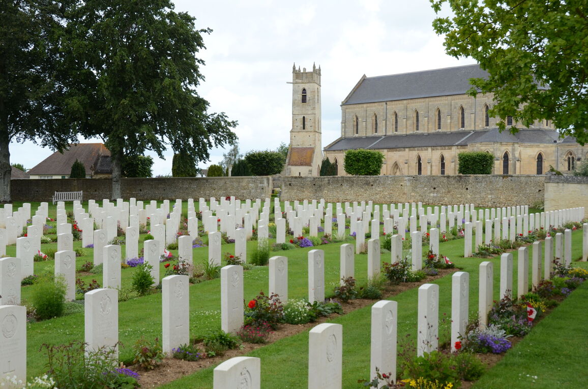
Ranville was the first village to be liberated in France when the bridge over the Caen Canal was captured intact in the early hours of 6 June by troops of the 6th Airborne Division, who were landed nearby by parachute and glider. Many of the division's casualties are buried in Ranville War Cemetery and the adjoining churchyard.
The CEMETERY contains 2,236 Commonwealth burials of the Second World War, 90 of them unidentified. There are also 323 German graves and a few burials of other nationalities.
The CHURCHYARD contains 47 Commonwealth burials, one of which is unidentified, and one German grave.