Dunkirk Memorial
- Country France
- Total identified casualties 4502 Find these casualties
- Region Nord
- Identified casualties from Second World War
- GPS Coordinates Latitude: 51.0306, Longitude: 2.38967
Location information
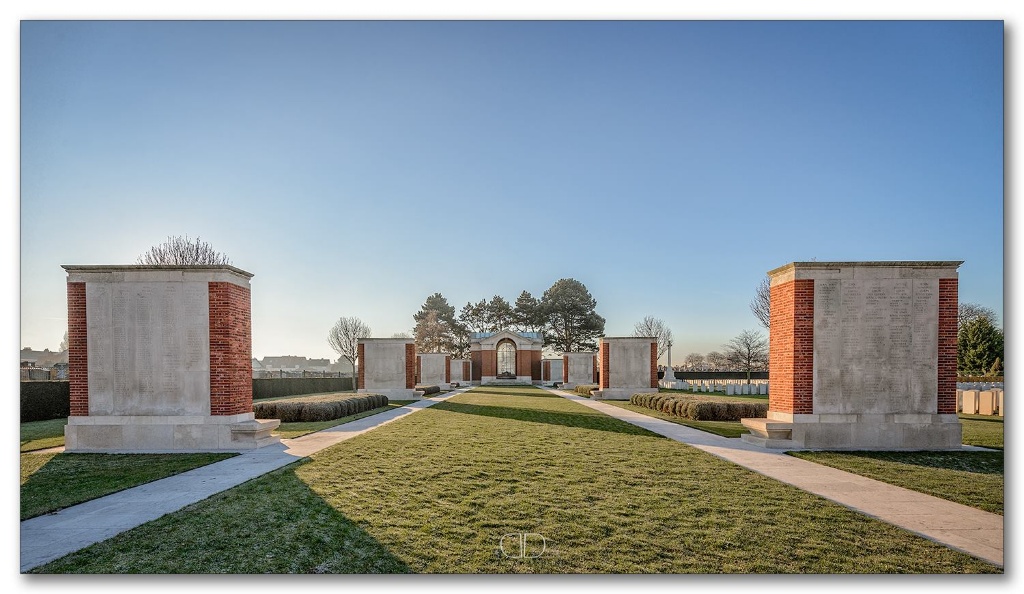
The Dunkirk Memorial stands at the entrance to the British War Graves Section of Dunkirk Town Cemetery, which lies at the south-eastern corner of the town of Dunkirk, immediately south of the canal and on the road to Veurne (Furnes) in Belgium.
On entering the cemetery through the columns of the Dunkirk Memorial, two Commonwealth war graves sections will be seen: Plots IV and V from the First World War and Plots I and II from the Second World War.
There is also a further First World War section (Plots I, II and III) in the main part of the cemetery to the right of the main entrance.
Visiting information
ARRIVAL
The route to the CWGC (Commonwealth War Graves Commission) plot within the municipal cemetery is signposted.
PARKING
There is off-street parking directly in front of the CWGC cemetery and Memorial entrance, along the main road, with a single accessible bay. The road is very busy with the parking layby partially recessed from the road. A stone kerb, approximately 100 mm high runs alongside the road. A cycle path-pedestrian pathway runs adjacent to the road. There is a large car park approximately 300 metres to the west of the main entrance of the CWGC Section in the Crematorium adjacent to Dunkirk Town Cemetery. Access to the car park is from Rue de Steendam, off Route de Furnes which runs along the front of the cemetery.
A flat, firm pavement follows the side of the main road from the car park to the main entrance gate.
ACCESS LAYOUT AND MAIN ENTRANCE
Behind the cycle path- pedestrian path is a raised semi-circular platform with flag poles on the top. There is a step up from the tarmac to a stone kerb, with two steps down to the platform.
Two steps lead down from the platform to a paved pathway that leads to the main gate. Step-free access to the gate is possible via a drop kerb at the eastern end of the cemetery, ten metres from the platform.
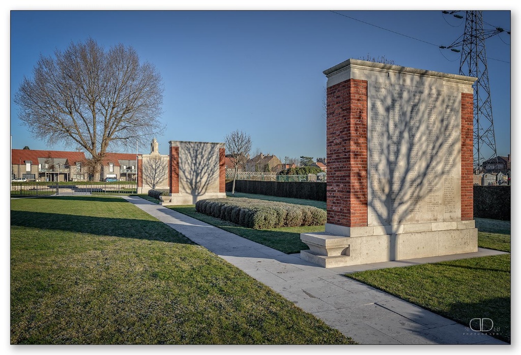
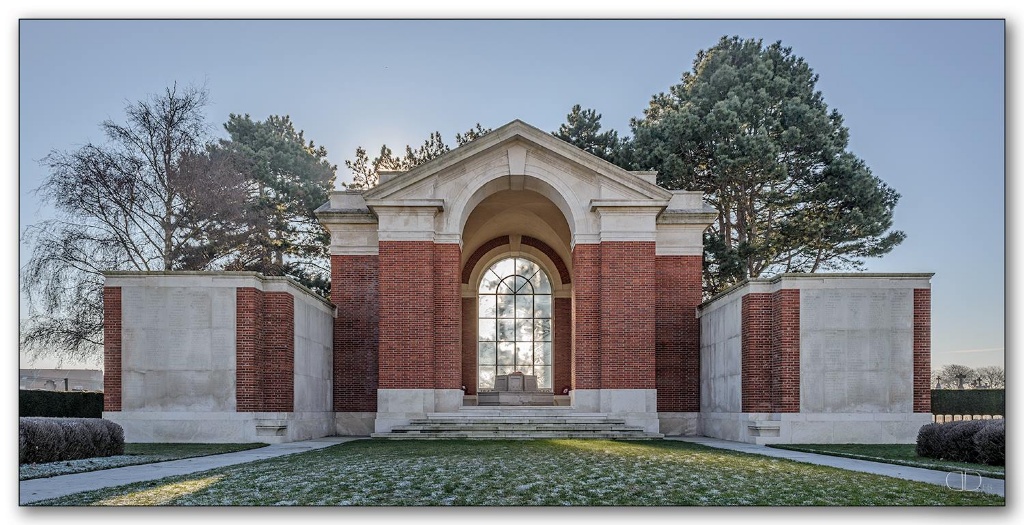
Behind the platform is the main gate to the Dunkirk Memorial. The gate is approximately 8 meters wide and made up of 8 sections.
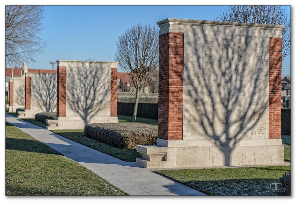
The gate is black and metal, mid-level (thigh height). The two – one metre wide centre sections open with a latch handle that lifts up. The gate opens inwards into the Memorial. Two pathways run adjacent to the Memorial stelae. Firm level grass surrounds the stelae. The pathways lead to the large memorial building at the rear of the memorial.
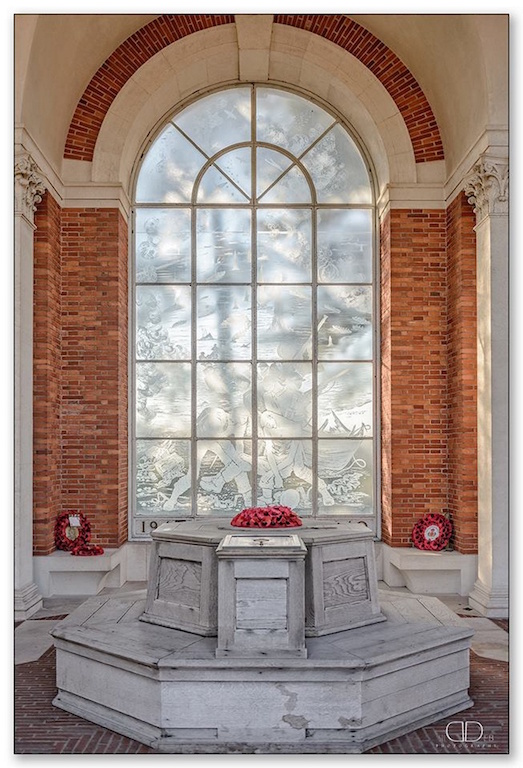
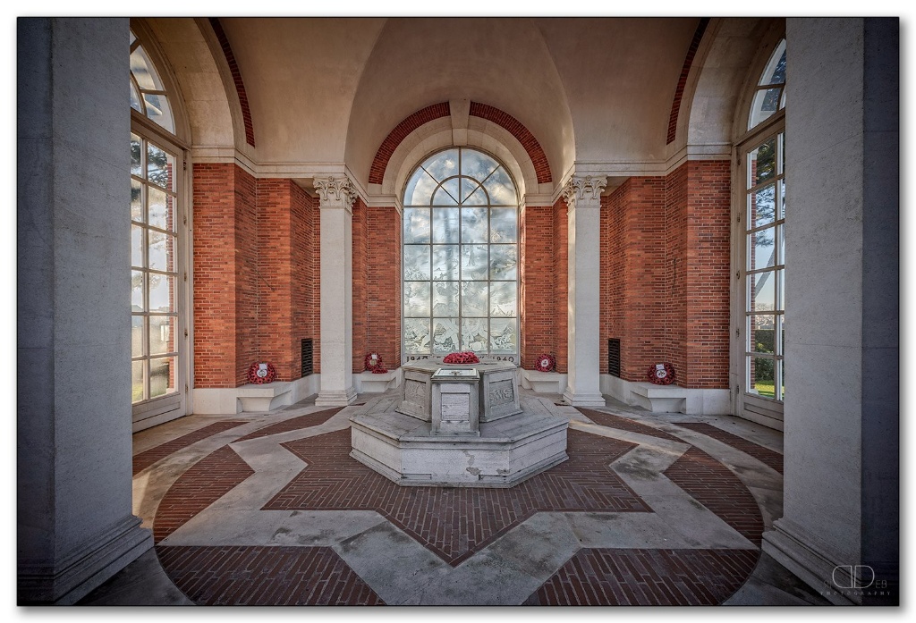
There are five white stone steps leading up to the interior of the Memorial shelter. The only access is via the steps, located on three sides of the shelter.
The Cemetery and Memorial Register Box is inside the memorial shelter, laid flat and built into a wooden octagonal bench. The Register Box door is opened by sliding the door towards the centre of the seating area.
Entrance into the cemetery is via the openings between the memorial stelae or down the steps from the Memorial Shelter at the rear of the Dunkirk Memorial.
The Cross of Sacrifice located in line with the Dunkirk Memorial shelter building at the southern end of the CWGC Cemetery.
Further wooden bench seating areas are located on opposite sides of the Cross of Sacrifice in the Cemetery.
There are information panels in several locations around the CWGC plots.
All internal paths within the CWGC section are grass or flagstone, flat and firm.
ALTERNATIVE ACCESS
Alternative access is through a double brown wooden gate (service entrance) at the south-eastern side of Memorial, accessed from the municipal cemetery. The latched gate is opened by turning a circular handle that opens inwards onto a grass surface to the rear of the memorial building. The ground is flat and firm.
ADDITIONAL INFORMATION
The memorial and Cemetery are permanently open.
History information
During the Second World War, Dunkirk was the scene of the historic evacuation of the British Expeditionary Force from France in May 1940.
The DUNKIRK MEMORIAL stands at the entrance to the Commonwealth War Graves section of Dunkirk Town Cemetery. It commemorates more than 4,500 casualties of the British Expeditionary Force who died in the campaign of 1939-40 or who died in captivity who were captured during this campaign and who have no known grave.
The memorial was designed by Philip Hepworth and unveiled by Her Majesty Queen Elizabeth The Queen Mother on 29 June 1957. The engraved glass panel, depicting the evacuation, was designed by John Hutton.