Locre No.10 Cemetery
- Country Belgium
- Total identified casualties 47 Find these casualties
- Region West-Vlaanderen
- Identified casualties from First World War
- GPS Coordinates Latitude: 50.77189, Longitude: 2.77698
Location information
Locre No. 10 Cemetery is located 11.5 Kms south-west of Ieper town centre, on a road leading from the Dikkebusseweg (N375). From Ieper town centre the Dikkebusseweg is reached via Elverdingsestraat, straight over a roundabout onto J.Capronstraat (for 30 metres), then left along M.Fochlaan. Immediately after the train station, the first right hand turning is the Dikkebusseweg.
On passing through the village of Dikkebus the road continues for 6 Km to the village of Loker. Continuing through the village of Loker the road becomes the Dikkebusstraat which runs for 2 Km to the village of Dranouter. The cemetery is located 1.5 Kms after this turning on the right hand side of the road.
Visiting information
ARRIVAL
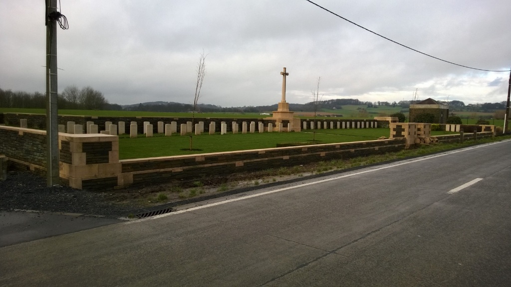
The cemetery is located on Dikkebusstraat (N322) south of the village of Loker. The cemetery is not signposted.
PARKING
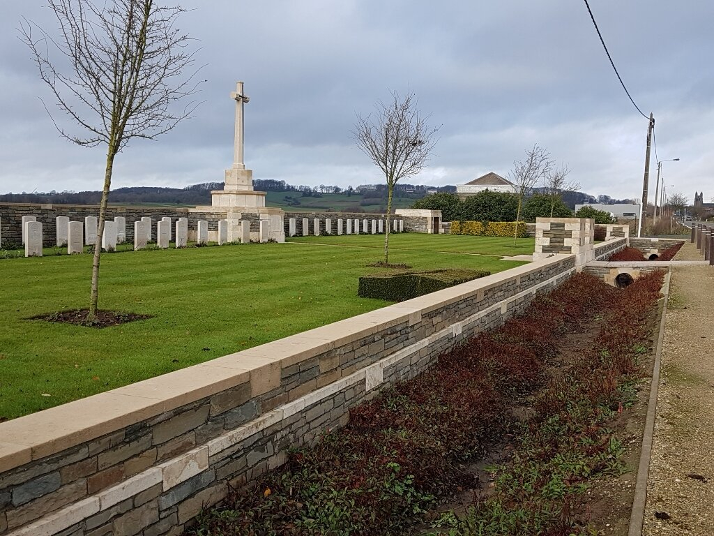
There is a path between edge of road and a drainage ditch. The path is marked on the roadside with spaced bollards and a narrow concrete kerb. It is not possible to park along the front of the cemetery.
There is space to park close to the left-hand side corner of the cemetery, where a there is a single-track lane and bridleway with space for up to 4 vehicles.
The ground is flat and firm tarmac, topped with a loose gravel surface and uneven in places.
The parking area is approximately 40 metres from the main entrance (along the side of the main road from the parking area). There is a gravel pathway with wooden bollards separating the road from the pathway leading to the main entrance.
ACCESS LAYOUT AND MAIN ENTRANCE
The cemetery is L shaped, with the long part running parallel to the road. A paved area in front of the entrance from main road, over a drainage ditch and storm drain, leads to the entrance gate located in the middle of the site along the main road. The paving is level with the gravel path and a shallow concrete drainage channel along the side of the road.
The main gate is a mid-height, (thigh level) black, metal gate with an up and down lift latch, located on the left side. The gate is approximately 1 metre wide and opens inwards into the cemetery. Paving from the gate leads to the Cross of Sacrifice built into the wall at the rear of the cemetery. The paving is level with the grass.
There is no seating or Register Box on site.
All internal cemetery paths are grass; the ground is flat and firm.
ALTERNATIVE ACCESS
There is no alternative access into the cemetery.
ADDITIONAL INFORMATION
The cemetery is permanently open.
History information
Locre (now Loker) was in Allied hands during the greater part of the war, and field ambulances were stationed in the Convent of St. Antoine. The village changed hands several times between 25 and 30 April 1918, when it was recaptured by the French. The hospice, or convent, was the scene of severe fighting on 20 May, but was not retaken until first week in July.
Locre No.10 Cemetery is one of a number made by the French troops in the Spring of 1918, but the graves of 248 French soldiers were later removed to another burial ground. The Commonwealth and German graves were brought into the cemetery from the battlefields after the Armistice.
The cemetery now contains 58 Commonwealth burials and commemorations of the First World War. 14 of the burials are unidentified but there are special memorials to three casualties known or believed to be buried among them. Only three of the 75 German burials are identified.
The cemetery was designed by W H Cowlishaw.


