Eterpigny British Cemetery
- Country France
- Total identified casualties 56 Find these casualties
- Region Pas de Calais
- Identified casualties from First World War
- GPS Coordinates Latitude: 50.25943, Longitude: 2.98255
Location information
Eterpigny is a village in the Department of the Pas-de-Calais.
From Vis-en-Artois take the D939 towards Cambrai until you come to a roundabout. Take the D956 to Dury, followed by a 2 kilometre track to the cemetery.
Visiting information
ARRIVAL
The cemetery is signposted. The cemetery is located on a one-way road (Rue Daniel Bernard). Approach by car is from the D9 (Grand Rue / Rue de la Chapelle) west of the cemetery.
PARKING
It is possible to park to the front of the cemetery at the edge of the road. There is a parking space marked out on the road in front of the cemetery.
The ground is firm with a tarmac and red gravel surface between the road and the cemetery boundary fence along the road. There is a concrete channel and raised kerb between the road and the gravel pathway.
ACCESS LAYOUT AND MAIN ENTRANCE
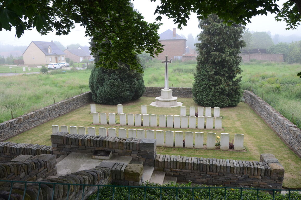
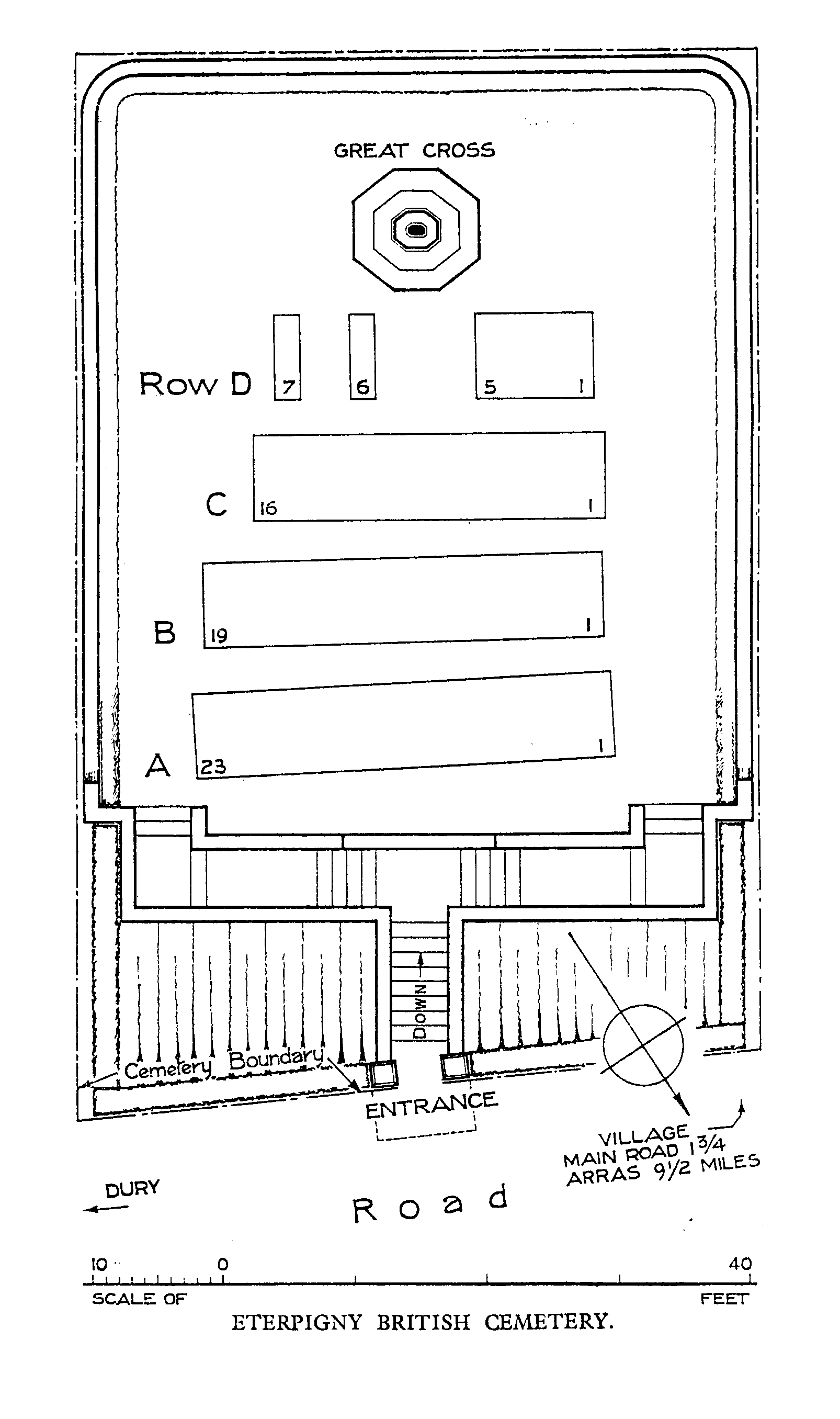
The cemetery is in low lying ground, below the level of the road, located at the bottom of a series of steps. The cemetery is surrounded by a low-level stone wall.
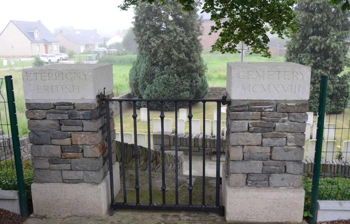
There is a paved area in front of two stone pillars, with a single leaf metal gate that opens inwards directly onto a steep stone stairway. There is no handrail. The black metal gate is one metre wide, with a latched handle on the top left side of the gate.
Access to the cemetery is via ten stone steps that leads steeply down from the main road, to a paved stone landing and steps on either side leading down into the cemetery.
There is a low level raised stone with a bronze panel affixed, in the middle of the first platform at the bottom of the first set of steps against the wall.
The first flight of 10 stone steps leads to a small rectangular platform which splits into a further set of 5 stone steps on either side. There are paved pathways enclosed on either side by walls at the bottom of the steps on each side, leading to a further five steps down into the burial area.
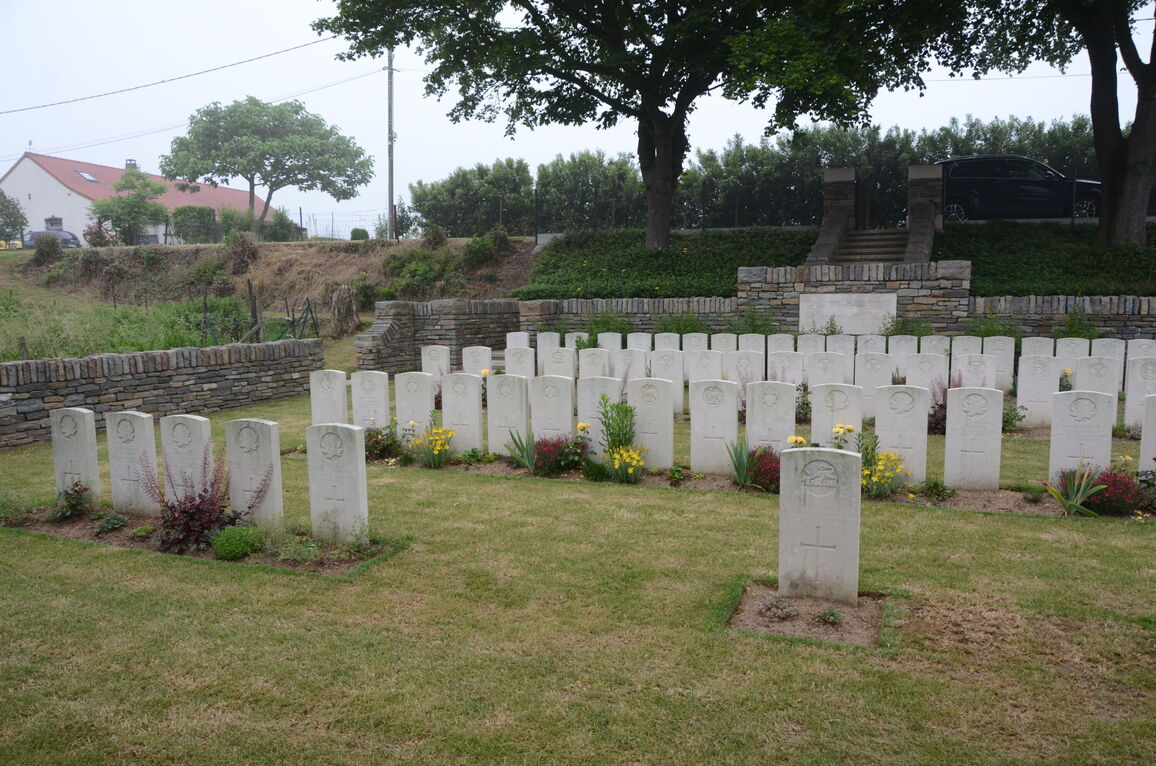
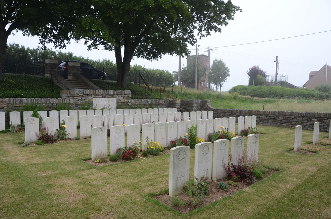
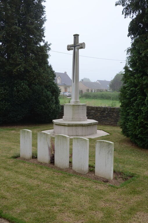
The Cross of Sacrifice is in the centre of the cemetery close to the rear wall.
There is no Register Box or seating in the cemetery.
The internal paths are grass, the ground is flat and firm.
ALTERNATIVE ACCESS
There is a steep grass bank along the length of the cemetery, the ground surface is a mixture of grass, earth, and gravel.
To the right of the cemetery entrance is a grass covered pathway used as a maintenance access into the site. The ground slopes steeply downwards across the width of the track as well as following the pathway to an opening in the boundary wall that leads directly onto grass. There is a barbed wire fence along the right side of the pathway. This track will be muddy and slippery in inclement weather.
ADDITIONAL INFORMATION
The cemetery is permanently open.
History information
Eterpigny British Cemetery was begun by the 4th and 1st Divisions and was used from the end of August 1918, to the middle of October. One grave was brought in after the Armistice.
The cemetery contains 66 burials and commemorations of the First World War. Ten of the burials are unidentified but there is a special memorial to one casualty believed to be buried among them.
The cemetery was designed by W H Cowlishaw.