Dorinne Communal Cemetery
- Country Belgium
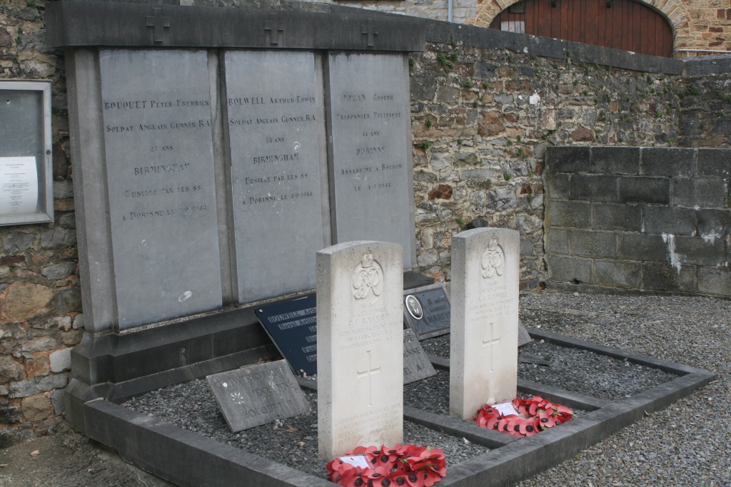
- Total identified casualties 2 Find these casualties
- Region Namur
- Identified casualties from Second World War
- GPS Coordinates Latitude: 50.31776, Longitude: 4.9735
Location information
The village of Dorinne is located north-east of the town of Dinant on the N937. From the motorway E411/A4 which runs between Namur and Luxembourg turn off at junction 19 onto the N946 direction Dorinne. Follow the N946 to the junction with the N937 and follow the N937 into Dorinne. At the crossroads by the town turn right into rue de l'Etat, then bear left into rue Chestree and at the crossroads left into rue d' en Haut, the cemetery is along on the left. The graves are located to the left of the entrance.
Visiting information
Dorinne Communal Cemetery contains two burials of the Second World War. The graves are marked by private memorials erected by the local authorities and by Commission headstones.
History information
The British Expeditionary Force was involved in the later stages of the defence of Belgium following the German invasion in May 1940, and suffered many casualties in covering the withdrawal to Dunkirk. Commonwealth forces did not return until September 1944, but in the intervening years, many airmen were shot down or crashed in raids on strategic objectives in Belgium, or while returning from missions over Germany.