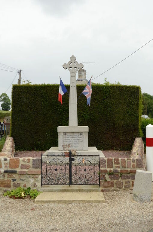
Livry (Le Repas) Isolated Grave
- Country France
- Total identified casualties 1 Find these casualties
- Region Calvados
- Identified casualties from Second World War
- GPS Coordinates Latitude: 49.09274, Longitude: -0.78407
Location information
Livry is a village 33 kilometres south-west of Caen. Le Repas is a hamlet on the road between Caumont L'Evente and Livry, 2 kilometres east of Livry.
Visiting information
ARRIVAL
The route to the single isolated grave and memorial is not signposted.
PARKING
There is no parking close to the grave.
ACCESS LAYOUT AND MAIN ENTRANCE
The single grave and memorial is located within a small triangular patch of land, next to a T junction of Route de Villers (D71) and Route de St. Germain (D173), at the boundary of Le Repas.
The small plot is enclosed by a low stone wall, approximately 400 mm tall.
There is a small black metal double gate with a top latch and handle, approximately 450mm tall and 900 mm wide. There are two shallow steps leading into the site, each approximately 50 mm tall.
The gate is at the top of the steps, between 2 concrete bollards located just in front of the low wall. The ground in front of the gate is comprised of gravel and vegetation.
ALTERNATIVE ACCESS
The only access to grave and memorial is through the gate.
ADDITIONAL INFORMATION
The site is permanently open to the public.
History information
The grave of Captain Grey, who was killed by a sniper whilst his tank was hit advancing through nearby Lutain Wood, lies in an isolated piece of ground at a fork in the main road from Caumont to Villers-Bocage in the hamlet of Le Repas.
As both the family of the officer and the inhabitants of Le Repas were emphatic in their desire for Captain Grey's body to remain in the village, it was decided that it should remain there. The grave is marked by a private memorial.


