Albert Communal Cemetery Extension
- Country France
- Total identified casualties 868 Find these casualties
- Region Somme
- Identified casualties from First & Second World War
- GPS Coordinates Latitude: 49.99881, Longitude: 2.65467
Location information
Albert is a town 28 Kms north-east of Amiens. The Communal Cemetery is on the south-east side of Albert and at the junction of the roads to Peronne (D938) and Bray sur Somme (D329), and the extension is entirely enclosed by it. The main entrance to the cemetery is on the Peronne road.
Visiting information
ARRIVAL
The Cemetery is about 400 metres south-east of the centre of the Albert commune in the Somme department. Albert Communal Cemetery is at the junction of the D938 and D329 roads, and the Albert Communal Cemetery Extension is entirely enclosed by it.
The main entrance into the CWGC section is on Rue du 11 Novembre (D938), approximately 250 metres east of the junction.
There is no CWGC road signage for the Extension. However, the Communal Cemetery is signposted in town.
PARKING
There is no car park for this site. There is, however, public parking on the D329 road, Rue Jean Mermoz, on the southern (opposite) side of the Communal Cemetery. The parking bays are level and firm ground, but there are no wheelchair-accessible bays. The parking is about 200 metres walk from the main entrance, by walking through the Communal Cemetery. There is a one metre wide pedestrian access gate into the civil cemetery adjacent to a two-leaf larger gate, located in the southeast corner of the Communal Cemetery.
ACCESS LAYOUT AND MAIN ENTRANCE
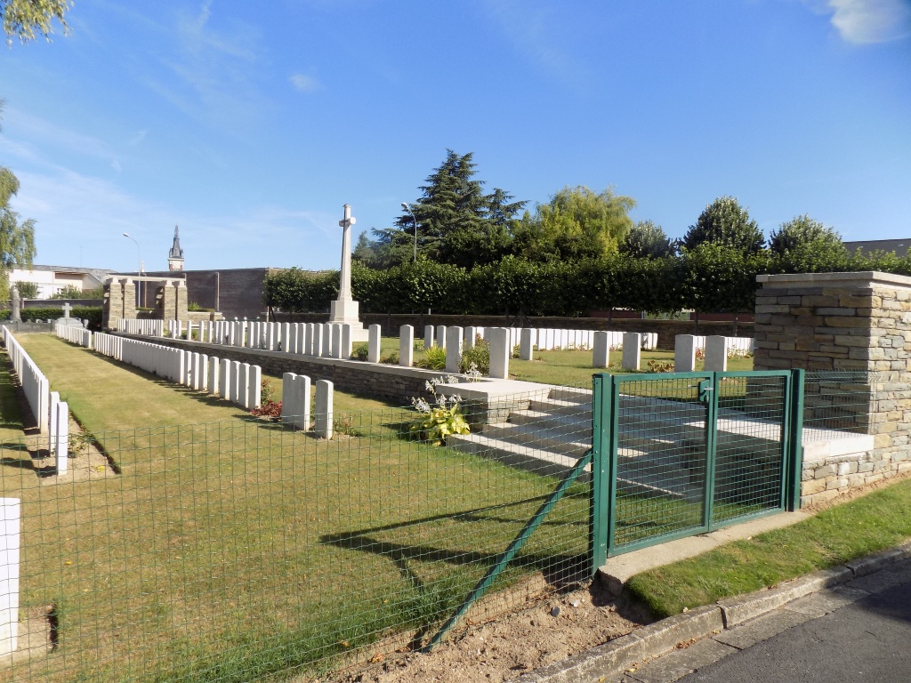
The approach to the Extension’s main entrance, on the D938, is firm and level, with no obstructions from the roadside. There is a tarmac footpath running the length of the cemetery wall along the road.
Access to the upper section of the cemetery is step-free, with a level threshold. There is a large opening at the entrance, with four bollards. The central opening is approximately 0.9 metres wide. On either side are two larger openings, approximately 1.5 metres wide, secured with removable chains, held on by hooks on left and right sides. There is a semicircular paved area at the entrance, with a metal drainage grill along the junction between the footpath and paving. There is a stone pergola to the right of the main entrance paving, with a single step down of approximately 150 mm down from the paving to the grass inside the cemetery.
There may be moveable wooden barriers behind the bollards to prevent rabbits from entering the cemetery. These can be moved to allow access but should be put back in place when leaving the site.
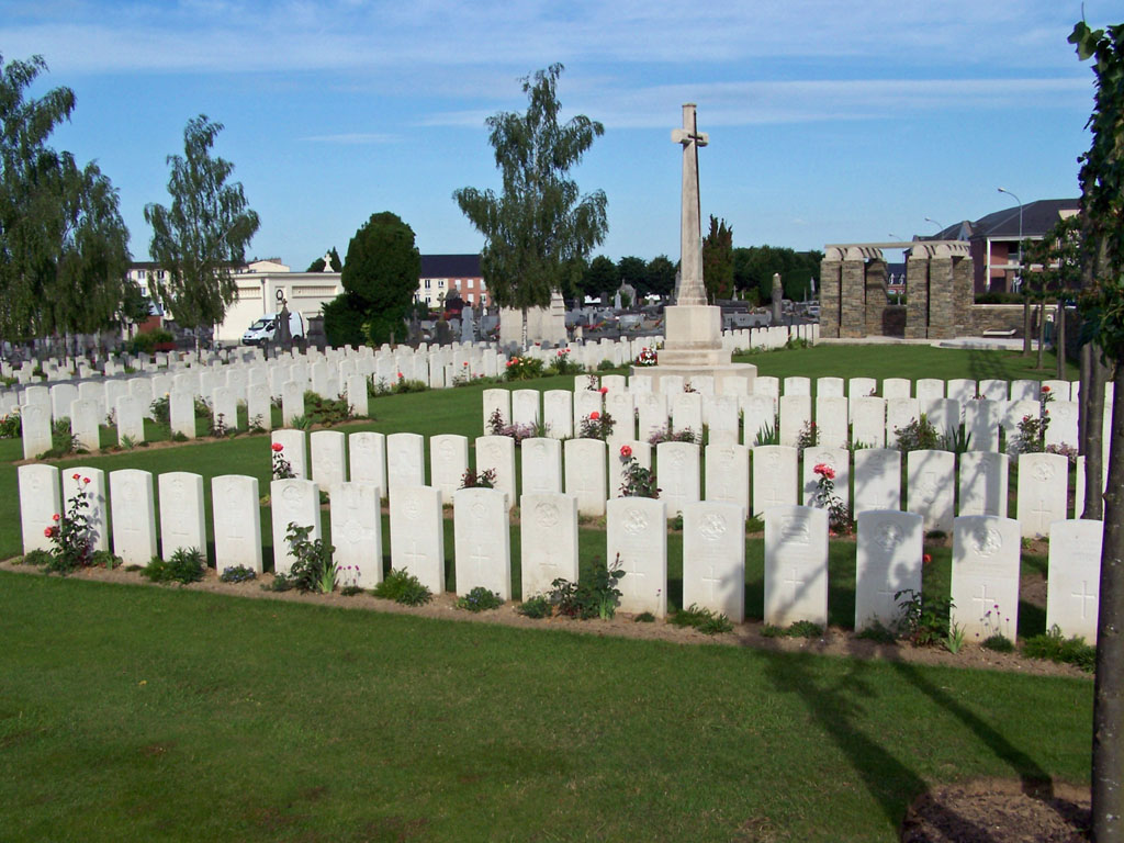
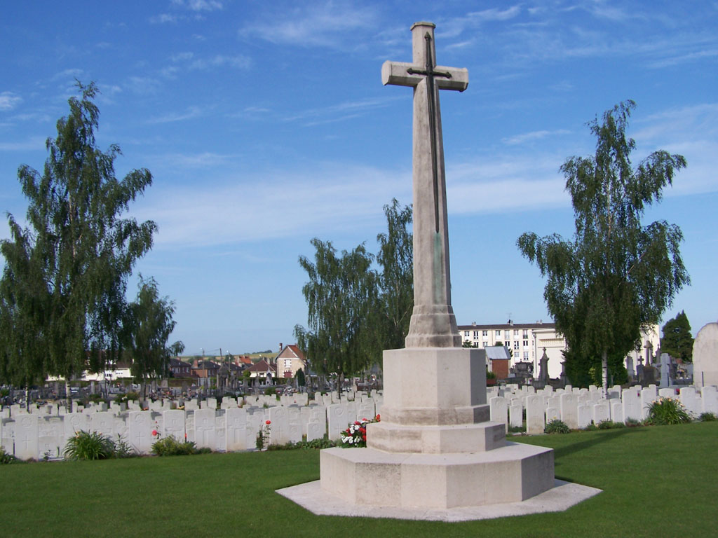
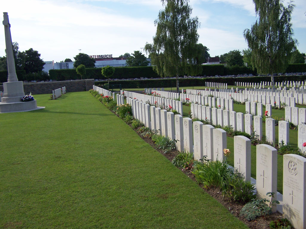
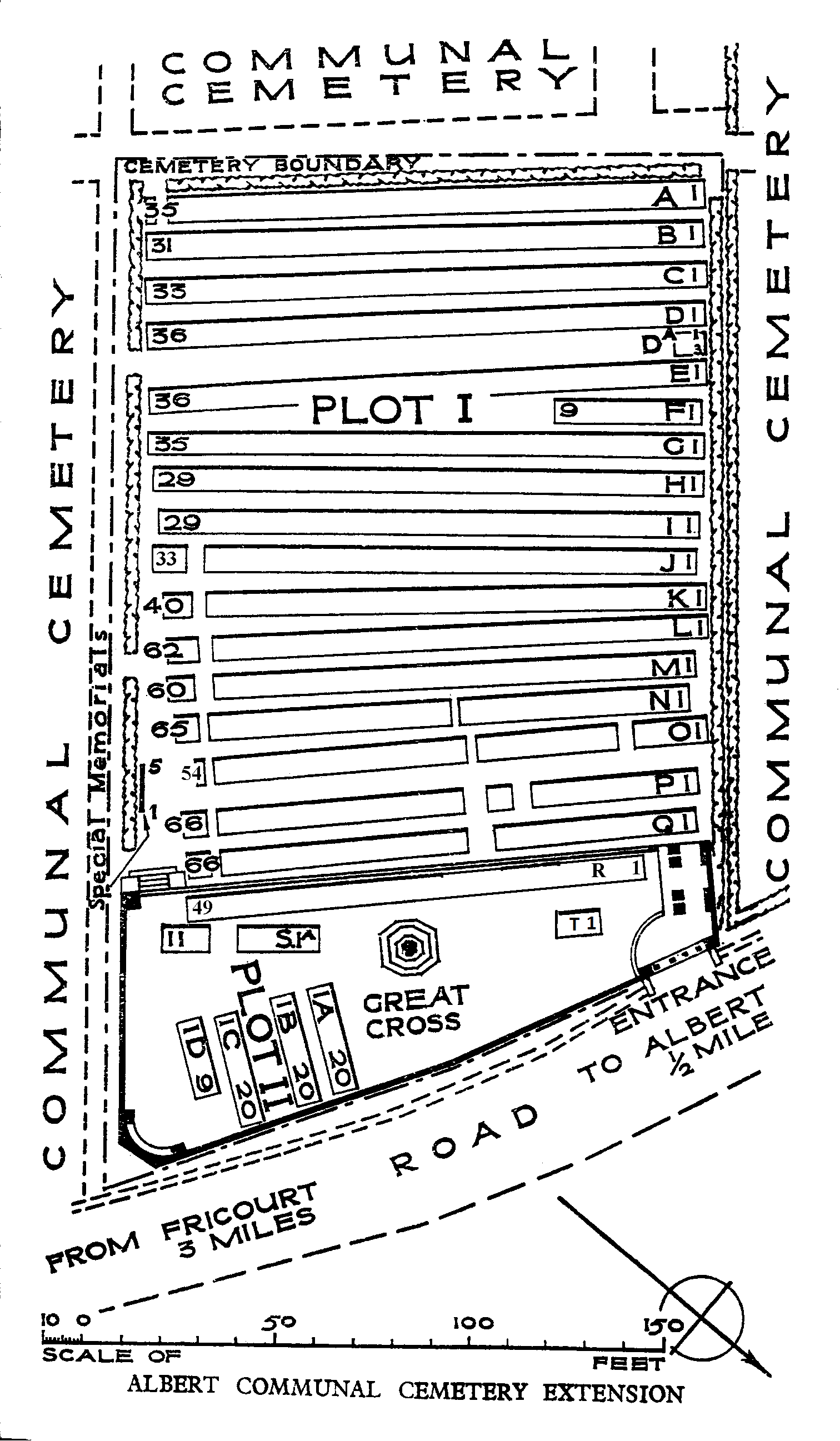
The Cross of Sacrifice is built in the front of the Cemetery, on the raised terrace along the front of the cemetery.
The paths inside the Cemetery are generally grassed, and are generally flat, firm and smooth throughout. To access the main part of the cemetery, below the raised terrace, there is a set of steps at the opposite end of the terrace from the entrance. Five steps lead down the main part of the cemetery. There are no handrails.
The Register Box is built into the inside face of the front-right pillar of the pergola feature near the entrance.
There is a curved stone bench seat at the eastern end of the of the raised terrace.
ALTERNATIVE ACCESS
There are several alternative gated entrances into the Extension from inside the Communal Cemetery. These entrances are not signposted from the main entrance feature. These entrances generally have a paved / stone threshold from the Communal Cemetery that are not flush.
There is a metal and wire double gate entrance near the steps on the east side of the cemetery, with two more single metal and wire gate entrances (one halfway along the east side, and the other in the south-east corner). The single gates are approx. 90cm wide, and the double-gate is approx. 1.8m wide. The gates have latched handles, which pull down. The gates open into the cemetery. There are raised stone curbs in front of the gates, up to 100 mm high, and have either concrete paving in front or uneven ground.
ADDITIONAL INFORMATION
The Cemetery is permanently open.
History information
Albert was held by French forces against the German advance on the Somme in September 1914. It passed into British hands in the summer of 1915; and the first fighting in July 1916, is known as the Battle of Albert, 1916. It was captured by the Germans on the 26th April 1918, and before its recapture by the 8th East Surreys on the following 22nd August (in the Battle of Albert, 1918,) it had been completely destroyed by artillery fire.
The Extension was used by fighting units and Field Ambulances from August 1915 to November 1916, and more particularly in and after September 1916, when Field Ambulances were concentrated at Albert. From November 1916, the 5th Casualty Clearing Station used it for two months. From March 1917, it was not used (except for four burials in March, 1918) until the end of August 1918, when Plot II was made by the 18th Division.
During the Second World War the extension was used again, when the French moved into it British casualties from isolated graves in and around Albert.
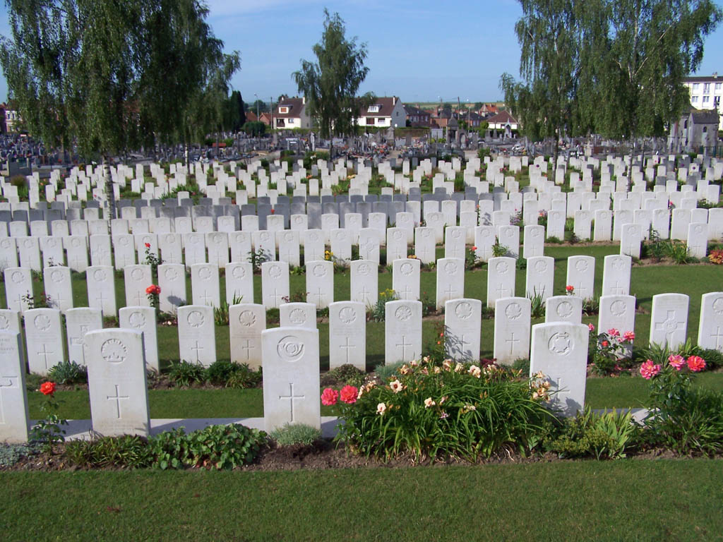
There are now 862 First World War and 25 Second World War casualties commemorated in this site. Of these, 12 First World War casualties and 8 Second World War casualties are unidentified. Five graves, destroyed by shellfire, are now represented by special memorials. Two soldiers known to be among the casualties buried here, but whose graves could not be identified, are commemorated by special memorials, inscribed, "Known to be buried in this cemetery".
This cemetery was designed by Sir Edwin Lutyens.