Motor Car Corner Cemetery
- Country Belgium
- Total identified casualties 128 Find these casualties
- Region Hainaut
- Identified casualties from First World War
- GPS Coordinates Latitude: 50.70948, Longitude: 2.8931
Location information
Motor Car Corner Cemetery is located 17 Kms south of Ieper town centre, on a road leading from the Rijselseweg N365, which connects Ieper to Wijtschate, Mesen, Ploegsteert and on to Armentieres.
From Ieper town centre the Rijselsestraat runs from the market square, through the Lille Gate (Rijselpoort) and directly over the crossroads with the Ieper ring road. The road name then changes to the Rijselseweg.
2 Kms after the village of Ploegsteert lies the left hand turning onto Witteweg (Chemin de la Blanche). Follow the Witteweg (Chemin de la Blanche) for 300 metres and turn right into Drève de la Rabecque. The cemetery lies 300 metres further on the right hand side of the road.
Visiting information
ARRIVAL
The cemetery is signposted.
PARKING
Parking for the cemetery is on the opposite side of the road from the cemetery, where there is space for 2 vehicles.
The distance from the parking to the main entrance is 15 metres.
The ground is flat and firm with gravel and grass surface.
ACCESS LAYOUT AND MAIN ENTRANCE
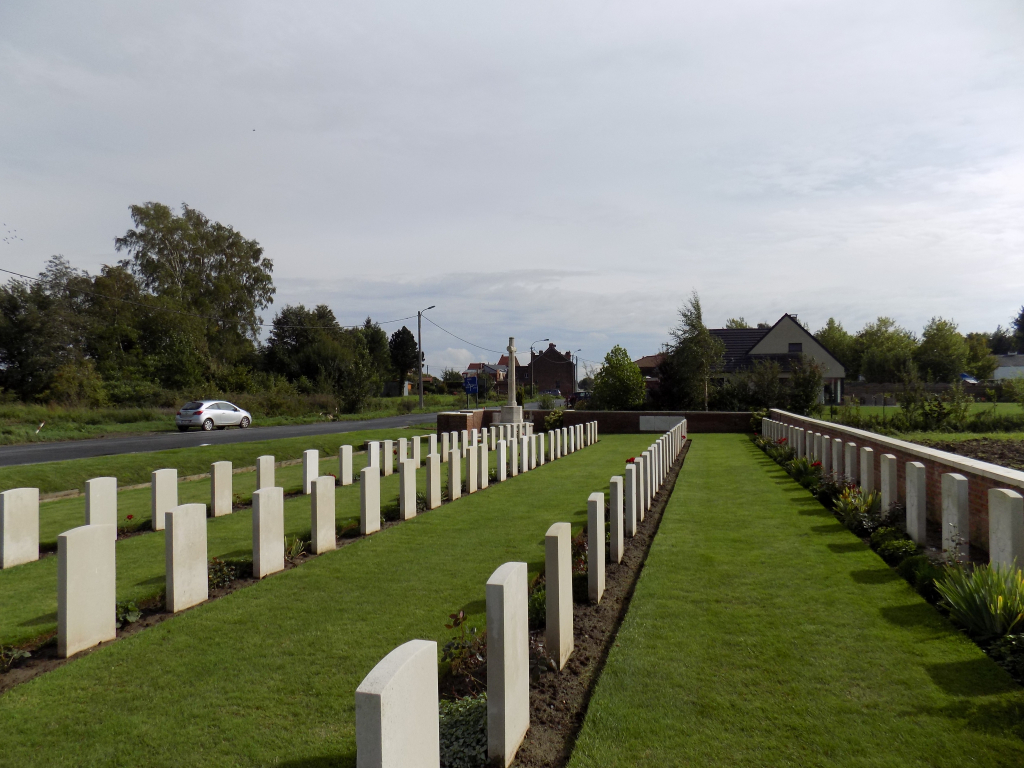
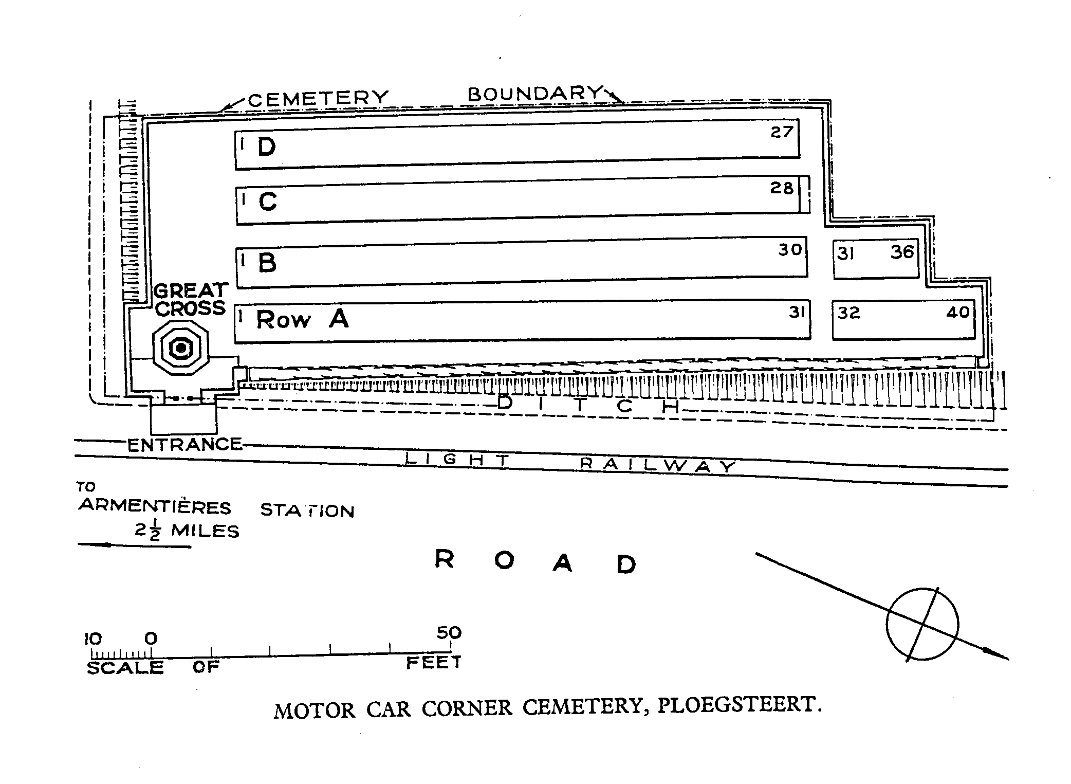
The cemetery, rectangular in shape and bound on three sides by a brick wall, runs parallel to the road. there are no walls or barriers between the road and access to the main entrance of the cemetery.
There is a grass ditch along the full length of the cemetery, the depth is over 1 metre. There is a wooden retaining wall along the edge of the cemetery, along the inside of the ditch. The wooden wall sits approximately 150 mm above the grass level and drops down to the ditch on the opposite side, a drop of 1 metre. The ground in front of the entrance is level with the road and the cemetery, with a turf bridge over the ditch.
There is a herringbone paved brick area in front of the main entrance surrounded by grass on the sides facing the road.
The main entrance opening is 94 centimetres wide. There is no gate but there are two stone bollards with paving underneath that leads step-free into the cemetery.
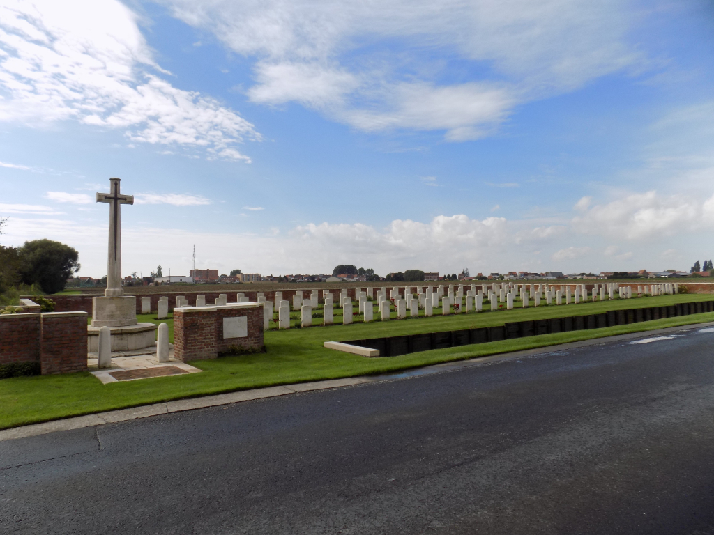
The Cross of Sacrifice is directly in front of the entrance.
The Register Box is built into the brick wall to the right of the main entrance viewed from inside the cemetery.
There is no seating in the cemetery.
ALTERNATIVE ACCESS
On the right side of the main entrance is a grass bridge over the ditch, approximately 1.2 metres wide. There is a raised stone kerb, approximately 75 mm tall along the edge of the ditch.
ADDITIONAL INFORMATION
The cemetery is permanently open.
History information
In this sector, Motor Car Corner marked the point beyond which military cars were not allowed to proceed towards the front. The cemetery was begun in June 1917 at the outbreak of the Battle of Messines and continued in use until the end of March 1918. It was originally sheltered by an avenue of trees and used in conjunction with a trench railway. The cemetery was in German hands between 10 April and 29 September 1918, during which period they extended it northwards. These German graves were later removed.
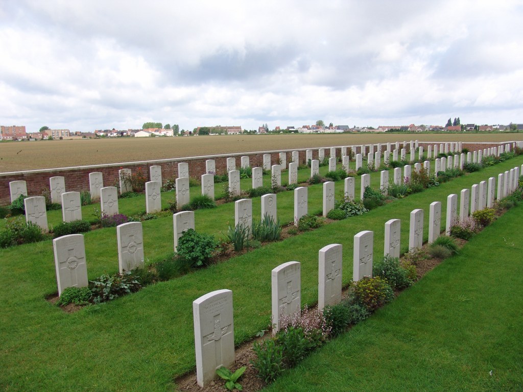
The cemetery now contains 131 Commonwealth burials of the First World War. One German war grave remains.
The cemetery was designed by G H Goldsmith.