Abeele Aerodrome Military Cemetery
- Country Belgium
- Total identified casualties 104 Find these casualties
- Region West-Vlaanderen
- Identified casualties from First World War
- GPS Coordinates Latitude: 50.81522, Longitude: 2.65705
Location information
Abeele Aerodrome Military Cemetery is located 16 Km west of Ieper town centre on the N38, a road leading from the N308 connecting Ieper to Poperinge.
From Ieper town centre the Poperingseweg (N308) is reached via Elverdingestraat then directly over two small roundabouts in the Capronstraat. The Poperingseweg is a continuation of the Capronstraat and begins after a prominent railway level crossing.
On reaching Poperinge the N308 joins the left hand turning onto the R33, Poperinge ring road. The R33 ring road continues to the left hand junction with the N38 Frans Vlaanderenweg. 4 Km along the N38 lies the right hand turning onto the Casselstraat, followed by an immediate left hand turning onto the Dodemanstraat. The cemetery is located 450 metres along the Dodemanstraat on the right hand side of the road. Visitors to this site should note a 150 metre grassed access path which is not suitable for vehicles.
Visiting information
ARRIVAL
There is a signpost at the side of the main road indicating the route to follow along a single lane track (Deodemanstraat) towards the cemetery.
A second sign at the side of the track identifies a mowed grass path through agricultural land towards the cemetery. The grass path is approximately 100 metres long.
PARKING
It is possible to park in an area on the right-hand side of the single lane track which branches off from the main road.
There is space for up to 2 vehicles at the edge of the track in a passing/turning area. The ground is firm and flat and is a mixture of grass and gravel.
ACCESS LAYOUT AND MAIN ENTRANCE
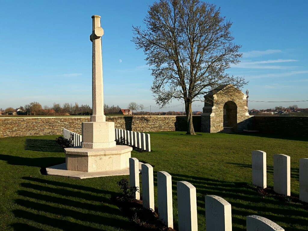
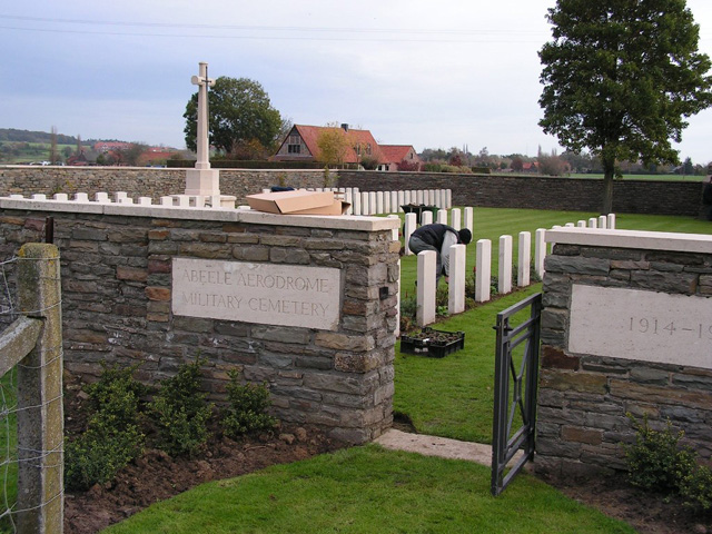
The cemetery is rectangular shaped and in agricultural land. There are engraved stone signs close to the main entrance.
The main gate is 90 centimetres wide, is a mid-level (thigh height), black metal gate with a lift up/down latch on top right of the gate and pull to open. The gate opens outwards from the cemetery. There is a narrow stone strip under the gate level with the grass on either side.
The Cross of Sacrifice is in the centre of the cemetery.
There is a brick and stone shelter in the far-right hand corner of the cemetery, opposite the entrance gate, with an internal stone bench seating area.
The Register Box is inside the main gate mounted into the wall to the right of the gate viewed from inside the cemetery,
All internal paths are grass, with the ground firm and flat.
ALTERNATIVE ACCESS
There is no alternative access into the cemetery.
ADDITIONAL INFORMATION
The cemetery is permanently open.
During periods of prolonged wet weather, the grass path to the cemetery from the single lane track can become waterlogged, muddy, and slippery.
History information
The cemetery, which took its name from an aerodrome that was opposite the site, was begun by French troops in April 1918 (Plot I) and extended by Commonwealth forces in the following July and August (Plot II). After the Armistice, the French graves were removed to other burial grounds and the resulting space was re-used to accomodate 25 Commonwealth burials (from April to August 1918) from the French Extension of Boeschepe Churchyard. Also, 84 American burials (Plot III), made between July and September 1918, were removed.
There are now 104 Commonwealth burials of the First World War in this cemetery.
The cemetery was designed by G.H. Goldsmith.


