Maroeuil British Cemetery
- Country France
- Total identified casualties 571 Find these casualties
- Region Pas de Calais
- Identified casualties from First World War
- GPS Coordinates Latitude: 50.32789, Longitude: 2.69989
Location information
Maroeuil is a village in the Department of the Pas-de-Calais, 6 kilometres north-west of Arras, between the roads to Houdain and Aubigny.
The British Cemetery lies at the end of a track running north from the road to Bray and Ecoivres (C.1).
Visiting information
The cemetery is on a steep slope with a single vehicle width track leading to the site.
ARRIVAL
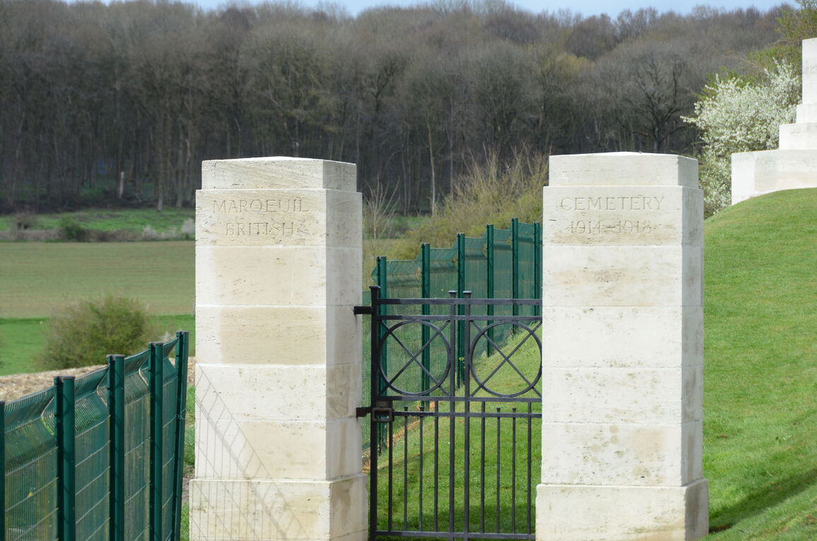
The cemetery is signposted. The track is off rue du Stade and is marked with a green CWGC Cemetery Direction sign at the bottom of the track.
PARKING
It is possible to park at the side of the road in the village, the distance to the main entrance is approximately 150 metres from rue du Stade.
ACCESS LAYOUT AND MAIN ENTRANCE
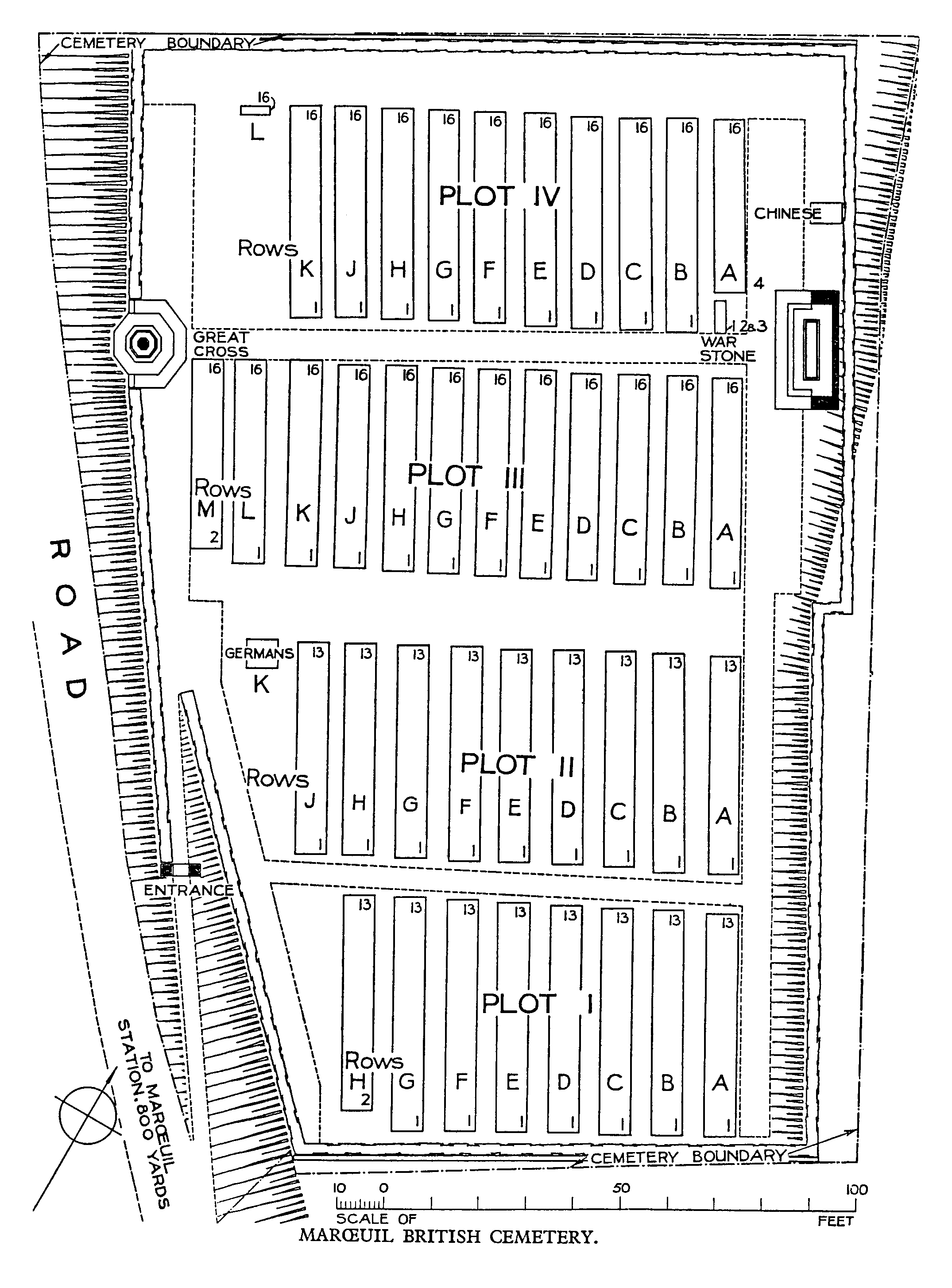
The cemetery is rectangular in shape with the entrance at the bottom left corner.
The track leading up to the entrance gate is a steep rutted farm track with uneven ground. At the end of the track, the main entrance is a 1 metre wide, black, metal mid-level (thigh height) gate, the latch is on the left side of the gate and opened by turning a loop handle clockwise. The gate opens inwards into the cemetery to a steeply sloped grass path leading up to the burial area. There is compacted gravel in front of the entrance gate and paving under the gate level with the gravel and grass.
The ground above the path leading up from the gate is very steep. The ground slopes downwards up to 4 metres from the burial area down to the path.
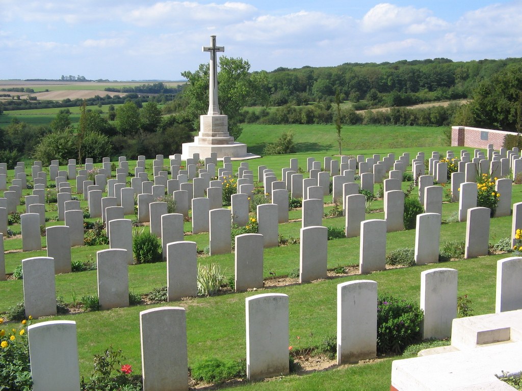
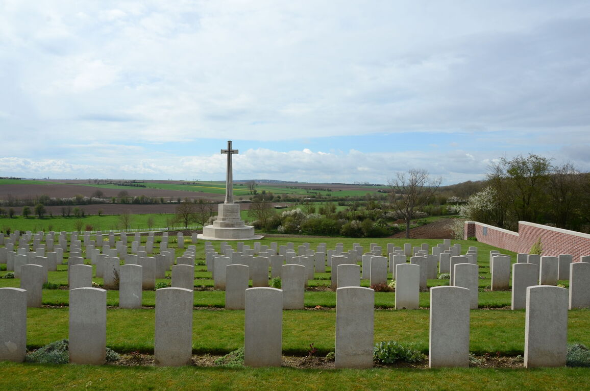
The Cross of Sacrifice is close to the main entrance at the very top of the access slope, on flat ground. The ground drops steeply behind the Cross of Sacrifice to a fence below.
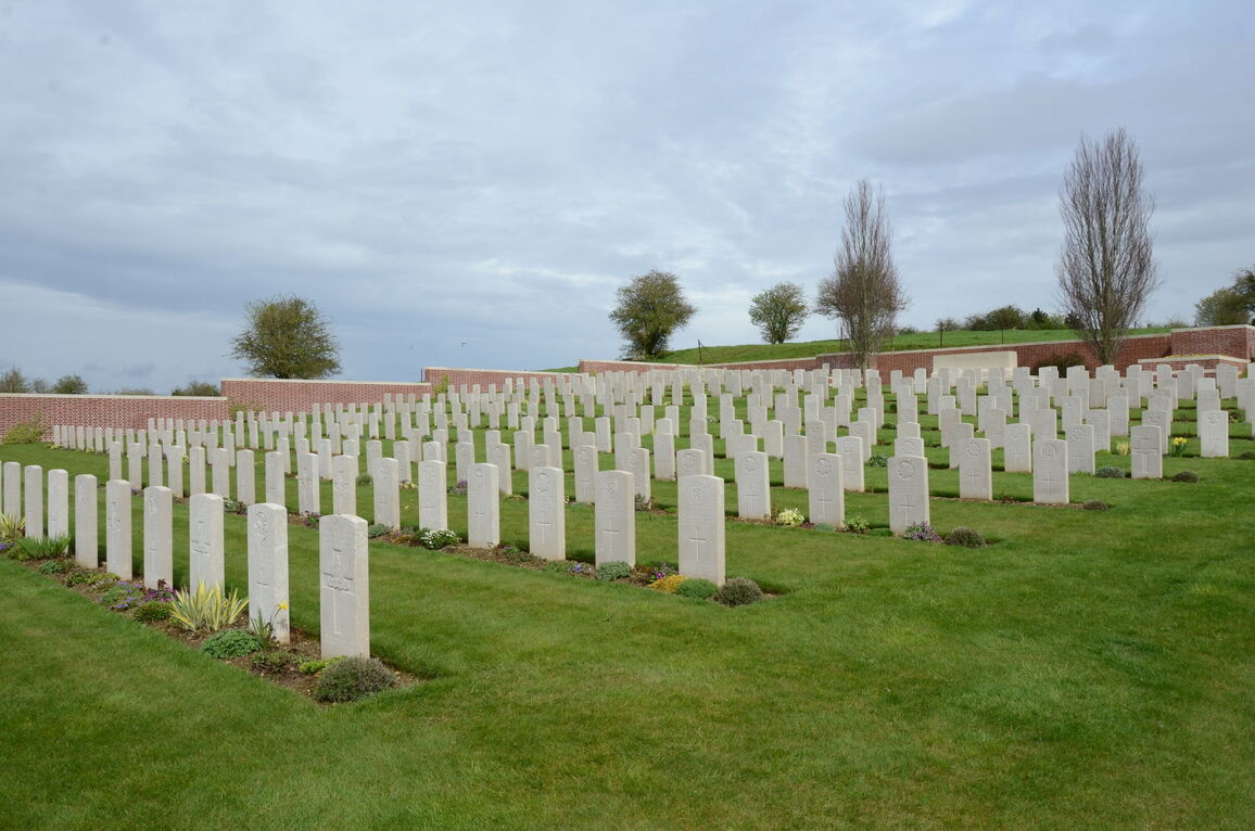
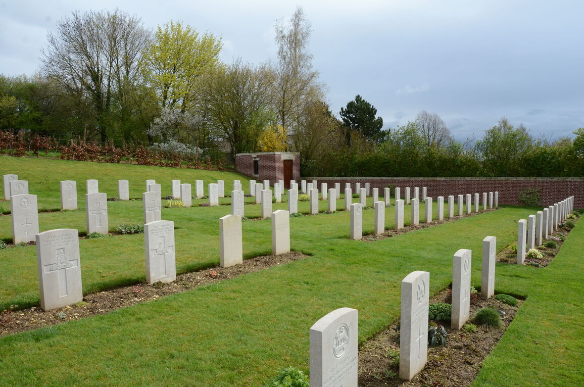
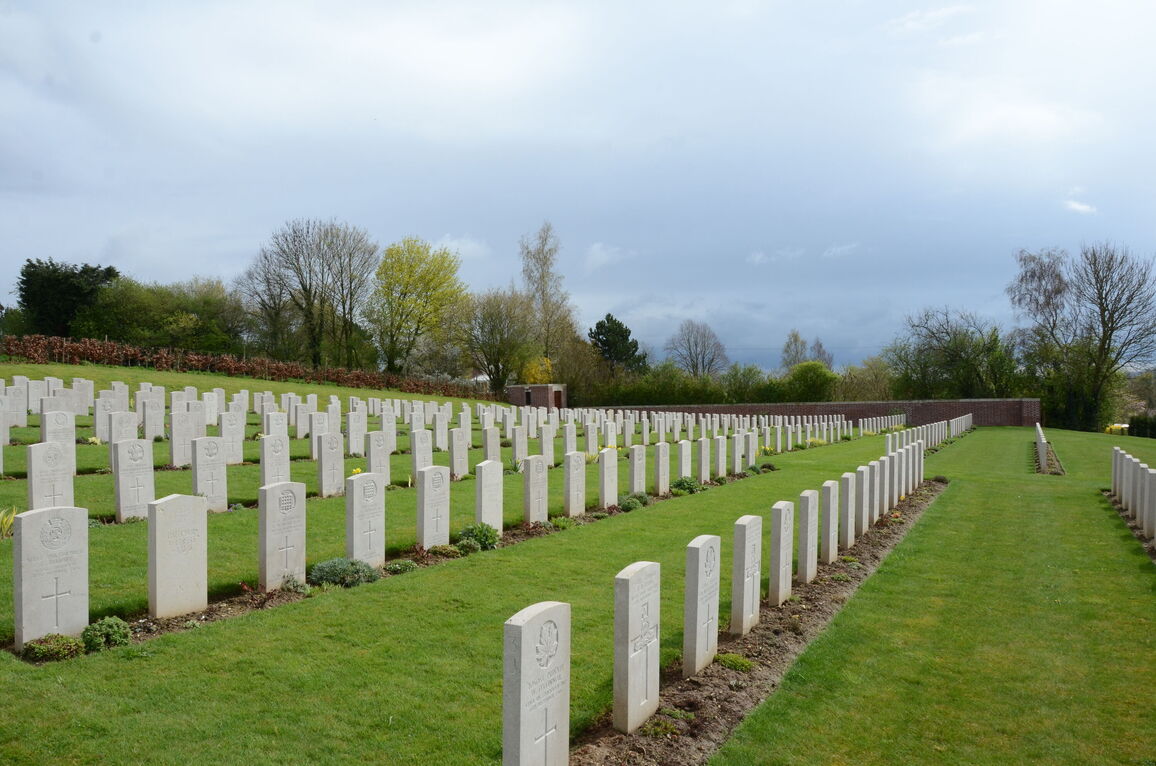
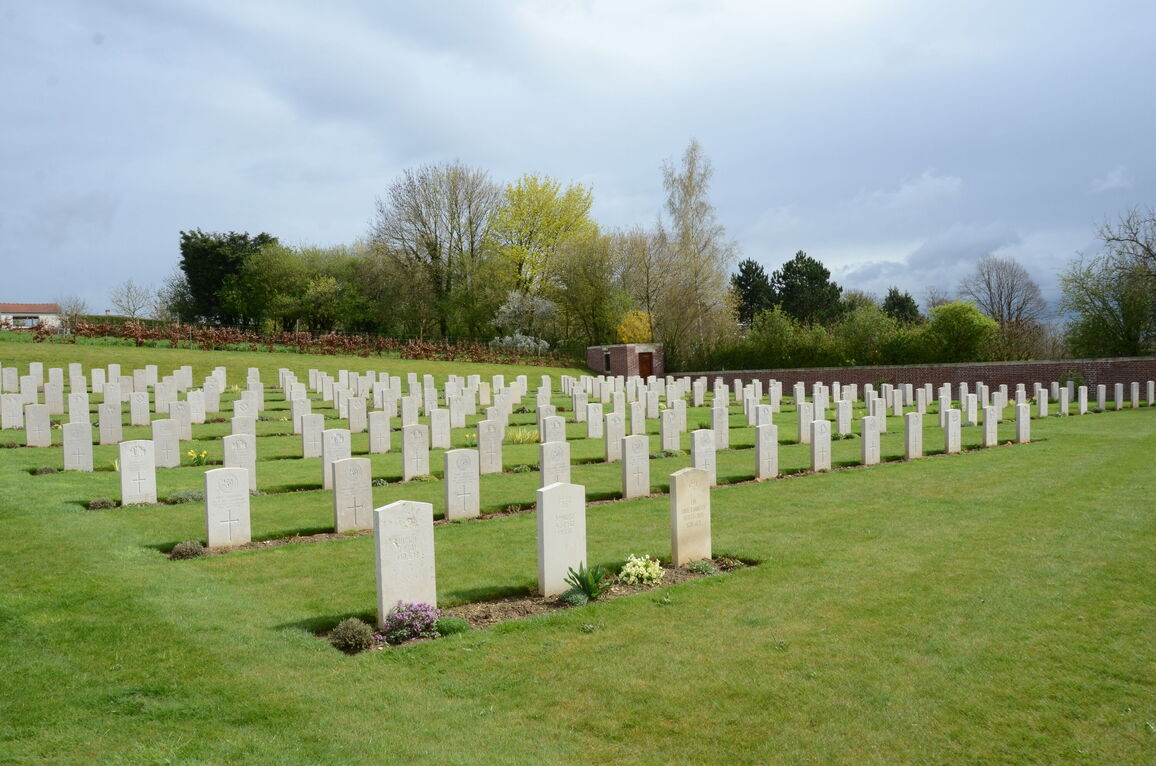
The burial area slopes upwards to the rear of the site, where the Stone of Remembrance is against the rear boundary wall.
The Register Box is inside the cemetery on the right-side stone entrance gate pillar.
All the internal paths are grass, the ground is steeply sloped with uneven areas.
There is no seating in the cemetery.
ALTERNATIVE ACCESS
There is no alternative access into the cemetery.
ADDITIONAL INFORMATION
The cemetery is permanently open.
The site is on a steep slope with rough grassed terrain, the site can become muddy and slippery during inclement weather and after excessive rain.
History information
The cemetery was begun by the 51st (Highland) Division when Commonwealth forces took over the Arras front in March 1916 and it retained its association with that division until the summer of 1918. Almost half of the graves are those of Highland territorials and many of those remaining are of London territorials who were at Maroeuil from July to December 1916. The cemetery also contains the graves of 25 officers and men of tunnelling companies of the Royal Engineers who died in mine explosions.
The cemetery was protected from observation by the crest of the hill behind it and whenever possible, bodies were brought back to it from the front line by tramway.
Maroeuil British Cemetery contains 563 Commonwealth burials of the First World War and 11 German war graves.
The cemetery was designed by Sir Reginald Blomfield.