Nieuwpoort Communal Cemetery
- Country Belgium
- Total identified casualties 94 Find these casualties
- Region West-Vlaanderen
- Identified casualties from First & Second World War
- GPS Coordinates Latitude: 51.13007, Longitude: 2.76444
Location information
Nieuwpoort Communal Cemetery is located in the town of Nieuwpoort, which is 20 Kms south west of Oostende.
From Oostende the N34 carries on to the N367 immediately after the King Albert Monument and the Achterhaven. 2 Kms along the N367 Brugsesteenweg lies the cemetery, on the right hand side of the road.
Visiting information
ARRIVAL
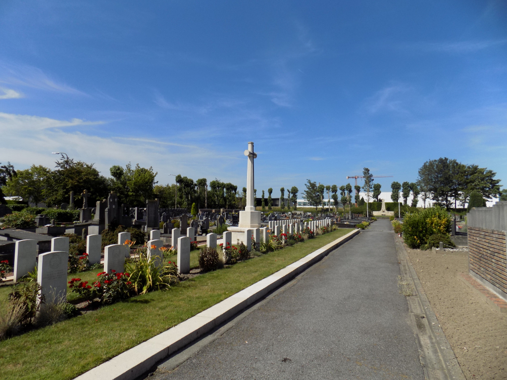
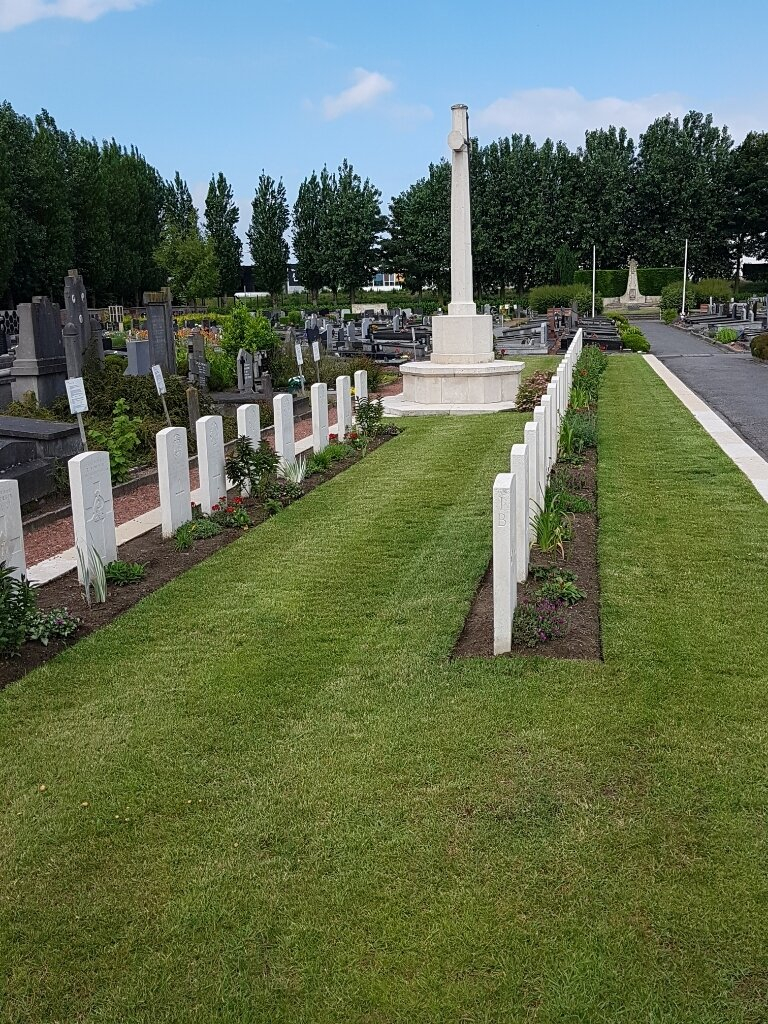
There are three CWGC (Commonwealth War Graves Commission) plots within Nieuwpoort Communal Cemetery.
The CWGC sections are in plot I, plot II and plot III.
The route to the cemetery is signposted.
PARKING
It is possible to park at the side of the road, Brugsesteeneg (N367) alongside the cemetery in a layby. Note the sections marked as bus stops. The distance from the closest available parking is 40 metres from the main entrance.
The ground is flat and firm with a tarmac surface.
It is also possible to park along the south side of the cemetery on the side of the road (Toevluchtweg).
ACCESS, LAYOUT AND MAIN ENTRANCE
The main entrance is a wide brick paved pathway leading to a large metal gate that is kept open during opening hours.
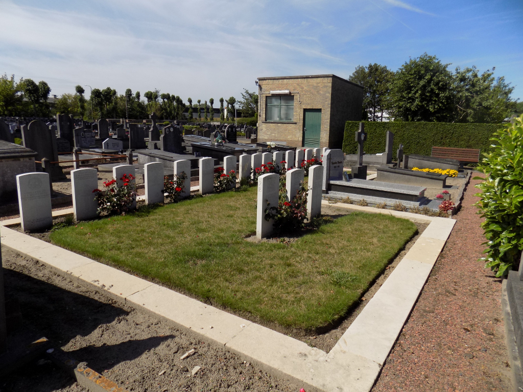
There are three CWGC plots located in various parts of the municipal cemetery.
Plots I and II (Great War casualties) are to the right of the main cemetery entrance once inside and can be located by the CWGC Cross of Sacrifice in the centre of the cemetery.
Plot III (Second World War casualties) is in the southeast corner of the corner of the cemetery, to the right of the Cross of Sacrifice plot and at the rear of the cemetery, straight down from the entrance.
All 3 plots are edged with raised white kerbstones, approximately 200 mm taller than the surrounding pathways. There are shallow concrete drainage channels between the pathways and the raised kerbs.
All plots are grass and the ground is flat and firm.
All the cemetery internal paths are paved or well compacted gravel.
There are benches scattered throughout the civil cemetery.
There is no Register Box for the site.
ALTERNATIVE ACCESS
There are entrances on the south side of the cemetery, off Toevluchtweg. There is a shallow stone gulley adjacent to the road, with a wide tarmac path leading through wide open gates into the cemetery. These entrances are closer to the CWGC plots, with the Cross of Sacrifice visible from the southeast entrances.
There is another entrance close to the northern end of the cemetery west of the main entrance. There is a double metal gate, approximately 2 metres wide that is open when the cemetery is open. There is parking in a layby on the opposite side of the main road opposite the entrance gate. There are cycle lanes on either side of the road with sloped kerbs from the roadside to cross and a slightly raised footpath adjacent to the cycle lane on the side of the road adjacent to the cemetery. Access is step free onto a tarmac path inside the cemetery.
ADDITIONAL INFORMATION
The cemetery is open
Monday to Saturday
April 1st to September 30th 09:00 to 21:00
October 1st to March 31st 09:00 to 19:00
Sundays and holidays 09:00 to 19:00
History information
Nieuwpoort (also known as Nieuport) was about the middle of the line held by XV Corps in June-November 1917. On 10 July 1917, there was heavy fighting in this sector as the Germans mounted an attack from Nieuwpoort northwards. Most of those buried in the cemetery died in June, July and August.
In May 1940, the British Expeditionary Force was involved in the later stages of the defence of Belgium following the German invasion, and suffered many casualties in covering the withdrawal to Dunkirk.
The cemetery contains 70 Commonwealth burials of the First World War (three of them unidentified) and 31 from the Second World War (four unidentified).