Oostende New Communal Cemetery
- Country Belgium
- Total identified casualties 339 Find these casualties
- Region West-Vlaanderen
- Identified casualties from First & Second World War
- GPS Coordinates Latitude: 51.20988, Longitude: 2.91582
Location information
Oostende New Communal Cemetery is located in the town of Oostende on the Stuiverstraat, a road leading from the R31 Elisabethlaan.
Travelling towards Brussels on the R31 the Stuiverstraat is located 500 metres after the junction with the N33.
The cemetery is located 800 metres along the Stuiverstraat on the right hand side of the road.
Visiting information
ARRIVAL
The route to the cemetery is signposted.
There are signs on the main gate indicating that there are CWGC (Commonwealth War Graves Commission) graves in the cemetery (Oostende Cemetery Stuiverstraat)
PARKING
There are parking spaces in a car park across the road from the cemetery entrance, as well as alongside the main road adjacent to the communal cemetery, on Stuiverstraat.
There is a dedicated accessible parking spot in the car park across from the main entrance. There is a pedestrian crosswalk adjacent to the car park to cross the main road to the cemetery entrance.
A bicycle path runs between the parking and the footpath along the cemetery boundary wall.
The ground surface is a mixture of brick paved and tarmac and is flat and firm.
ACCESS, LAYOUT AND MAIN ENTRANCE
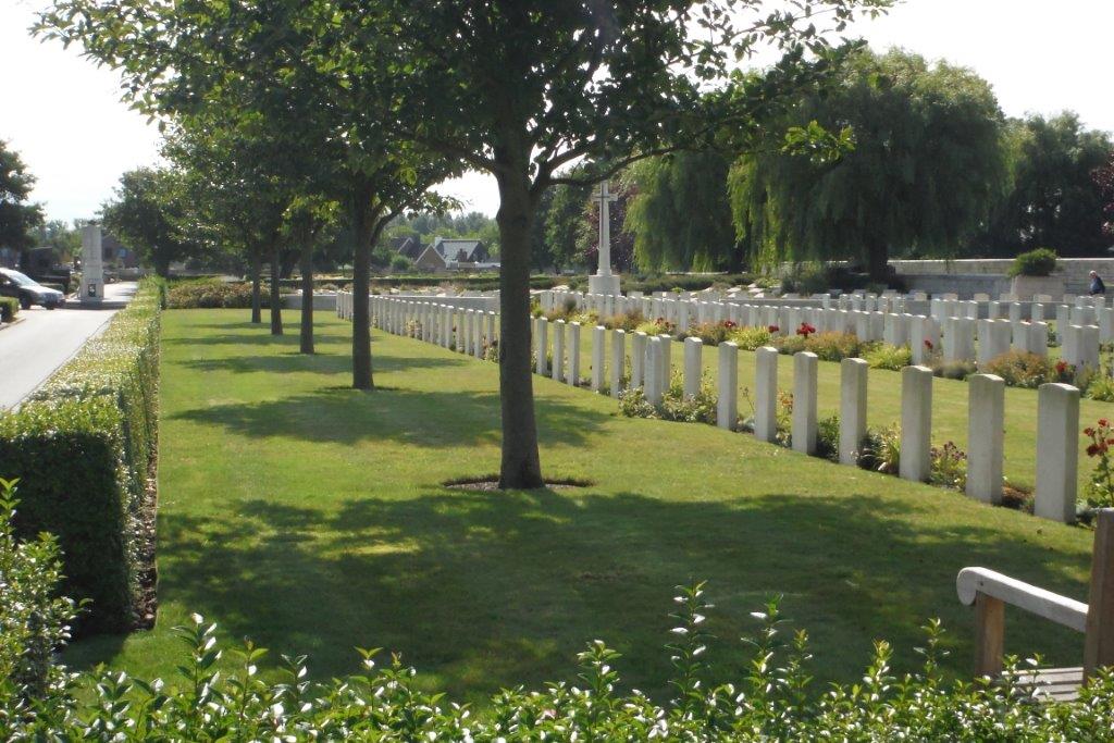
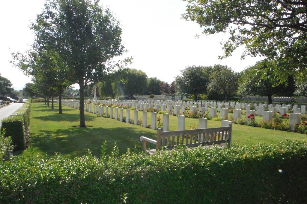
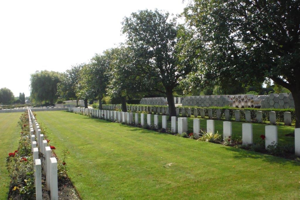
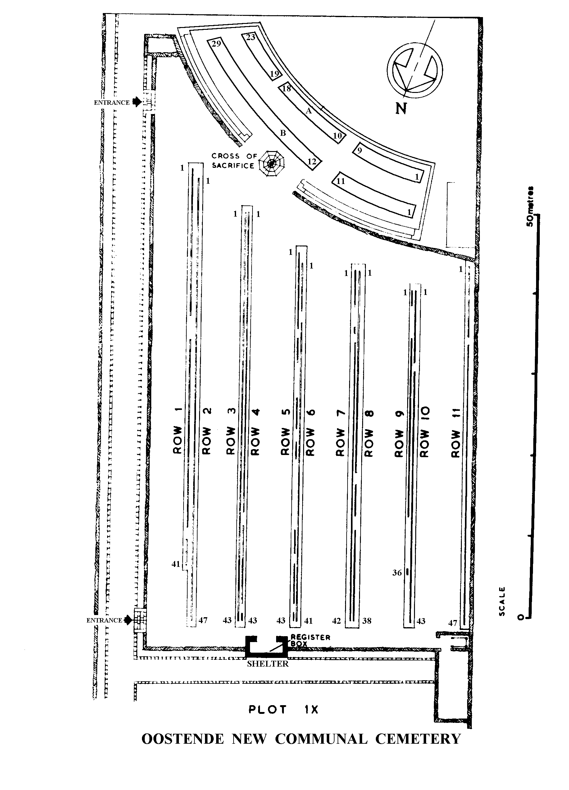
The cemetery is a large municipal, civilian cemetery organised into sections containing military and civilian burials.
The main entrance has a tall and wide black metal gate with a central opening section that is a single vehicle width. There are 2 doors in the gate on either side of the centre section.
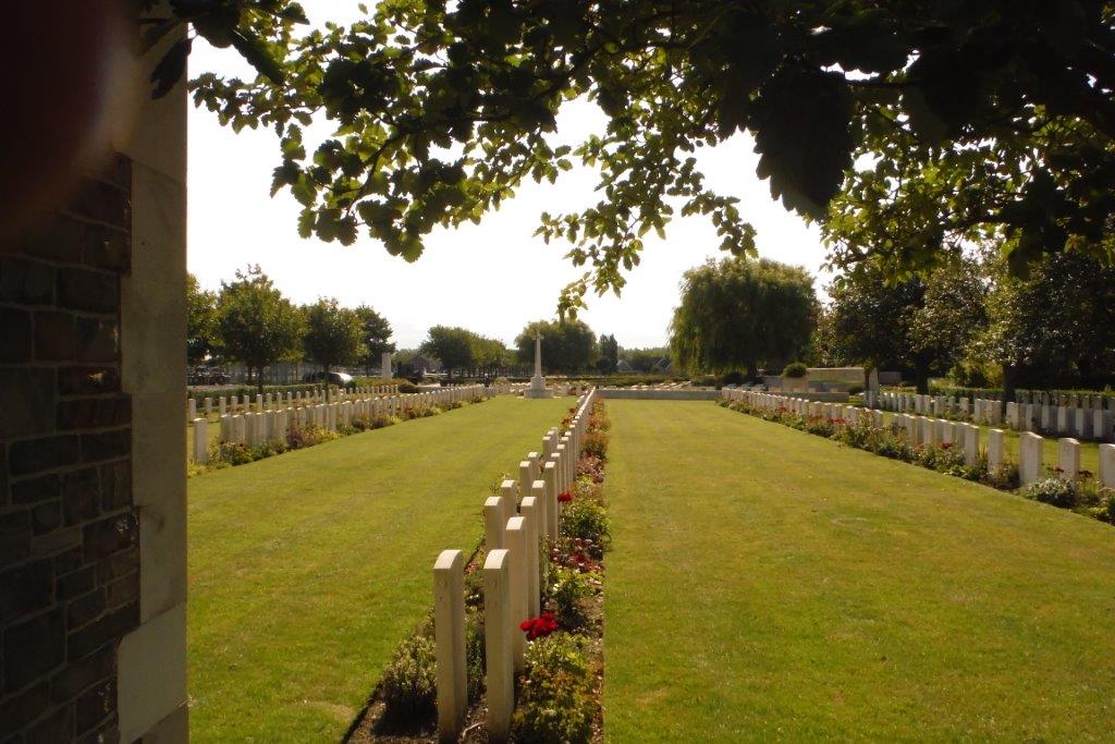
The CWGC plot is close to the centre of the cemetery, approximately 150 metres from the main entrance. Follow the pathway from the main entrance towards the centre of the cemetery. The pathway is a single vehicle width and tarmacked, the ground is flat and firm.
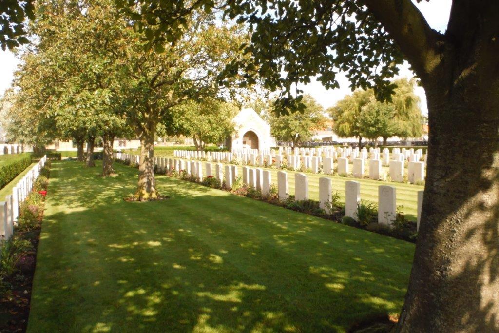
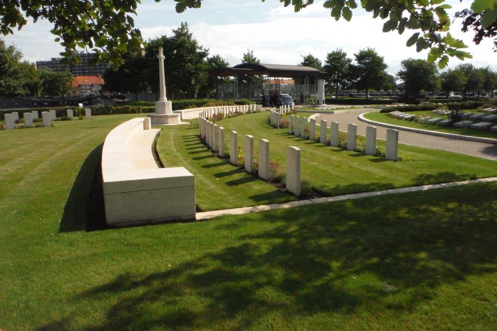
Access to the cemetery plot is at either end of the site along the paved access road in the civil cemetery. A shallow brick drainage channel runs along the tarmac road. From the road, three steps lead up to the cemetery at the southern end of the site, near the Cross of Sacrifice. Four steps lead up at the far end of the site, near a shelter building. Both sets of steps lead directly onto grass.
There is a separated section of the plot, with a curved seating structure running along the boundary. Access into this section is on either side of the Cross of Sacrifice, located at the centre of the arc. A stone kerb, level with the turf and road also offers access. The kerb along the road is approximately 100 mm high.
There is a stone and brick-built shelter building at the far end of the cemetery. A shallow step up from a paved area in front of the shelter leads inside. The Register Box is located inside along with wooden benches.
ALTERNATIVE ACCESS
On the far top right corner of the site, on a paved road along the northern boundary near the shelter building, a depressed kerb, approximately 800 mm wide allows step free access into the site. Grass leads up to an opening in the boundary hedge into the rear right corner of the cemetery.
ADDITIONAL INFORMATION
The Oostende Stuiverstraat Cemetery website indicates that the side is accessible at all times.
History information
From the 13th to the 22nd August, 1914 Oostende (also known as Ostende) was a British seaplane base, and for four days at the end of the month it was protected by the British Marine Brigade. From the 7th to the 12th October it was the seat of the Belgian Government. On the 8th October the 3rd Cavalry Division landed at Oostende; but the port was closed on the 14th and entered by the Germans next day.
Thereafter, Oostende was periodically bombarded by ships of the Royal Navy and bombed by Allied airmen. On 23 April and 10 May 1918, it was raided by the Dover patrol in an attempt to block the port as an outlet for German torpedo boats and submarines based at Bruges. The attack of 23 April failed to block the harbour but that of 10 May, when "Vindictive" was sunk in the channel, partially succeeded. The town was finally entered by Allied forces on 17 October 1918, without opposition.
During the Second World War, the British Expeditionary Force was involved in the later stages of the defence of Belgium following the German invasion in May 1940, and suffered many casualties in covering the withdrawal to Dunkirk. Commonwealth forces did not return until September 1944 (Oostende was liberated by the Canadians on 8 September), but in the intervening years, many airmen were shot down or crashed in raids on strategic objectives in Belgium, or while returning from missions over Germany.
The Commonwealth plots at Oostende New Communal Cemetery contain 50 burials of the First World War and 366 from the Second World War, 75 of the latter unidentified. The plots also contain eight non-war burials and eight war graves of other nationalities.