Fontaine-La-Louvet Churchyard
- Country France
- Total identified casualties 5 Find these casualties
- Region Eure
- Identified casualties from Second World War
- GPS Coordinates Latitude: 49.16531, Longitude: 0.44985
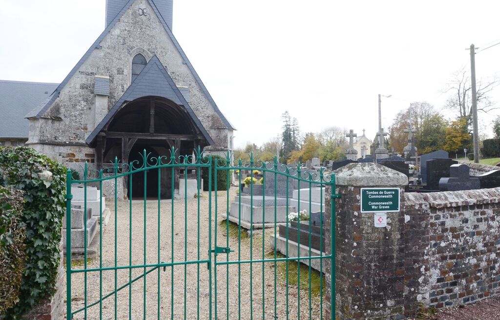
Location information
Fontaine-la-Louvet is a village and commune lying about 53 kilometres west-north-west of Evreux and 16 kilometres east of Lisieux, just over 1.5 kilometres north of the main Evreux-Lisieux road (N.13). The most convienient railway station however, is Bemay, approximately 24 kilometres south-east of the village, on the Rouen-Le Mans-Tours railway, where taxis are available to complete the journey to the churchyard.
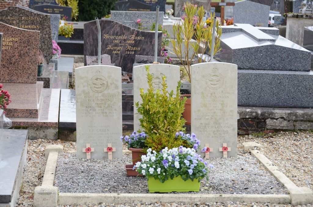
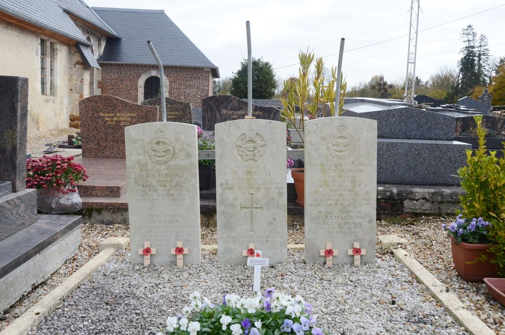
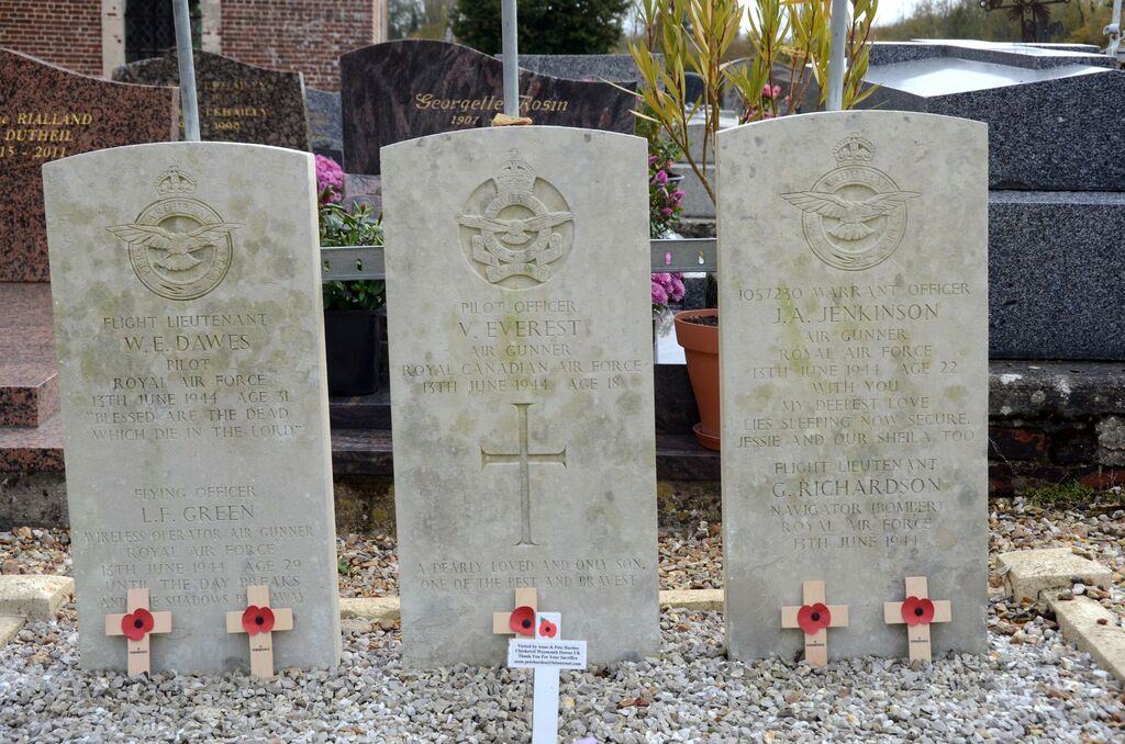
Near the north-western corner of the church is the Collective Grave of 5 airmen.