Bayeux Memorial
- Country France
- Total identified casualties 1798 Find these casualties
- Region Calvados
- Identified casualties from Second World War
- GPS Coordinates Latitude: 49.27423, Longitude: -0.71383
Location information
The town of Bayeux, in Normandy, lies 30 kilometres north-west of Caen. The Bayeux Memorial is situated in the south-western outskirts of the town on the by-pass (D5), which is named Boulevard Fabian Ware. On the opposite side of the road is the Bayeux War Cemetery.
Visiting information
ARRIVAL
The memorial is on Boulevard Fabian Ware, the route to the memorial and cemetery is signposted.
PARKING
Approximately 300 metres from the memorial is Musee de la Bataille de Normandie, where there is a large car park with space for multiple vehicles.
The route from the car park to the memorial is along a pedestrian path at the side of the main road.
The ground is flat and firm with a tarmac surface.
It is not possible to park in front of the memorial.
ACCESS LAYOUT AND MAIN ENTRANCE
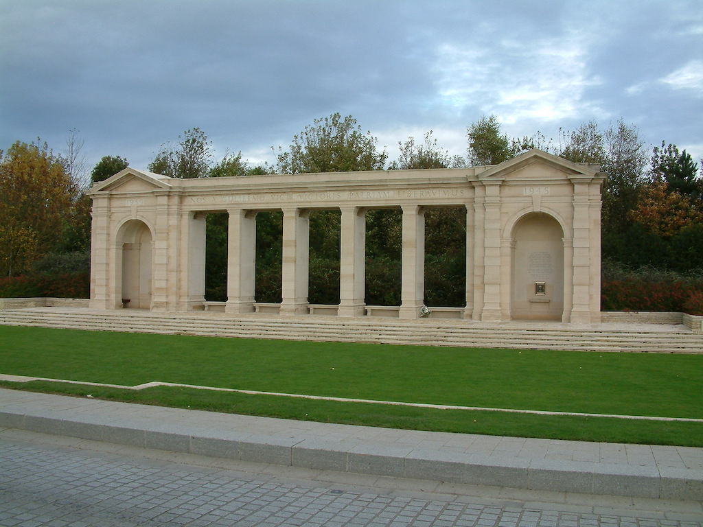
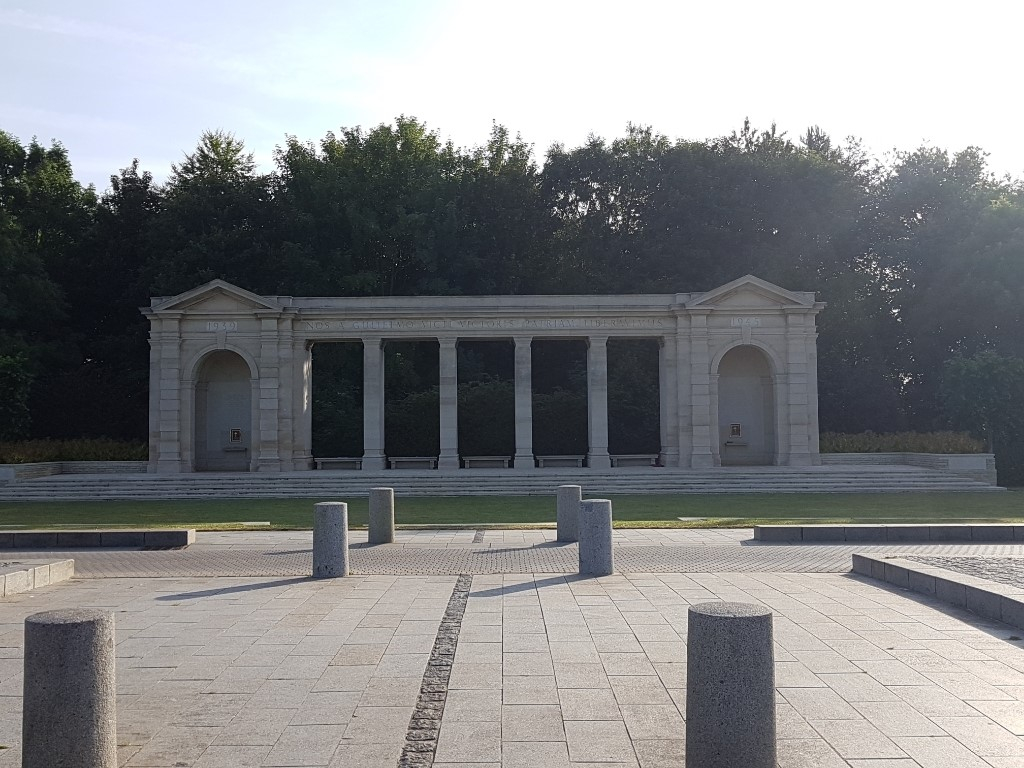
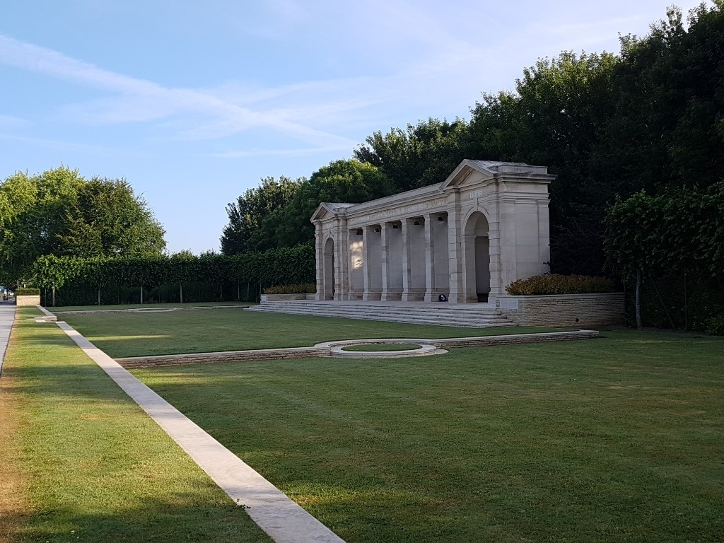
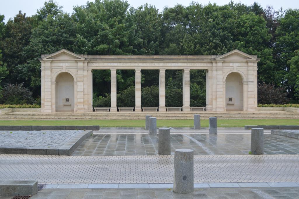
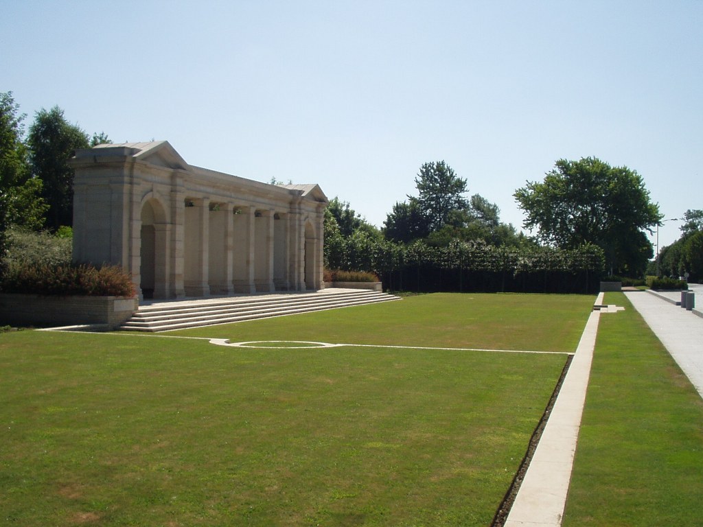
A large stone memorial located on a raised platform, with 5 stone steps going up to the structure from ground level. The memorial platform is comprised of roughened cobbles, with flat paving between the pillars.
At each end of the memorial are enclosed shelter buildings containing seating and Register Boxes. There are five open archways with stone bench seating areas. These seating areas are open to the rear of the memorial.
There is large flat grassed area between the pedestrian path and the steps leading up to the memorial. The area is surrounded by a low-level wall approximately 150 to 400 mm above grass level along the left and right sides facing the memorial and along the wall adjacent to the pedestrian pathway. Three steps lead down to the grassed area from the pedestrian pathway, and two semi-circular steps lead down to the lower adjacent section of grass on the left and right sides of the grassed area.
ALTERNATIVE ACCESS
There is no alternative access to the memorial.
ADDITIONAL INFORMATION
The Memorial is permanently open, there are no gates or barriers around the Memorial.
Access to the memorial is within three metres of the pavement and 25 metres from the main entrance to Bayeux War Cemetery, across a pedestrian crosswalk. The road is comprised of two single lanes for vehicle traffic, and a 4 metre-wide paved island between. The road is cobbled with flat paving stones for pathways adjacent to the roadway.
History information
The Allied offensive in north-western Europe began with the Normandy landings of 6 June 1944.
The BAYEUX MEMORIAL stands opposite the cemetery and bears the names of more than 1,800 men of the Commonwealth land forces who died in the early stages of the campaign and have no known grave. They died during the landings in Normandy, during the intense fighting in Normandy itself, and during the advance to the River Seine in August.
There was little actual fighting in Bayeux although it was the first French town of importance to be liberated. BAYEUX WAR CEMETERY is the largest Commonwealth cemetery of the Second World War in France and contains burials brought in from the surrounding districts and from hospitals that were located nearby.
The cemetery contains 4,144 Commonwealth burials of the Second World War, 338 of them unidentified. There are also 505 war graves of other nationalities, the majority German.
The Memorial was designed by P.D. Hepworth and unveiled by The Duke of Gloucester on 5 June 1955.