Gouesnou Churchyard
- Country France
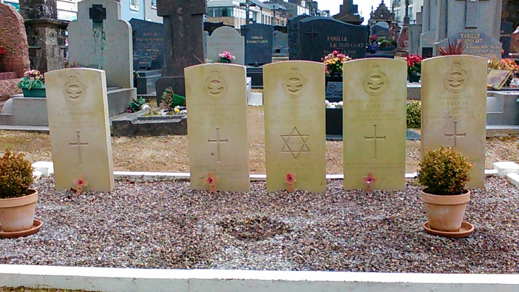
- Total identified casualties 5 Find these casualties
- Region Finistere
- Identified casualties from Second World War
- GPS Coordinates Latitude: 48.45166, Longitude: -4.46713
Location information
The village of Gouesnou is about 57 kilometres north-west of Quimper and some 7 kilometres north of Brest, at the point where the main road from Brest meets the roads from Guipavas, Plabennec, St Renan and Lannilis. The churchyard is in the centre of the village and in the northern corner, left of the entrance, are the graves of 5 airmen of the Royal Air Force.