Bertenacre Military Cemetery, Fletre
- Country France
- Total identified casualties 143 Find these casualties
- Region Nord
- Identified casualties from First & Second World War
- GPS Coordinates Latitude: 50.77789, Longitude: 2.63051
Location information
Bertenacre Military Cemetery is situated half way between the villages of Eeke and Godewaersvelde, which are 10 kilometres north-east of Hazebrouck in the department of the Nord.
From Eeke, take the D139 and head east. Once over the motorway, which is some 2 kilometres from the village, turn immediately right onto the track leading to Bertenacre Military Cemetery.
Visiting information
ARRIVAL
The route to the cemetery from the main road is sign posted.
PARKING
It is possible to park off the main road (D-139) in a small turning circle (area) where a single lane metalled track turns off to the left-hand side of the main road.
ACCESS LAYOUT AND MAIN ENTRANCE
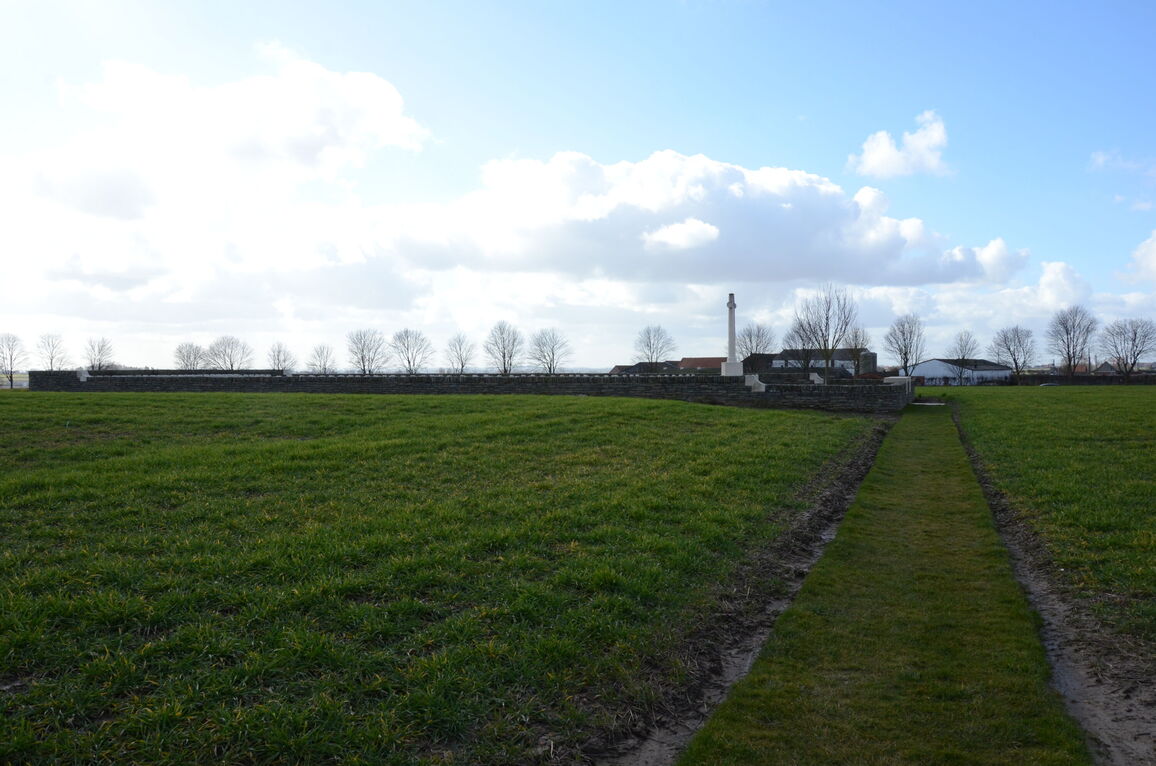
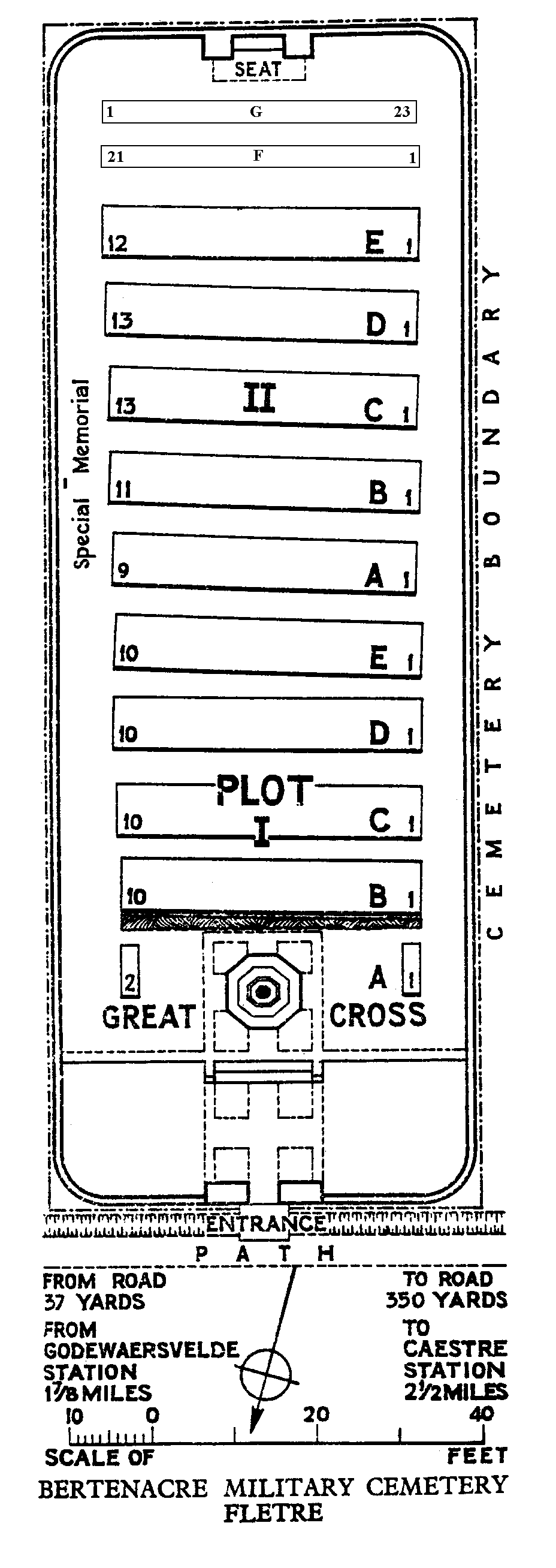
There is a gravel and dirt track that winds from the turning area, a distance of approximately 300 metres to a grass pathway that leads to the cemetery entrance. The pathway is 40 metres long. The cemetery is rectangular in shape and within agricultural fields.
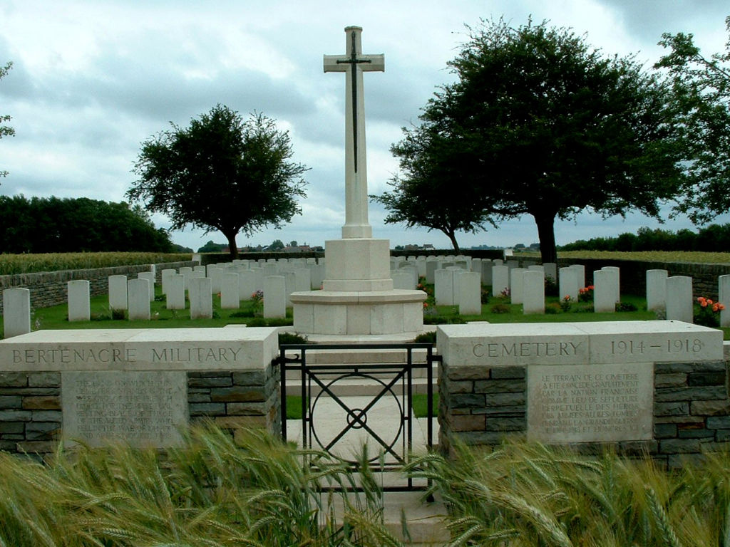
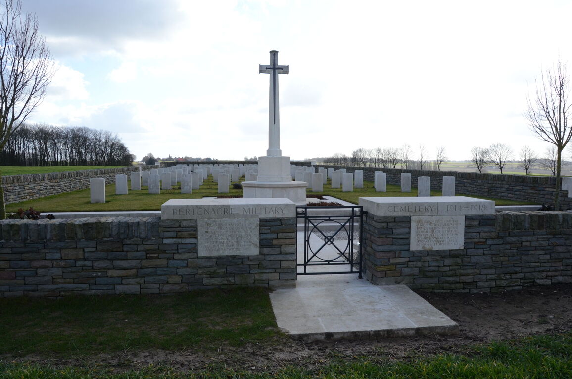
The main entrance to the cemetery is built into a stone wall with a central gate. A black metal, waist- height gate with an up-down latch, opens inwards into the cemetery.
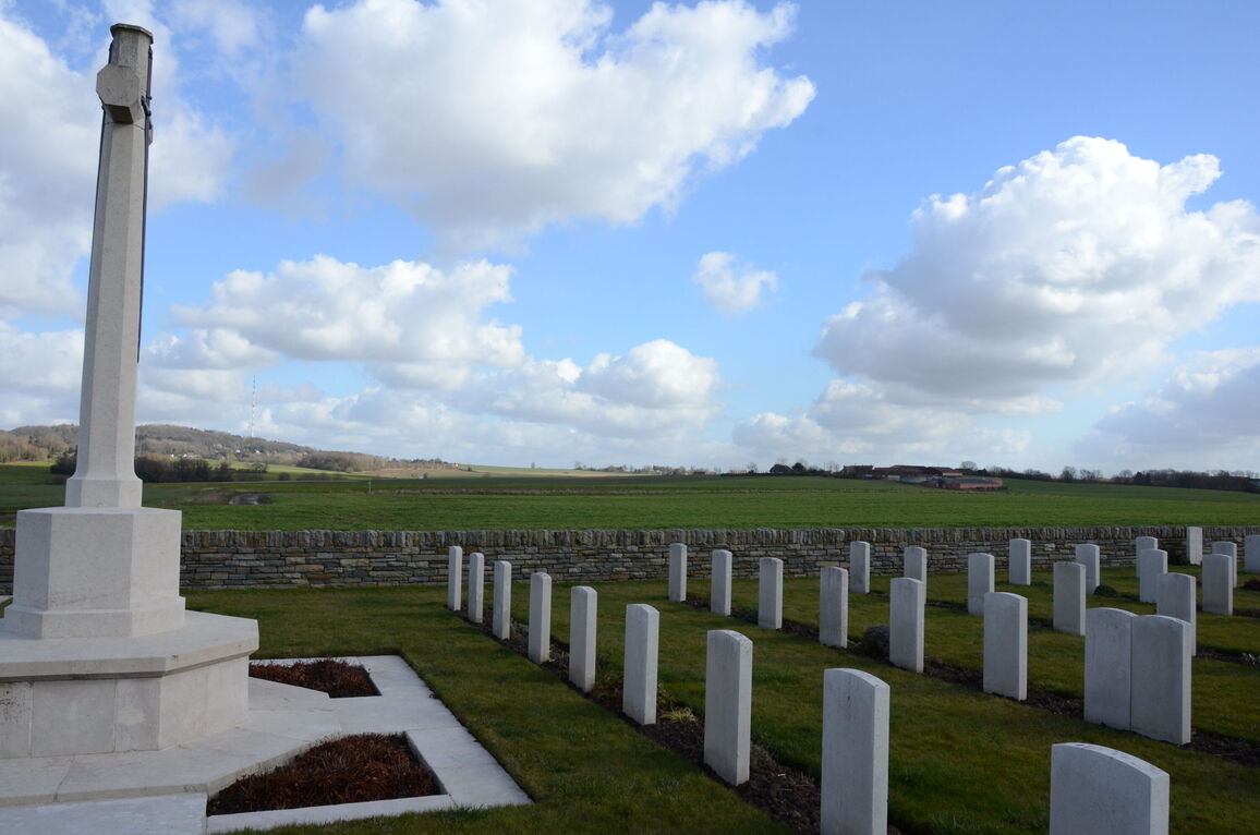
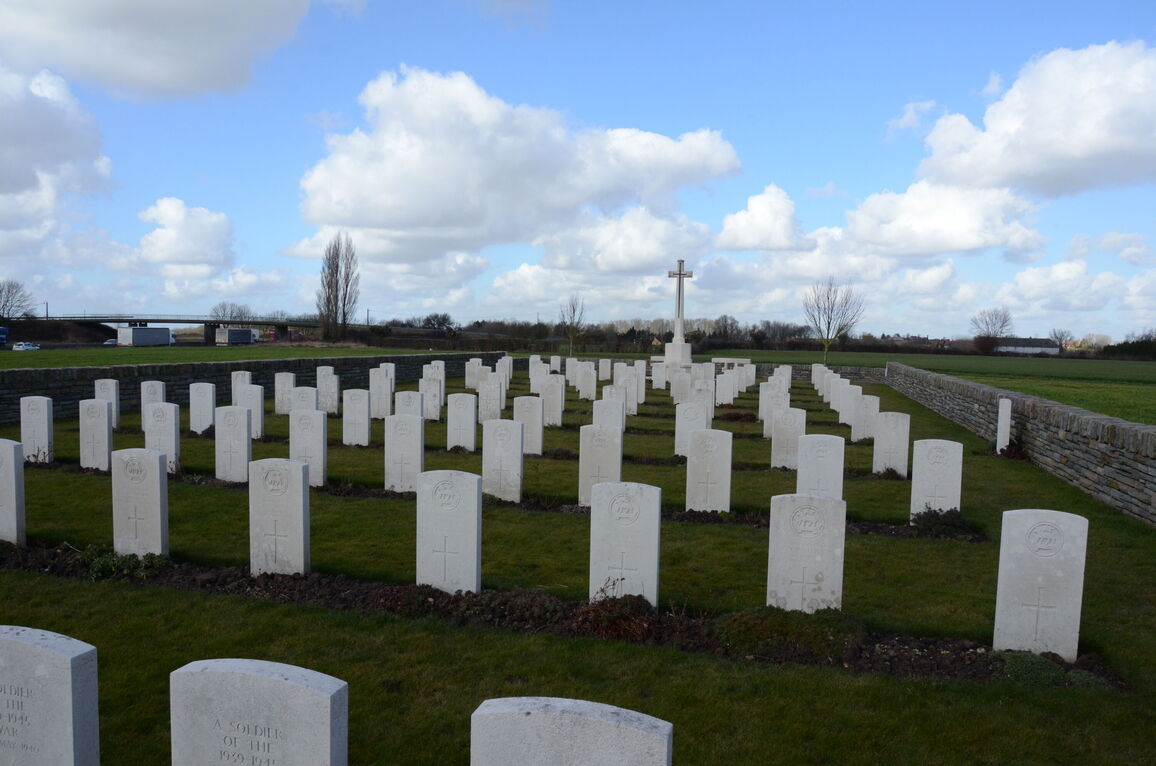
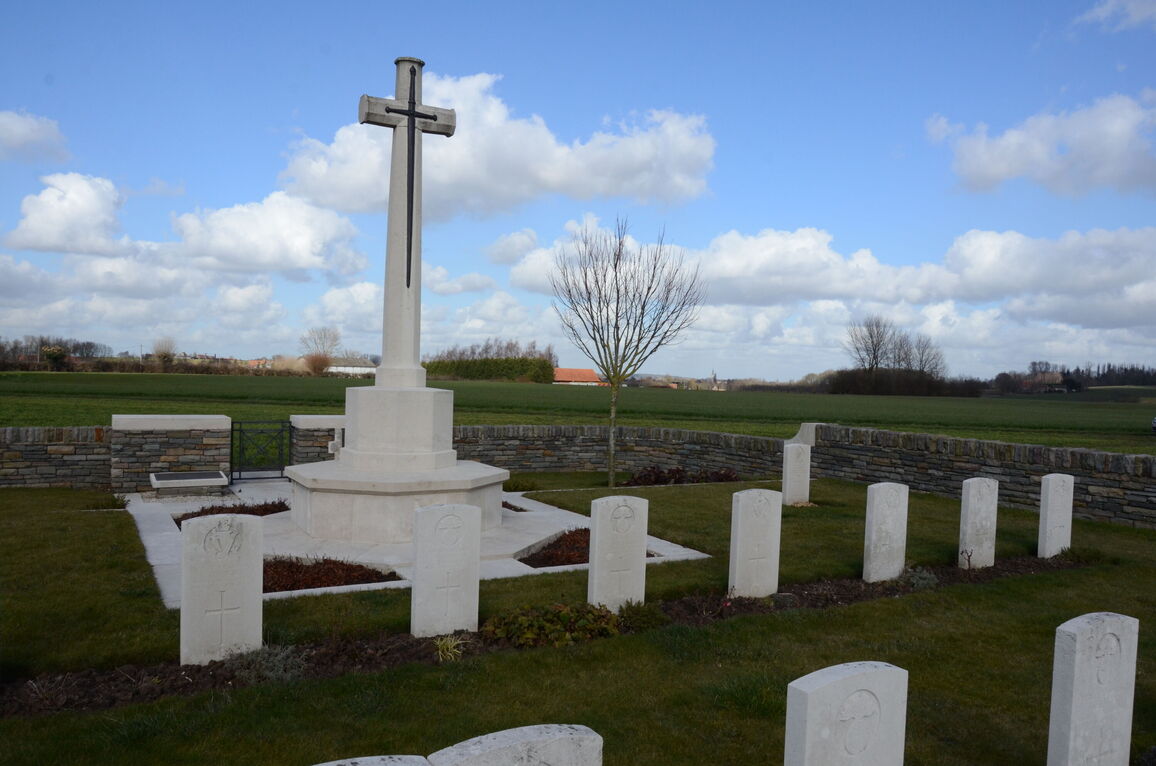
Stone paving, level with the grass, is located on the outside of the entrance and carries through inside to the lower section of the cemetery. There is a combination of paved and gravelled area, with a wall approximately 600 mm tall separating the upper section. Three steps lead up to the Cross of Sacrifice and the burial area behind the Cross. The ground level of the upper section is 600 mm higher than the entrance level, with a vertical drop from the top of the wall which is level with the grass.
The Register Box is located at the main entrance, on the inside wall adjacent to the gate.
There is a stone bench seating area at the far end of the cemetery, opposite the main entrance.
All internal paths are grass, the ground is firm and gently sloped.
ALTERNATIVE ACCESS
The only access into the cemetery is via the main entrance.
Tracks leading to the cemetery can become muddy and waterlogged in wet weather conditions.
ADDITIONAL INFORMATION
The cemetery is within agricultural fields and is built on a gentle slope.
The cemetery is permanently open.
History information
The cemetery was made by French troops (as the Cemetery "du Calvaire de Bertenacre", from the crucifix on the main road), and used in July-September, 1918, after the Battles of the Lys, by the 36th (Ulster) Division. After the Armistice the 115 French and two German graves were removed, and British graves were brought in from the following cemetery:-
ROYAL WEST SURREY CEMETERY, Fletre, was about 460 metres to the South-East. It contained the graves of 42 soldiers from the United Kingdom killed in an enemy air raid on the 18th August, 1917 (of whom 38 belonged to the 10th Queen's), and one Canadian soldier who fell in June, 1918.
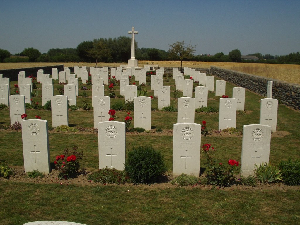
There are now nearly 150, 1914-18 and over 30, 1939-45 war casualties commemorated in this site. One grave from the 1914-18 War, destroyed by shell fire, is represented by a special memorial. Most of the burials from the 1939-45 War were men of the 5th Cinque Ports Battalion, Royal Sussex Regiment.
The cemetery covers an area of 716 square metres and is enclosed by a rubble wall.