Ascq Communal Cemetery
- Country France
- Total identified casualties 58 Find these casualties
- Region Nord
- Identified casualties from First & Second World War
- GPS Coordinates Latitude: 50.61896, Longitude: 3.16602
Location information
Ascq is a town 7 kilometres south-east of Lille on the road to Tournai.
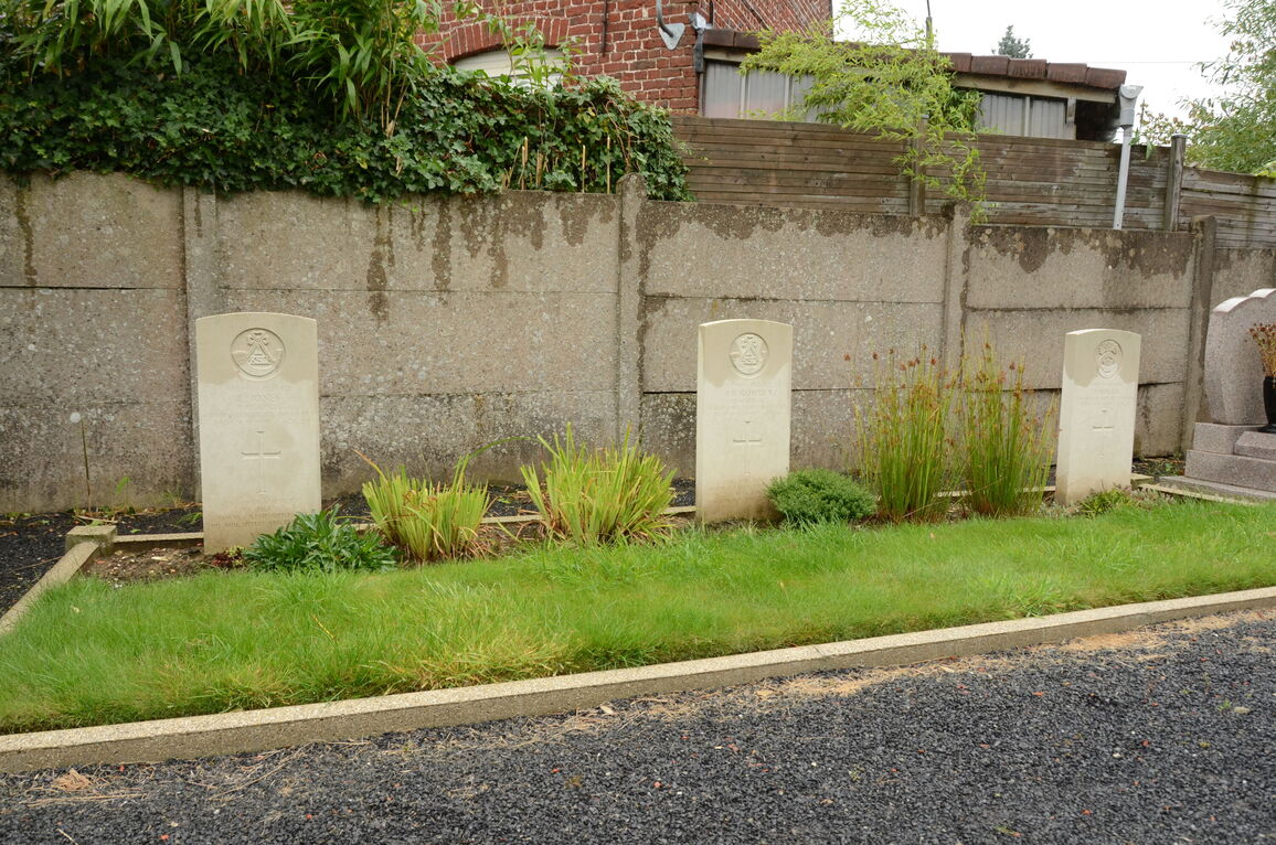
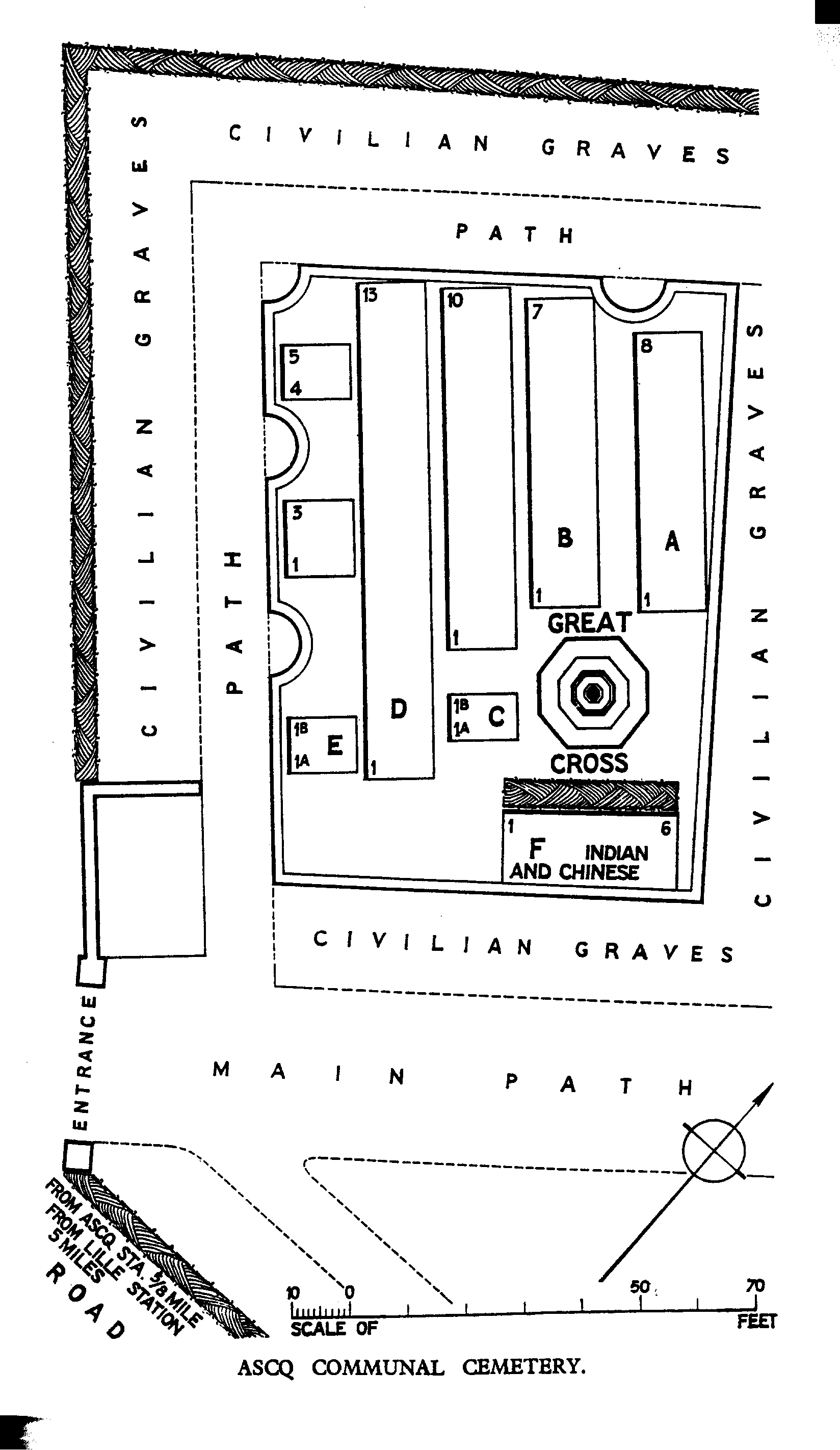
From the church in Ascq, head north-east towards Annappes. Take the first right, opposite the Marie, and then first left onto Rue de l'Abbe Lemire. The communal cemetery is 200 metres along on the left hand side of the road. The main Commonwealth War Graves plot is on the left near the entrance, and the second plot is 50 metres further along on the right.
Visiting information
ARRIVAL
The cemetery is signposted and located within the Commune’s public cemetery (Cimetiere d’Ascq) in Villeneuve-d’Ascq, on the eastern edge of Lille.
The entrance to the cemetery is located at the junction of Rue de l’Abbe Lemire and Rue Aristide
PARKING
There is a car park at the front of the civilian cemetery with space for multiple vehicles.
There is a dedicated disabled parking space next to the entrance gate.
The distance from the parking area to the main entrance is approximately 25 metres.
The ground is flat and firm; a combination of tarmac and paving stones.
ACCESS LAYOUT AND MAIN ENTRANCE
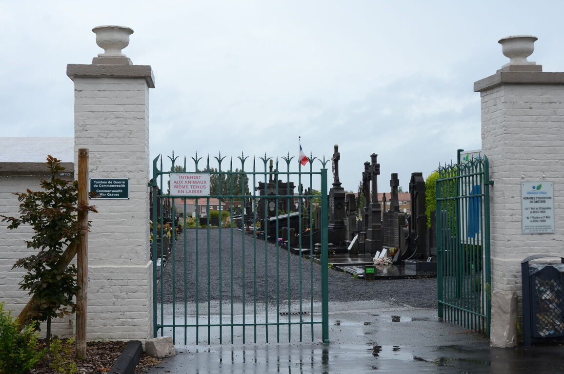
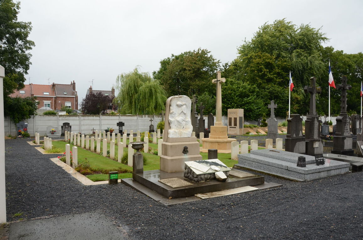
The main cemetery gates are 4 metres wide, blue metal, and double sided. The gate should be open during opening hours. The CWGC plot is located inside the main gate on the left side of the main pathway in the civil cemetery.
There is a cobbled drainage channel and drainage grille inside the main entrance on the main tarmac pathway into the cemetery.
A tarmac and gravel pathway leads to the CWGC plot on the left side just inside the entrance.
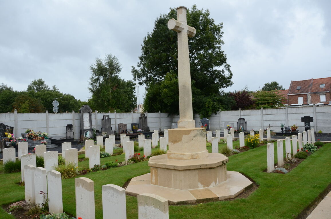
The plot is surrounded by a stone kerb boundary. The kerb height above the interior grass plot varies from 100 to 50 mm.
In the centre of the plot is the Cross of Sacrifice.
The internal paths are grass; the ground is flat and firm.
The paths surrounding the CWGC plot are flat, firm tarmac or compacted gravel.
There is no Register Box or seating in the plot. There is a wooden bench in a council shelter building next to the entrance.
ALTERNATIVE ACCESS
It is possible to enter the civil cemetery from rue Kleber, at the opposite end of the cemetery. There is a gravel track leading to a two leaf metal gate, approximately 50 metres from the road. The central tarmac pathway leads to the CWGC plot, a distance of over 200 metres.
ADDITIONAL INFORMATION
Access to the cemetery is within working hours as advised on the main gate.
April 1st – October 15th 08h30 to 20h00
October 16th – March 31st 08h30 – 17h00
History information
The 229th Field Ambulance, the 13th and 63rd Casualty Clearing Stations and the 39th Stationary Hospital were posted in the village for periods of a few months at the end of 1918 and in 1919.
There are now over 50, 1914-18 and a small number of 1939-45 war casualties commemorated in this site.
The British plot covers an area of 249 square metres and is enclosed by a low stone curb.