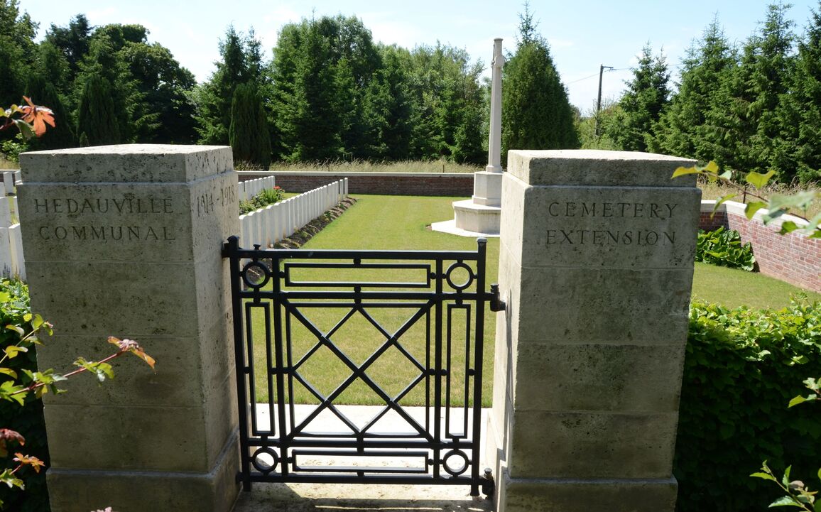
Hedauville Communal Cemetery Extension
- Country France
- Total identified casualties 176 Find these casualties
- Region Somme
- Identified casualties from First & Second World War
- GPS Coordinates Latitude: 50.04755, Longitude: 2.56542
PLEASE NOTE
Due to access works at the communal cemetery, the cemetery will be inaccessible until the end of December 2025. We apologize for any inconvenience we caused.
Location information
Hedauville is approximately 5 kilometres north-west of Albert, on the road to Doullens.
Using the D919 from Arras to Amiens you will drive through the villages of Bucquoy, Puisieux, Serre-les-Puisieux and Mailly Maillet. After leaving Mailly Maillet continue on the D919 until you come to a crossroads where you should turn right on to the D938 in the direction of Doullens. Hedauville Communal Cemetery is 600 metres further on the right.
Visiting information
The cemetery is signposted, the Commonwealth War Graves Commission (CWGC) cemetery is to the right of the municipal cemetery.
ARRIVAL
There is a signpost at the side of the road, indicating the route following a grass track leading to the cemetery.
The entrance of the track from the side of the road is a steep bank with a mixture of gravel, earth, and grass.
PARKING
It is possible to park at the side of the main road along the front of the municipal cemetery in the layby.
The ground is firm and flat, and is a mixture of gravel and compacted earth.
ACCESS LAYOUT AND MAIN ENTRANCE
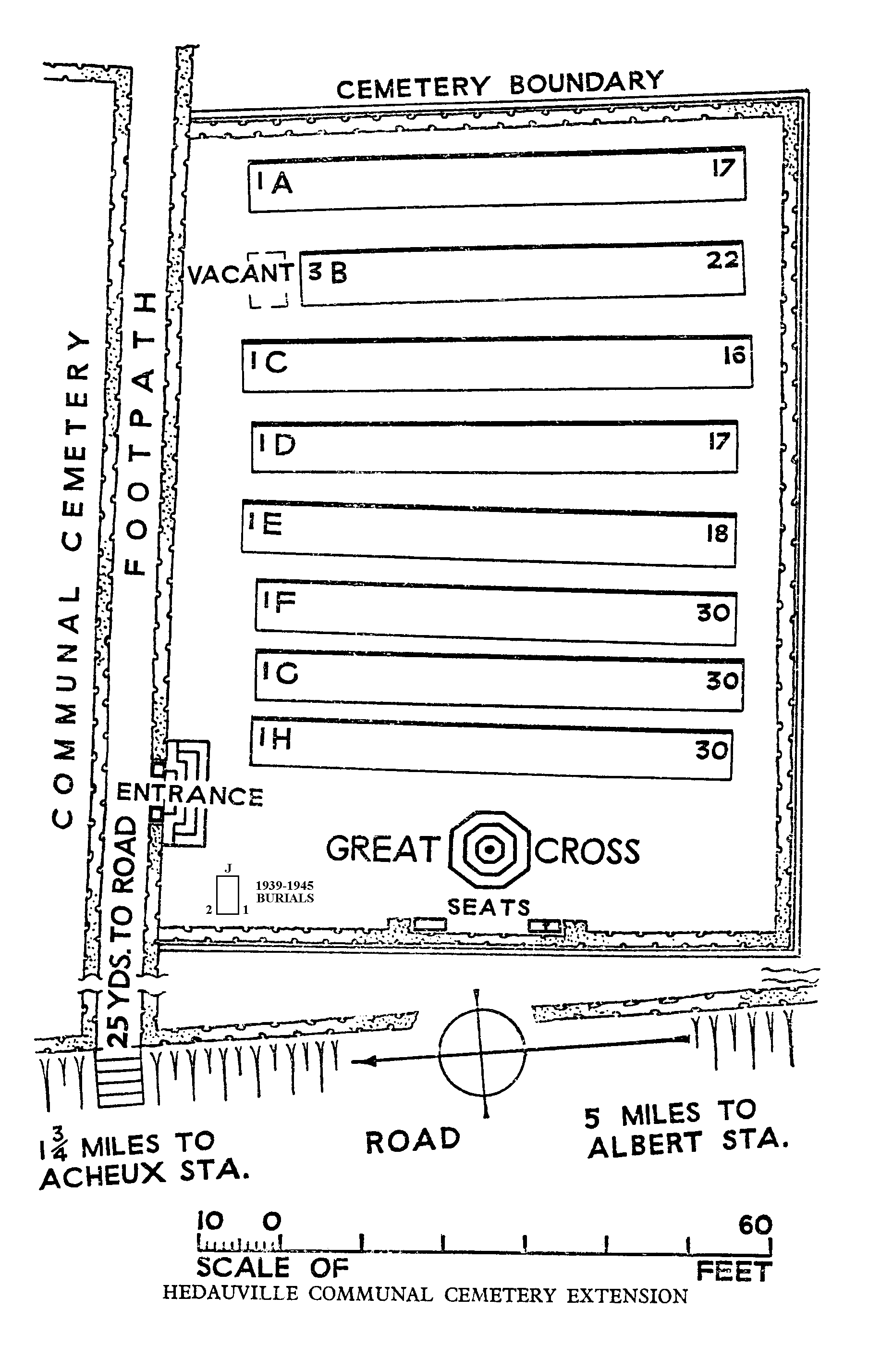
There is a 30-metre-long grass track from the main road and parking area, leading to the main entrance to the cemetery. The grass pathway continues another 25 metres to the far end of the cemetery.
The main gate is on the right-hand side of the path. The gate is mid-level, black metal, waist height, with an up and down latch handle on the left side and opens into the cemetery. There is a 75 mm wide, 50 mm deep dirt strip between the grass and the paving underneath the gate. The paving is 50 mm higher than the grass on the outside of the gate. There are steps down immediately inside the gate in line with the stone pillars on either side of the gate.
There are four stone steps from the inside of the gate, down into the burial area. There is a 75 mm wide dirt strip between the paving and the grass inside the cemetery.
The Register Box is built into the pillar on the right inside the main entrance.
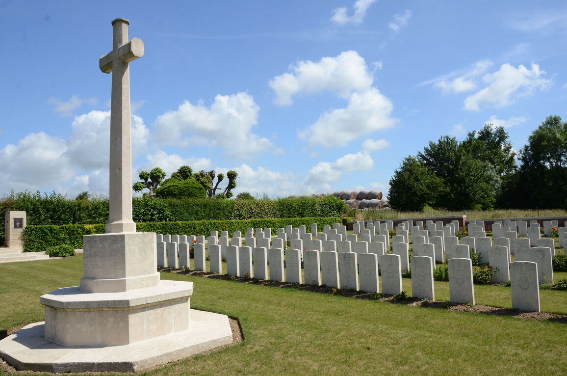
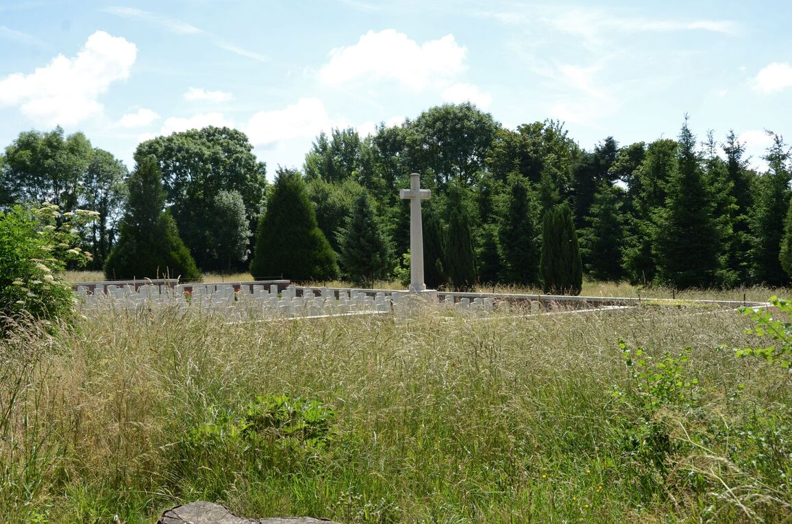
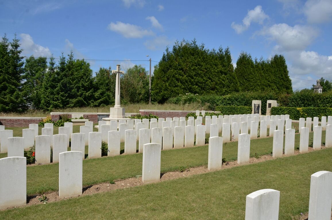
The Cross of Sacrifice is close to the main entrance in the centre of the cemetery.
There are stone bench seating areas against the perimeter wall of the cemetery, behind the Cross of Sacrifice.
Internal paths are grass, the ground is firm and mostly flat, there are some slightly sloped areas.
ALTERNATIVE ACCESS
There is an unrestricted entrance into the cemetery, beyond the main entrance gate at the end of the grass track coming from the main road and parking area.
There is an opening between the hedge and wall, approximately 1.5 metres wide with a stone kerb level with the grass on either side. The grass slopes downwards steeply from the path into the cemetery.
ADDITIONAL INFORMATION
The cemetery is permanently open.
History information
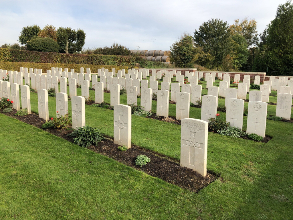
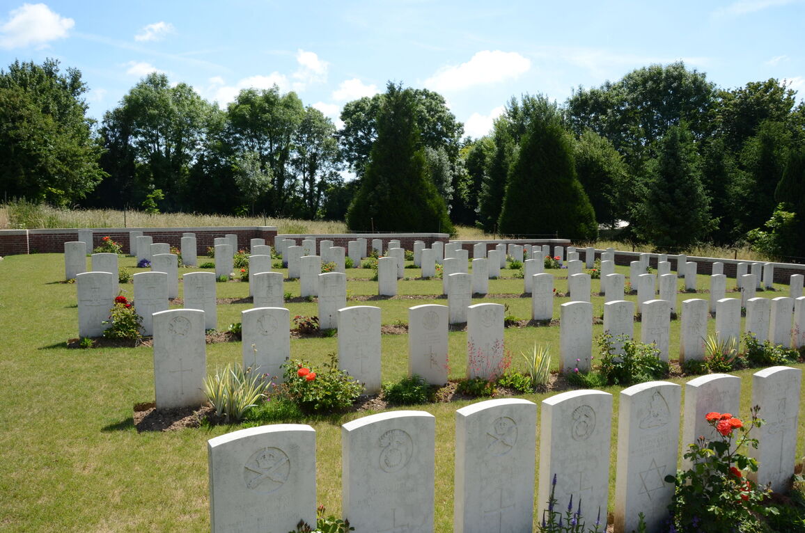
The extension was begun at the end of March 1918, when the front line was consolidated a short distance east of the village following the German offensive. It was used by field ambulances and fighting units until the following August. The extension contained 95 graves at the Armistice, but was later increased when graves were brought in from the surrounding battlefields of March-August 1918.
There are now 178 First World War burials in the extension and two from the Second World War.
The extension was designed by W H Cowlishaw.