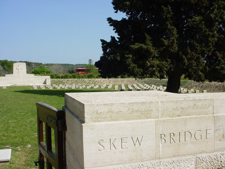
Skew Bridge Cemetery
- Country Turkey (including Gallipoli)
- Total identified casualties 257 Find these casualties
- Identified casualties from First World War
- GPS Coordinates Latitude: 40.05973, Longitude: 26.19982
Location information
Follow the road to Helles, opposite the Kabatepe Museum. After 14.2 km's, take a right turn at the 'T' junction and after 14.3 km's take the left fork. After a total of 25.2 km's, the cemetery will be found on the right, down a short track. It is also 2 km's north-east of Sedd-el-Bahr, between the road to Krithia and Kilid.
Visiting information
The Cemetery is permanently open and may be visited at any time.
Please note that in the absence of a cemetery register, visitors are advised to locate the Grave/Memorial reference before visiting. This information can be found in the CASUALTY RECORDS within this page.
For further information and enquiries please contact enquiries@cwgc.org
History information
The eight month campaign in Gallipoli was fought by Commonwealth and French forces in an attempt to force Turkey out of the war, to relieve the deadlock of the Western Front in France and Belgium, and to open a supply route to Russia through the Dardanelles and the Black Sea.
The Allies landed on the peninsula on 25-26 April 1915; the 29th Division at Cape Helles in the south and the Australian and New Zealand Corps north of Gaba Tepe on the west coast, an area soon known as Anzac.
On 28 April, following the landings at Helles, the first attack was mounted towards Achi Baba, the ridge which dominates the southern part of the peninsula. Fatigue, however, brought the assault to a halt some kilometres short of the objective, near the village of Krithia. Turkish counter attacks followed but were repulsed and during the period 6-8 May, the 29th and French Divisions, reinforced by the 2nd Australian and New Zealand Infantry Brigades, carried out a renewed attack on Krithia, making some gains but suffering heavy casualties.
Between 1 May and the beginning of June, the 29th Indian Infantry Brigade and 42nd (East Lancashire) Division landed on the peninsula. With these reinforcements, the Allied force at Helles pushed forward once more on 4 June, but again to little effect. A further attack between 28 June and 5 July at Gully Ravine inflicted heavy casualties on the Turkish forces, but despite local gains - at one point the line was pushed forward more than a kilometre - there was no breakthrough. By 13 July the advance at Helles was effectively over and the position remained unchanged until the evacuation in January 1916.
Skew Bridge Cemetery was named from a wooden "skew" bridge carrying the Krithia road across the Dere, just behind the centre of the line occupied by the Allied forces on 27 April 1915. It was begun during the fighting of 6-8 May and used throughout the occupation. At the Armistice it contained only 53 graves (Plot I, less Row E), but was greatly enlarged when further burials were brought in from the battlefields and from the following smaller cemeteries:- Orchard Gully, R.N.D., Backhouse Post and Romanos Well.
There are now 607 First World War servicemen buried or commemorated in this cemetery. 351 of the burials are unidentified but special memorials commemorate a number of casualties known or believed to be buried among them.
The cemetery covers an area of 2,210 square metres.


