Vimy Memorial
- Country France
- Total identified casualties 11232 Find these casualties
- Region Pas de Calais
- Identified casualties from First World War
- GPS Coordinates Latitude: 50.3795, Longitude: 2.77385
Location information
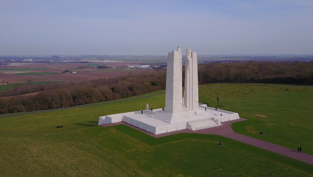
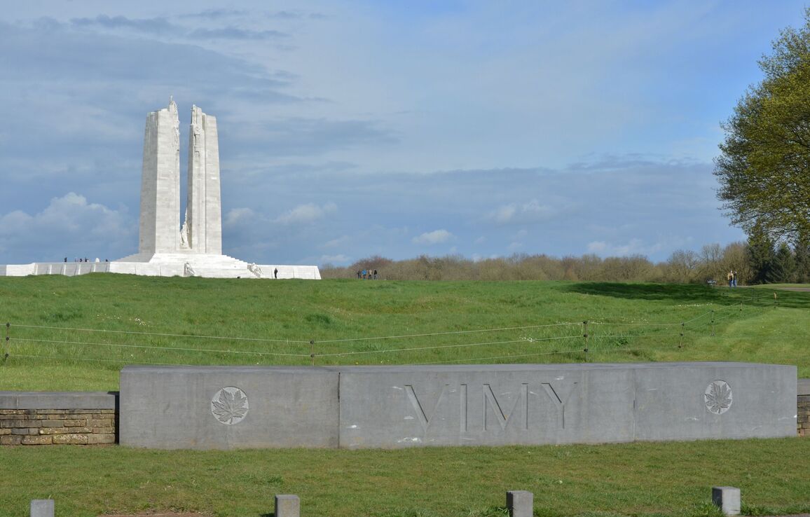
The Vimy Memorial overlooks the Douai Plain from the highest point of Vimy Ridge, about eight kilometres northeast of Arras on the N17 towards Lens. The memorial is signposted from this road to the left, just before you enter the village of Vimy from the south. The memorial itself is someway inside the memorial park, but again it is well signposted.
Visiting information
The Canadian National Vimy Memorial site is accessible to visitors year-round. Site activities, interpretive services and student guides are available when the Visitor Education Centre is open. Tunnel and trench tours take place every 30 minutes from the opening of the Visitor Education Centre until 30 minutes before closing. For further information, please visit the Veterans Affairs Canada website: https://www.veterans.gc.ca/en/remembrance/memorials/overseas/canadian-national-vimy-memorial
History information
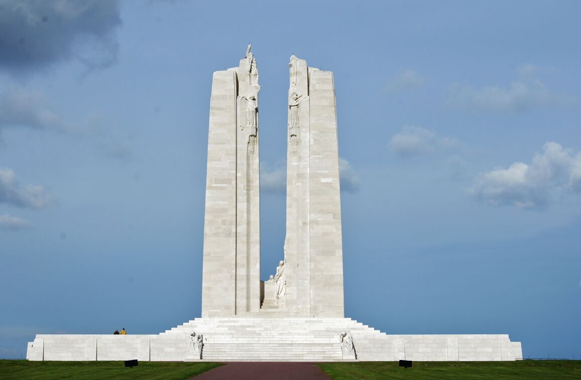
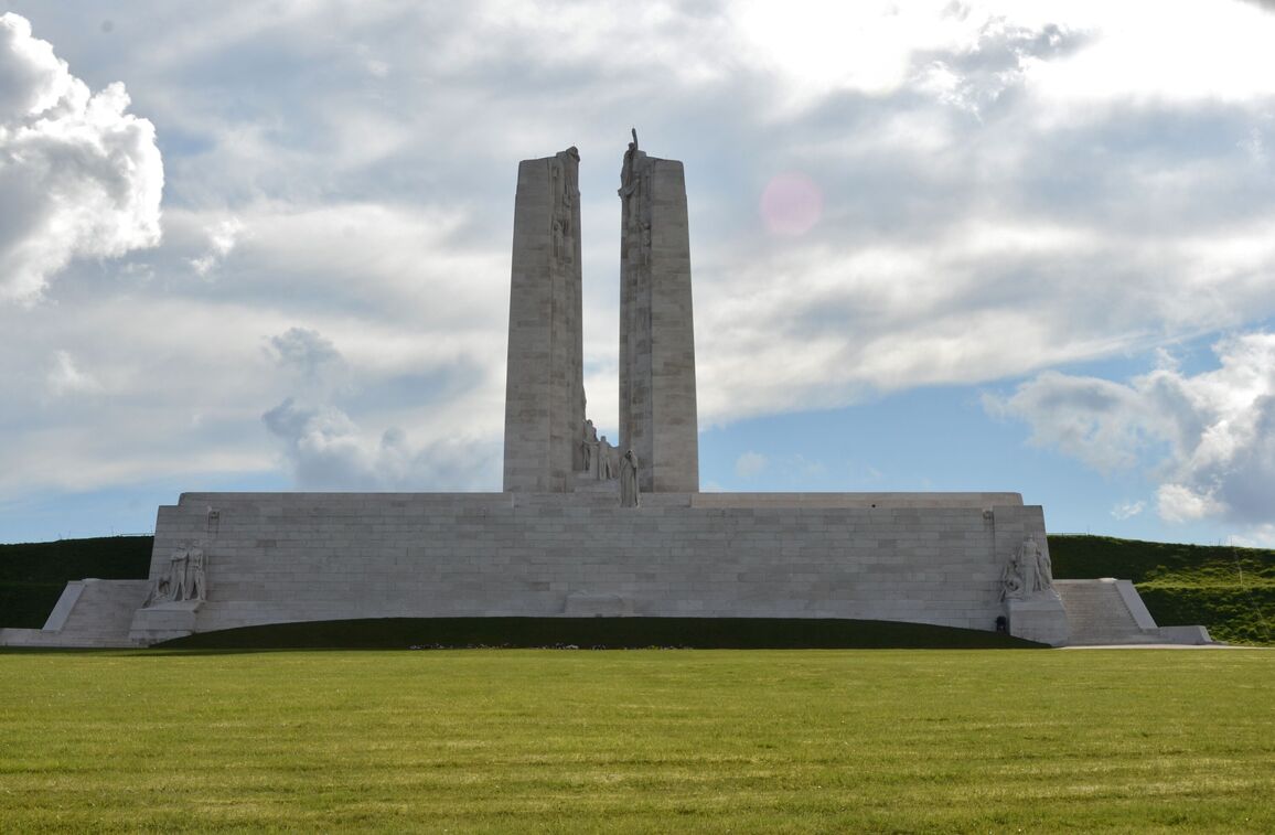
On the opening day of the Battle of Arras, 9 April 1917, the four divisions of the Canadian Corps, fighting side by side for the first time, scored a huge tactical victory in the capture of the 60 metre high Vimy Ridge.
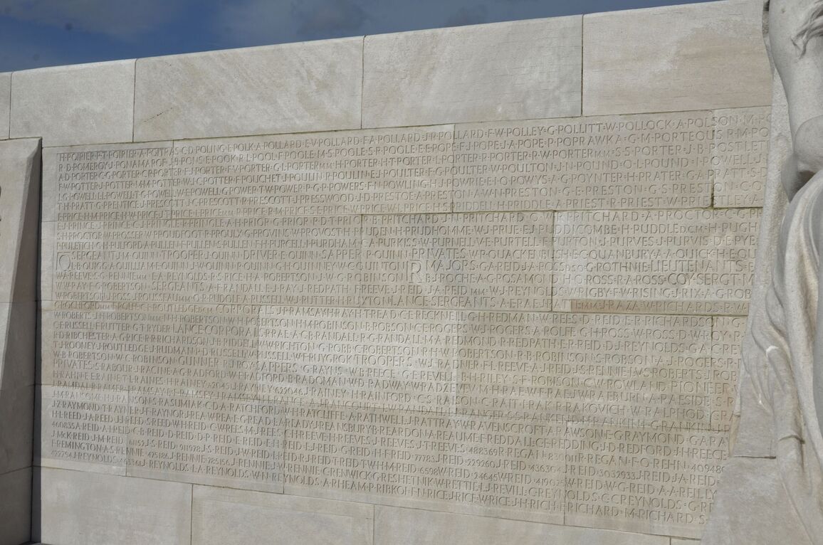
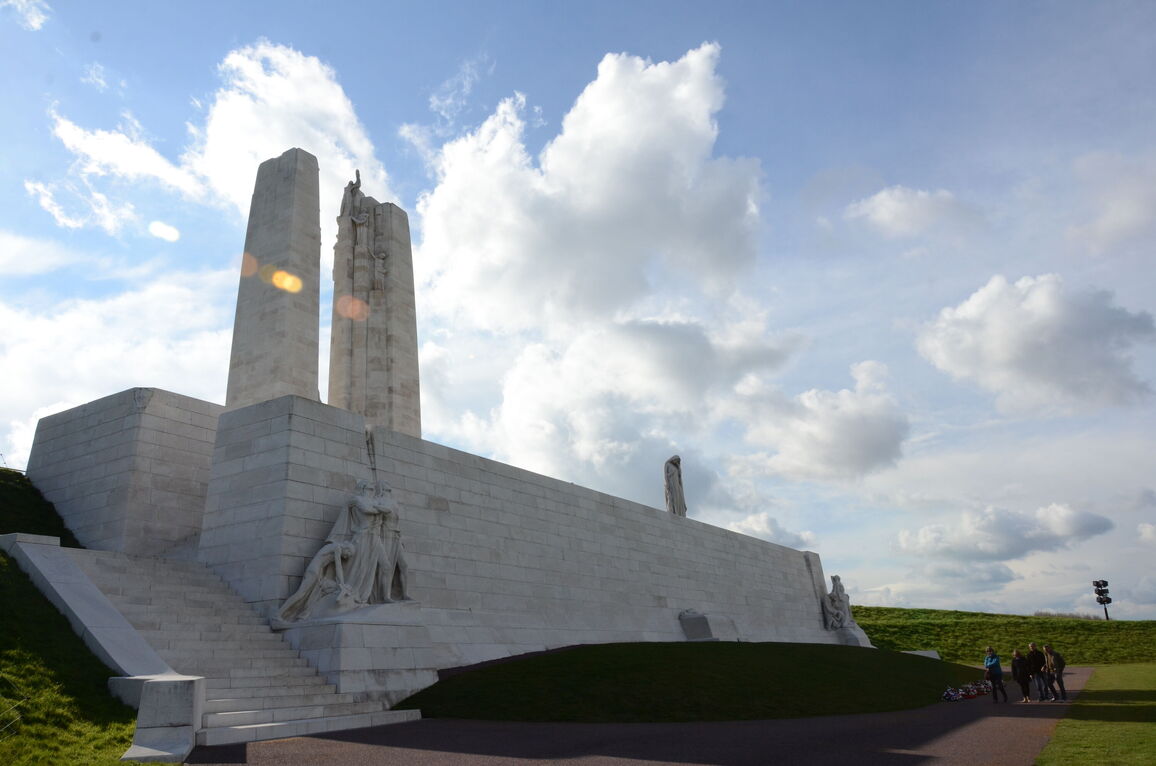
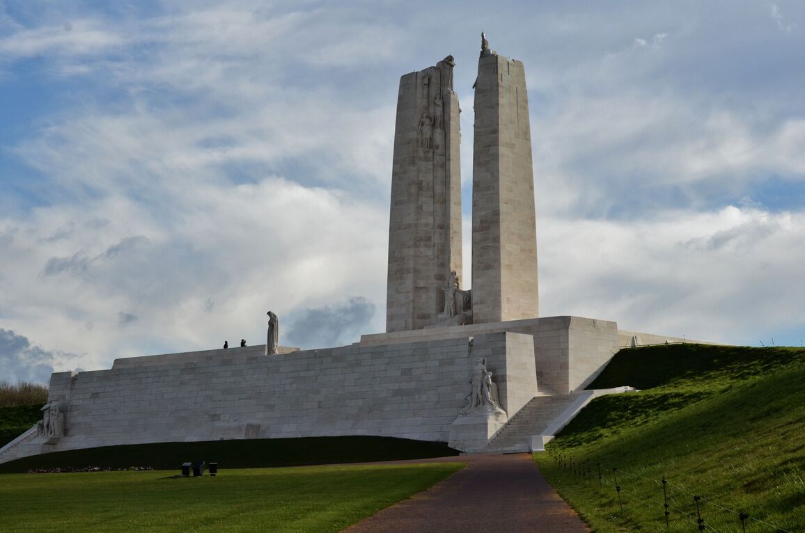
After the war, the highest point of the ridge was chosen as the site of the great memorial to all Canadians who served their country in battle during the First World War, and particularly to the 60,000 who gave their lives in France. It also bears the names of 11,000 Canadian servicemen who died in France - many of them in the fight for Vimy Ridge - who have no known grave.
The memorial was designed by W.S. Allward. It was unveiled by King Edward VIII on 26 July 1936.
The Canadian Government view this memorial as an historic structure and their approach to conservation entails maintaining the exact original design and inscription. Actual engraved casualty data may therefore be incorrect - the CWGC Database is the source for the correct details and official place of commemoration for all Canadian casualties.