Gunners Farm Military Cemetery
- Country Belgium
- Total identified casualties 177 Find these casualties
- Region Hainaut
- Identified casualties from First World War
- GPS Coordinates Latitude: 50.71816, Longitude: 2.89646
Location information
Gunners Farm Military Cemetery is located 16 km from Ieper town centre, on a road leading from the N365, connecting Ieper to Wijtschate, Ploegsteert and on to Armentieres. From Ieper town centre the Rijselsestraat runs from the market square, through the Lille Gate (Rijselpoort) and directly over the crossroads with the Ieper ring road. The road name then changes to the Rijselseweg. 2 km after passing through the village of Ploegsteert lies the left hand turning onto Witteweg (Chemin de la Blanche). The cemetery lies 1km along the Witteweg on the left hand side of the road.
Visiting information
ARRIVAL
The cemetery is located situated in agricultural fields close to a residential area and approximately 500 metres from Calvaire Essex Military cemetery.
PARKING
Parking is to the front of the cemetery along the verge (Chemin de la Blanche), on a narrow cobblestone area with space for up to 3 vehicles. The road is paved.
Alternatively, parking is available on the opposite side of the main road across from the entrance. The ground surface on the opposite side of the road is compacted gravel.
ACCESS LAYOUT AND MAIN ENTRANCE
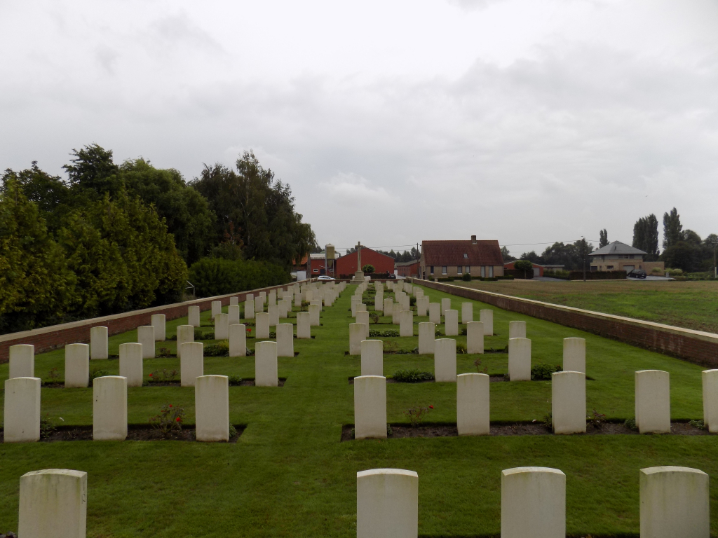
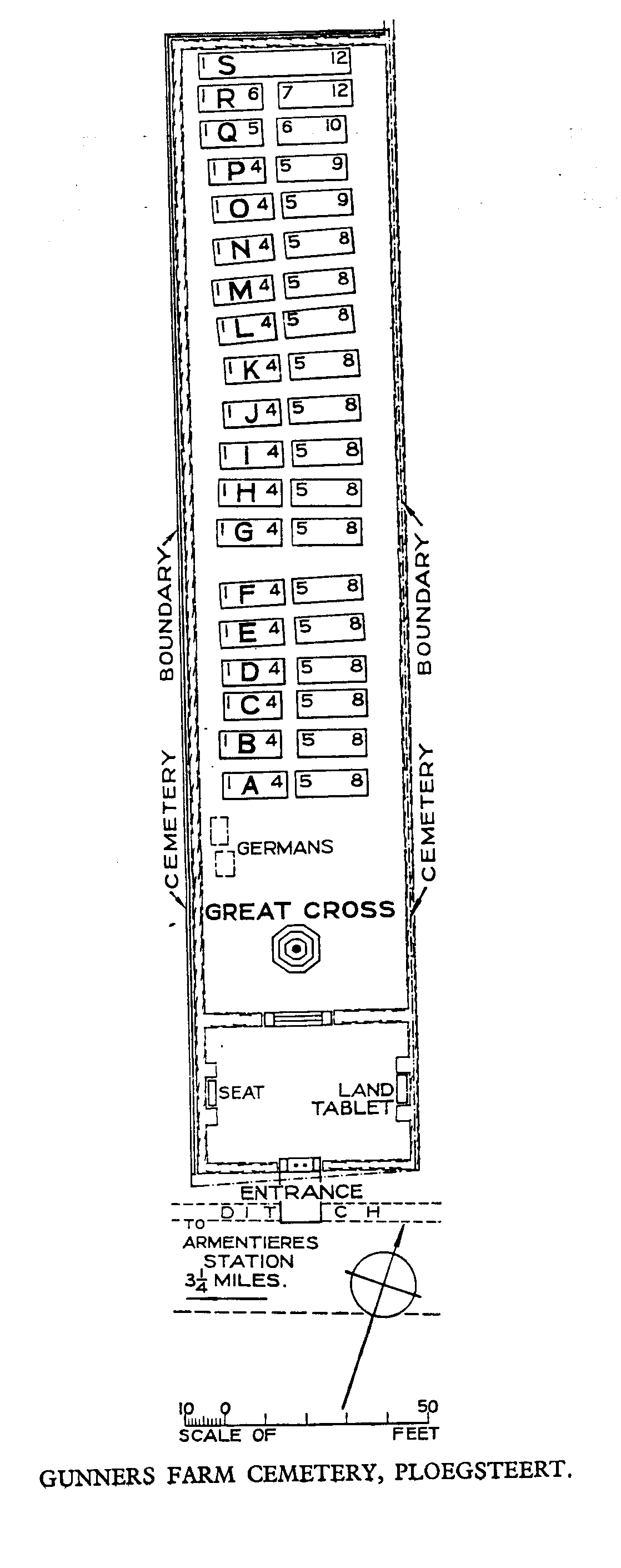
The long narrow rectangular cemetery is on 2 levels separated by sloping grass on either side of steps leading upward.
The main entrance consists of a gap in the cemetery entrance wall containing white stone bollards. The gap between the stone bollards is 90 centimetres. Stone paving surrounds and internal brick pathway leading to the entrance. The paving at the entrance is raised on either side, sloping down to a level entrance between the bollards. Entry into the cemetery is to the left and right once through the bollards, with a stone wall immediately in front. There is a clear opening of 60 centimetres between the entrance pillars and the stone wall. There is a dirt strip, 75 to 150 mm wide between the paving and the grass inside the cemetery. The dirt strip is approximately 25 mm lower than the grass.
The Register Box is mounted into this wall.
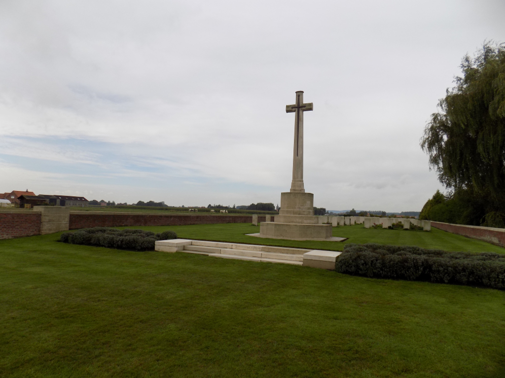
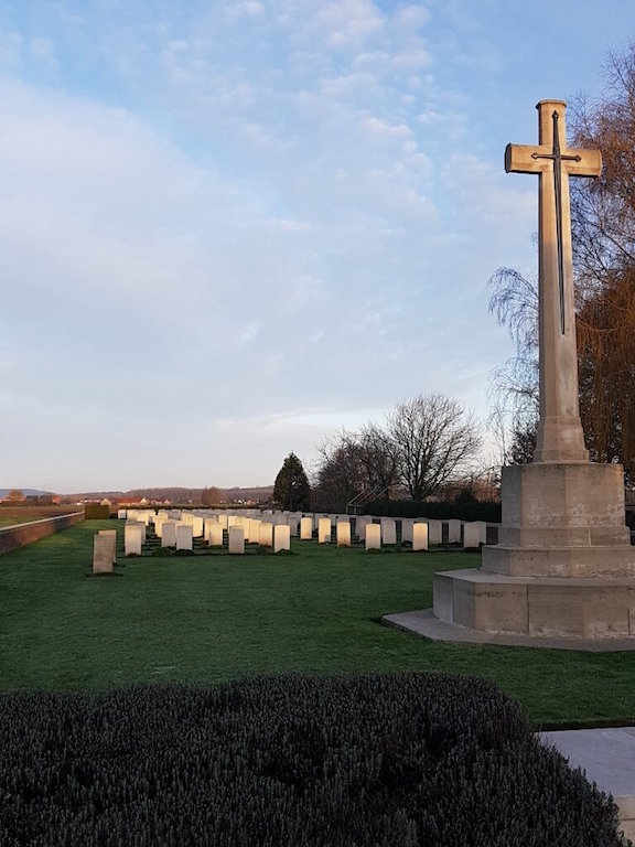
There are 3 stone steps in front of the Cross of Sacrifice with sloping grass on either side.
The Cross of Sacrifice is in the centre of the cemetery, close to the main entrance.
There are stone bench seating areas on either side of the cemetery, just in front of the steps leading up to the Cross of Sacrifice.
All the internal paths are grass, the ground is flat and firm.
ALTERNATIVE ACCESS
There is no alternative access into the cemetery.
ADDITIONAL INFORMATION
The cemetery is permanently open.
History information
Gunners Farm Cemetery took its name from a farm which stood on the opposite side of the road and is an example of a regimental cemetery, many of which were made in 1914 and 1915.
The cemetery was begun in July 1915 by the 9th Essex and 7th Suffolk Regiments (Rows A to C), carried on by the 9th Loyal North Lancashire Regiment and the 11th Lancashire Fusiliers (Rows D to J), and the 9th (Scottish) Division (Rows J to Q). Apart from a small number of later burials, the cemetery was completed by service battalions of the Royal West Kent and Queen's Royal West Surrey Regiments in May and June 1916. It was in German hands from 10 April to 29 September 1918.
There are now 175 Commonwealth burials of the First World War and four German war graves in the cemetery.
The cemetery was designed by G H Goldsmith.