Calvaire (Essex) Military Cemetery
- Country Belgium
- Total identified casualties 218 Find these casualties
- Region Hainaut
- Identified casualties from First World War
- GPS Coordinates Latitude: 50.71878, Longitude: 2.89843
Location information
Calvaire (Essex) Military Cemetery is located 16 km from Ieper town centre, on a road leading from the N365, connecting Ieper to Wijtschate, Ploegsteert and on to Armentieres.
From Ieper town centre the Rijselsestraat runs from the market square, through the Lille Gate (Rijselpoort) and directly over the crossroads with the Ieper ring road. The road name then changes to the Rijselseweg. 2 km after passing through the village of Ploegsteert lies the left hand turning onto Witteweg (Chemin de la Blanche). The cemetery lies 2 km along the Witteweg on the right hand side of the road.
Visiting information
ARRIVAL
There is no signpost for the cemetery.
PARKING
Parking is to the front of the cemetery in the layby on the main road (Chemin de la Blanche)
There is space for up to four vehicles on either side of the main entrance.
The ground is flat and firm, with the surface gravel and compacted soil.
ACCESS LAYOUT AND MAIN ENTRANCE
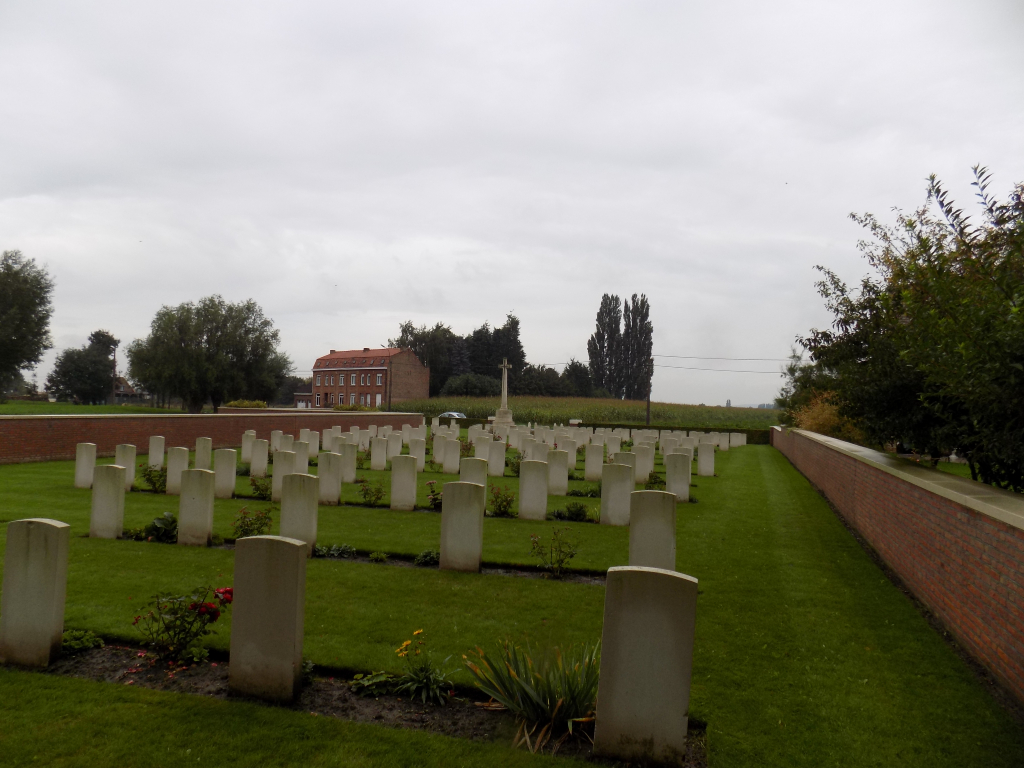
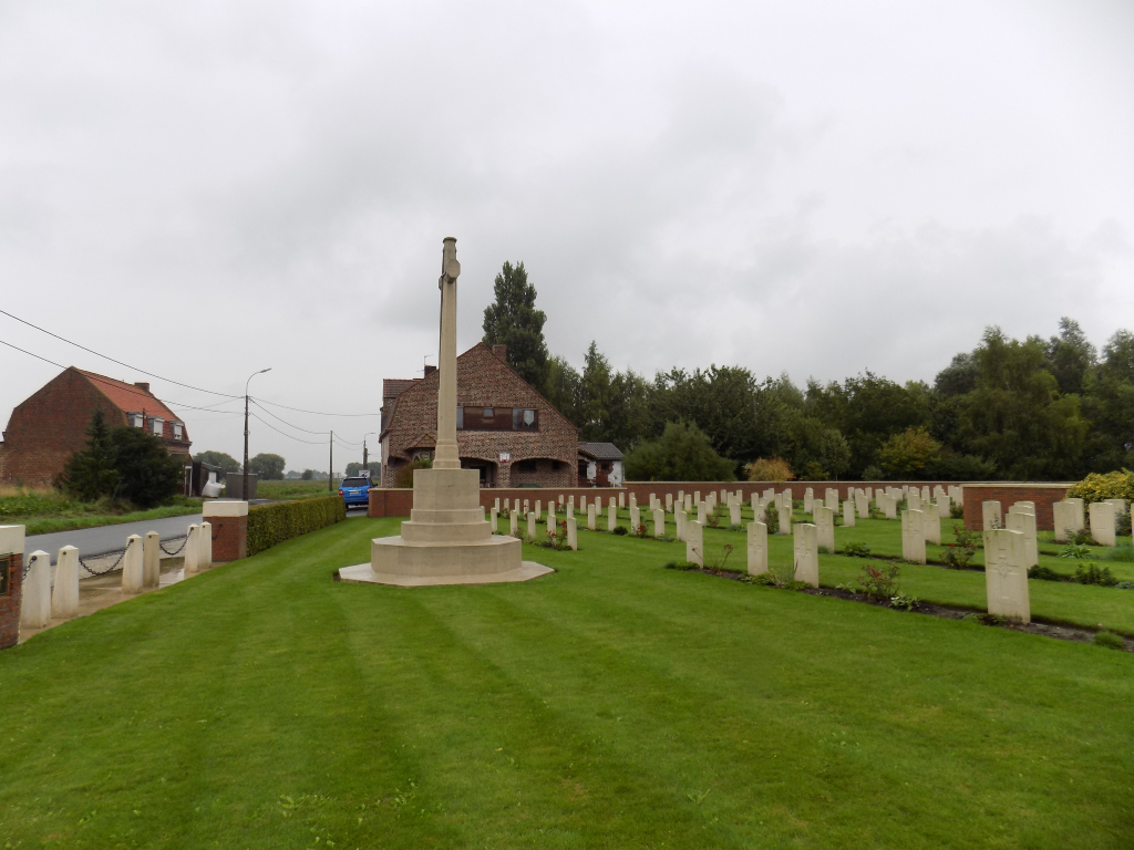
The cemetery is L-shaped with a hedge along the road-side of the cemetery and a brick boundary wall along the rest of the cemetery edges.
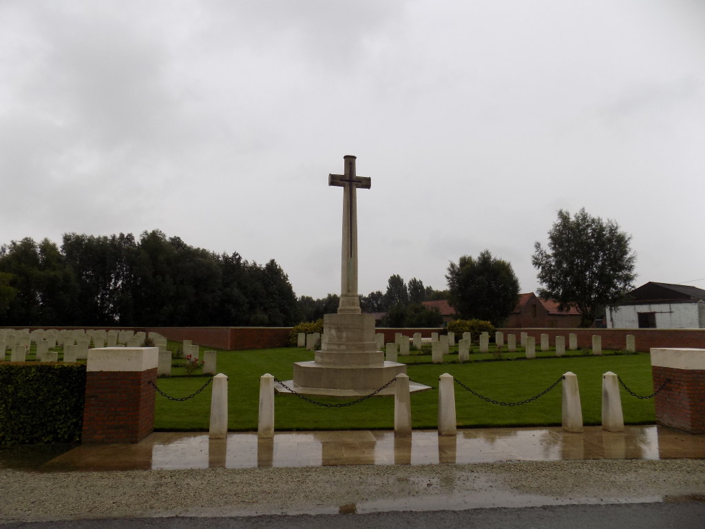
There are 6 white stone bollards at the main entrance with gaps of 175 centimetres each between the two central sets of pillars and 70 cm between the brick entrance pillars and bollards.
Across each gap is a black metal chain hooked from the right-hand bollard for opening on left side of the entrance and on the left-hand bollard for the opening on the right side of the entrance. There is stone paving level with the gravel layby and with the grass inside the cemetery,
The Cross of Sacrifice is immediately inside the cemetery.
There are stone bench seating areas on both sides of the cemetery.
The Register Box is built into the right-hand pillar at the main gate, inside the cemetery.
There is no seating in the cemetery.
All internal paths are grass, the ground is flat and firm.
ALTERNATIVE ACCESS
On the left side of the cemetery at the end of the layby is an opening between the hedge and the boundary wall of the cemetery, with an opening of one metre. There is no level difference between the layby and the grass.
The ground is flat and firm with grass throughout.
ADDITIONAL INFORMATION
The cemetery is permanently open.
History information
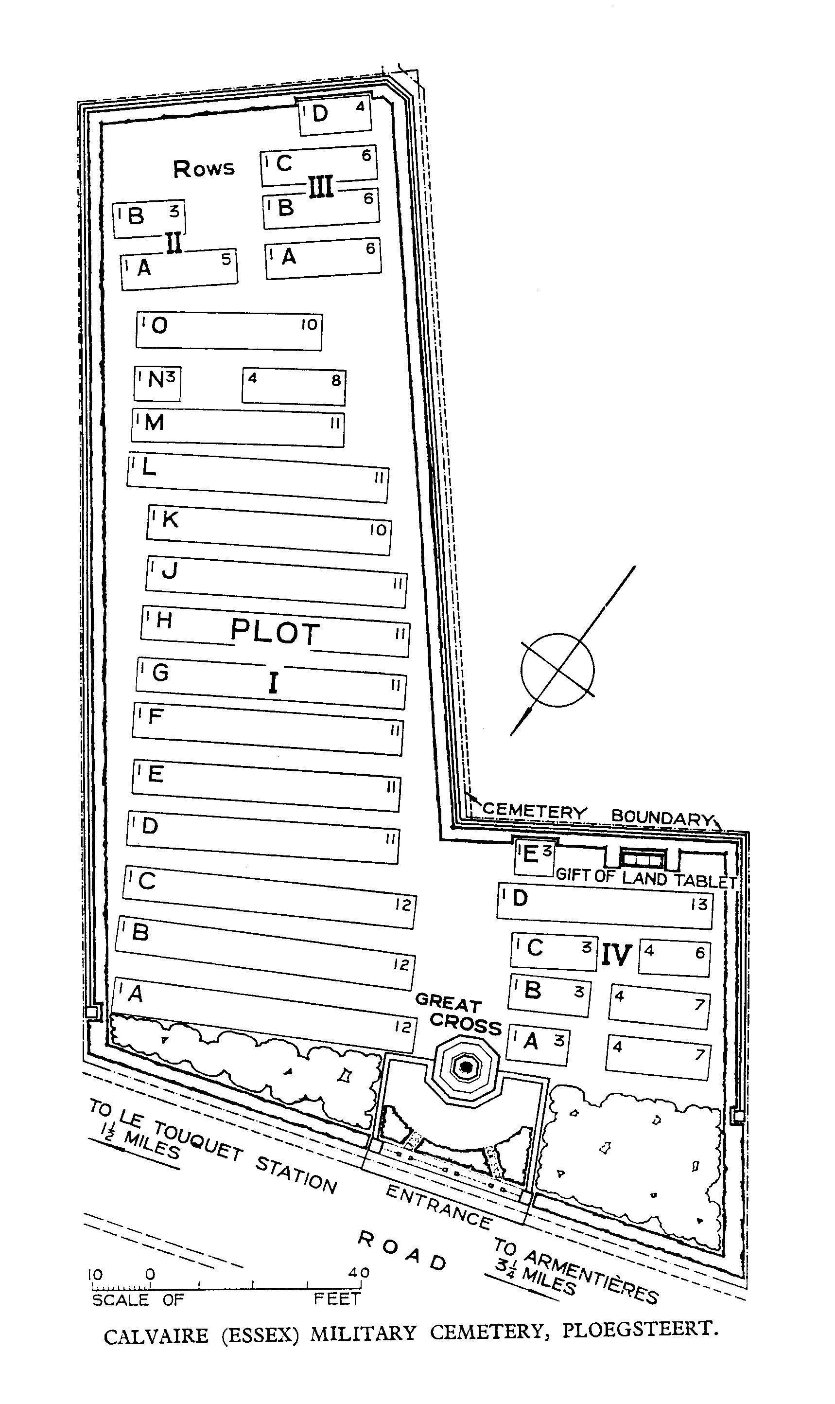
This cemetery was established beside a building known as Essex House and is an example of a regimental cemetery, many of which were made in 1914 and 1915.
It was begun in November 1914 by the 2nd Essex and 2nd Monmouthshire Regiments (Rows A to M of Plot I), continued by the 9th Royal Fusiliers and the 11th Middlesex Regiment (Plot I, Row 0), the 7th Suffolk and 9th Essex Regiments (Plot II), the 6th Buffs (Plot III), and the 1/7th and 1/8th Worcestershire Regiment (Plot IV, Rows A to C). Apart from two later burials, the cemetery was completed by the 11th Queen's Royal West Surrey and 10th Royal West Kent Regiments in June and July 1916. It was in German hands from 10 April to 29 September 1918.
There are now 218 First World War burials in the cemetery.
The cemetery was designed by G H Goldsmith.