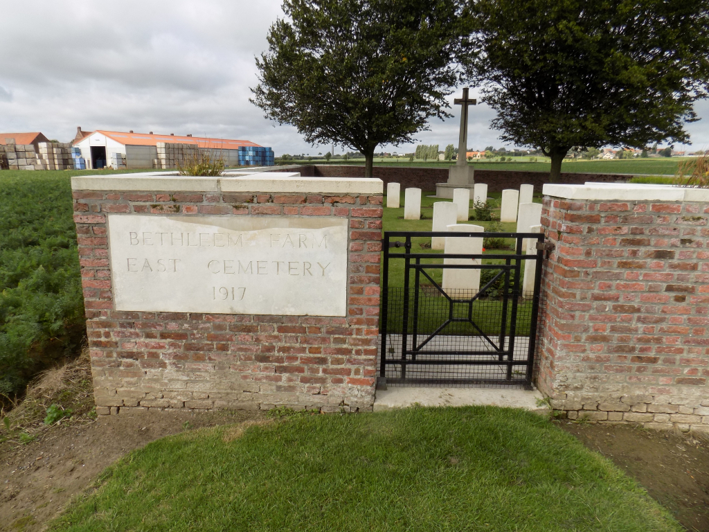
Bethleem Farm East Cemetery
- Country Belgium
- Total identified casualties 37 Find these casualties
- Region West-Vlaanderen
- Identified casualties from First World War
- GPS Coordinates Latitude: 50.76081, Longitude: 2.91151
Location information
Bethleem Farm East cemetery is located 10 Km south of Ieper town centre and 1 km south east of Mesen, on a road called the Rijselstraat, which leads from Mesen market square. (Mesen itself is located 10 Km from Ieper via the N365 connecting Ieper to Armentieres).
The cemetery lies 1 Km beyond Mesen market place along the Rijselstraat, on the left hand side of the road. Visitors to this site should note a 250 metre grassed access path which is unsuitable for vehicles.
Visiting information
ARRIVAL
The route to the cemetery is signposted.
A single lane track branches off the side of a main road (Rijselstraat) and leads to a single lane track through fields. At the end of this track is a grass track that leads to the cemetery entrance.
PARKING
Parking is to the side of the single lane farm track.
The parking area is in a turning/passing area approximately 100 metres from the main road, there is space for 1 vehicle. The ground is compacted earth and will be muddy and uneven in wet weather.
The parking area is 155 metres from the main entrance of the cemetery.
ACCESS LAYOUT AND MAIN ENTRANCE
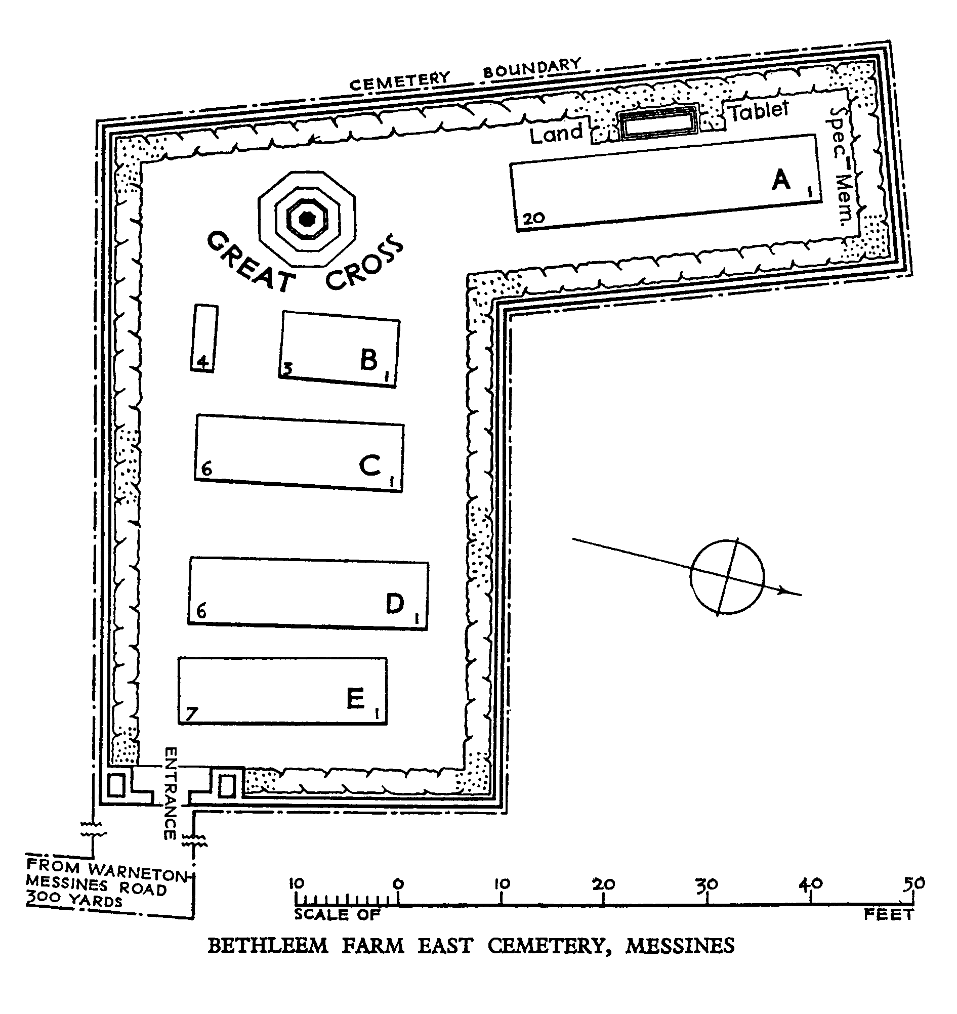
Access to the cemetery is at the end of a single lane farm track. The cemetery is L-shaped and surrounded by a 1 metre high brick wall.
There is a mid-level (thigh height), black, latched metal gate that is 900 mm wide in the perimeter wall of the cemetery. There is paving level with the grass on either side underneath the gate, which opens inwards into the cemetery.
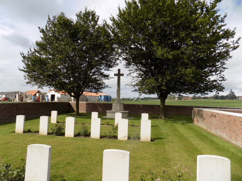
The Cross of Sacrifice is at the rear of the cemetery.
There is no Register Box at the site.
All the internal paths are grass, the ground is level and mostly firm.
ALTERNATIVE ACCESS
There is no alternative access into the cemetery.
ADDITIONAL INFORMATION
Due to the location in agricultural fields and ground conditions, access to the cemetery can be difficult during and after periods of heavy rainfall.
The cemetery is permanently open.
History information
Bethleem Farm East Cemetery was made by Australian units when the nearby Bethleem Farm was captured by the 3rd Australian Division on 7 June 1917, in the Battle of Messines. The majority of the burials are those of officers and men killed in action on 8 or 10 June, though the cemetery continued to be used until the following September. There is also a West Cemetery nearby.
There are 44 servicemen of the First World War buried or commemorated in the cemetery. Eight of the burials are unidentified but a special memorial commemorates one casualty know to be buried among them.
The cemetery was designed by G H Goldsmith.