

17 August 2026
The Ultimate Self-Guided One-Day Tour of the Somme Battlefields
The Somme is a landscape mixed with tragedy and beauty. It still bears the scars of the infamous battle, fought here at enormous cost over a century ago.
Today, the Somme is also one of the busiest former battlefields of the Great War. A picturesque mix of rolling farmland, gentle river valleys, and charming towns and villages is dotted with the remains of trenches, bunkers, and strong points.
Then there are the Commonwealth War Graves Commission cemeteries and memorials on the Somme. Hundreds of locations hold CWGC war graves or commemorations across the region, from purpose-built war cemeteries to memorials to the missing and individual graves in local churchyards or burial grounds.
Looking to visit The Somme and need inspiration? CWGC Senior Interpretation and Visitor Experience Manager Max Dutton showcases the ultimate one-day self-guided tour of the Somme Battlefields.
At a glance: What's on this page:
This page offers a one-day tour of the Somme battlefields and CWGC cemeteries and memorials, including:
- Historic background to the Battle of the Somme
- How to plan your visit and visit CWGC sites respectfully
- Trail routes that cover the Somme sector
- Why Somme battlefield visits matter
A journey through the Somme battlefields
The peaceful fields of the Somme conceal one of the defining battlefields of the First World War. Between July and November 1916, soldiers from Britain, France, Germany and across the British Empire fought across this landscape. The offensive lasted nearly five months and drew in millions of servicemen from around the world.
This one-day self-guided Somme battlefield tour begins in the northern sector of the British line on 1 July 1916.
From Serre, it travels south through Beaumont-Hamel, Thiepval and La Boisselle before crossing the ground over which the fighting continued during the summer and autumn of 1916. The journey ends close to the furthest extent of the British advance at the Butte de Warlencourt.
It is an ambitious day, but it offers an exceptional introduction to the Battle of the Somme, its changing landscape and the cemeteries and memorials in which its human cost is recorded.
Before you begin: travelling safely on the Somme
The Somme is a rural landscape of working farms, narrow roads, small villages and isolated cemeteries.
Mobile reception can be inconsistent, so download your maps and the what3words app before setting out. Enter the three-word address exactly as shown, including the full stops between each word.
For a safe and respectful visit:
- Use designated parking spaces wherever available and never block farm entrances, tracks or private driveways.
- Drive cautiously on narrow roads, particularly around blind corners and when passing agricultural vehicles.
- Do not stop on road verges unless it is clearly safe and legal to do so.
- Wear sturdy, weather-appropriate footwear. Paths, grass and field edges can become slippery or muddy.
- Remain on recognised paths and within publicly accessible areas.
- Never enter cultivated fields or climb over fences.
- Do not touch or collect metal objects, ammunition or other material found on the ground.
- Unexploded wartime ordnance is still occasionally uncovered in the region.
- Take water, sun protection and waterproof clothing, as facilities between the principal sites are limited.
- Check the opening arrangements for staffed visitor sites before travelling.
- Allow additional time for reflection. These are cemeteries, memorials and places of remembrance rather than conventional tourist attractions.
This itinerary involves considerable walking as well as driving. The suggested schedule is deliberately structured to help you complete the route, but opening hours, access conditions and weather may affect what is possible.
Stop 1: Serre and Sheffield Memorial Park
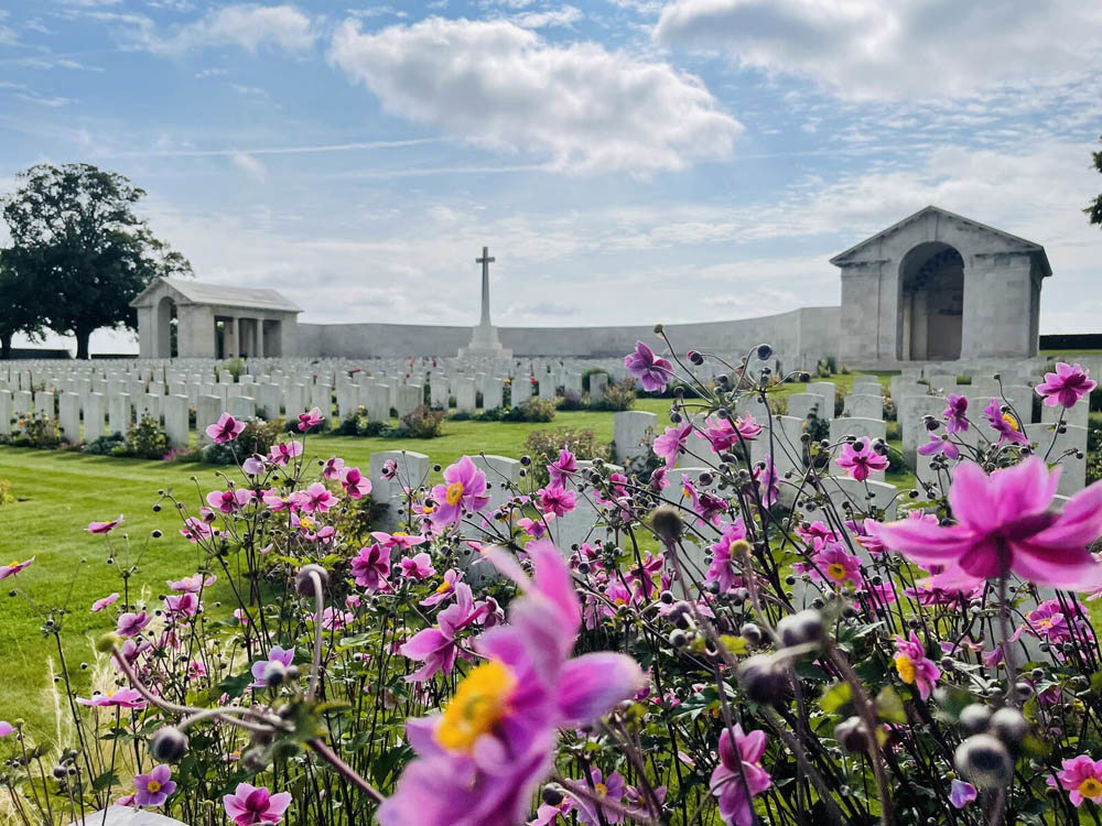
Image: Serre Road Cemetery No.2 in bloom
- Suggested visit: 35 to 45 minutes
- Park at Serre Road Cemetery No. 1: ///backward.claps.godfather
- Walk to Sheffield Memorial Park: ///nightcap.rods.reinvention
Begin at Serre, at the northern end of the British attack on 1 July 1916. This is an ideal place to understand how the apparent simplicity of an open agricultural landscape could conceal an immensely strong defensive system.
The British front line ran through this area, facing German positions around the village of Serre. Units of the 31st Division attacked here on 1 July.
Many attacking soldiers had enlisted together in Pals Battalions and came from the same towns, workplaces and communities. Their shared identities gave the formations great cohesion, but also meant that battlefield losses could have a devastating effect on individual communities at home.
Walk towards Sheffield Memorial Park and pause to study the ground. Look at the distance between the British and German positions, the exposed slopes and the limited cover available to soldiers advancing across them.
The surviving landscape helps explain why apparently short distances proved so difficult and costly to cross.
The Serre area now contains several Commonwealth war cemeteries. Serre Road Cemetery No. 2, nearby, is the largest CWGC cemetery on the Somme and contains the graves of more than 7,000 servicemen.
Stop 2: Beaumont-Hamel, the Sunken Road and Hawthorn Crater
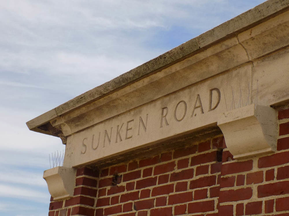
Image: The entrance to Sunken Road Cemetery, Contalmaison, one of two Sunken Road cemeteries in the Somme sector
- Suggested visit: 45 minutes
- Beaumont-Hamel British Cemetery: ///innovators.superficial.flouted
- The Sunken Road: ///attributing.annoys.couch
- Hawthorn Crater: ///armloads.geology.obligated
Continue to Beaumont-Hamel, where the landscape contains some of the most recognisable locations associated with the opening of the Battle of the Somme.
The Sunken Road was used as an advanced assembly position by men of the Lancashire Fusiliers before their attack. Standing within it provides a powerful sense of the restricted view available to the soldiers and the uncertainty they faced before moving into the open.
From here, walk towards Hawthorn Ridge and its surviving mine crater. A large mine was detonated beneath the German position shortly before the main attack began. Rather than simply destroying the defences, the explosion also alerted German troops that an assault was imminent and gave them time to prepare.
Look back across the ground towards the British positions. The contours may appear gentle, but even small rises gave defenders observation and fields of fire across the approaches.
Stop 3: Beaumont-Hamel Newfoundland Memorial
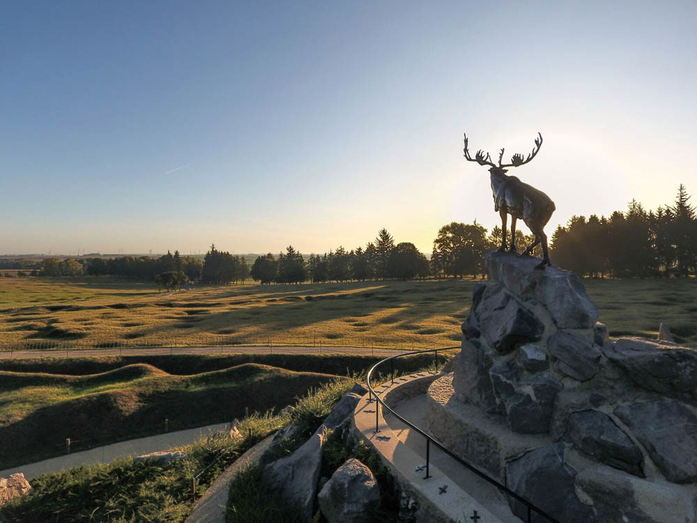
Image: The Caribou, symbolising Newfoundland, looks forlornly over the former Beaumont-Hamel battlefield at the Newfoundland Memorial Park
- Suggested visit: At least 60 minutes
- Entrance: ///handpick.protects.jugs
The Beaumont-Hamel Newfoundland Memorial is one of the most important surviving battlefield landscapes on the Western Front. Its preserved trenches, shell holes and open ground allow visitors to see how the battlefield was organised and how little protection was available once soldiers left their trenches.
On 1 July 1916, the Newfoundland Regiment advanced from this area into intense machine-gun fire. The memorial park commemorates the Newfoundlanders who served and died during the First World War, including those with no known grave whose names appear beneath the bronze caribou memorial.
Begin at the visitor centre if it is open, then follow the marked route through the preserved trench system. From the Caribou Memorial, look across the battlefield towards the German lines. Note the distance the soldiers had to cover and the exposed nature of the approach.
Free guided tours are provided by Canadian student guides, but the site can also be visited independently. Allow at least an hour, as rushing through the park would significantly reduce its impact.
Stop 4: Ulster Memorial Tower
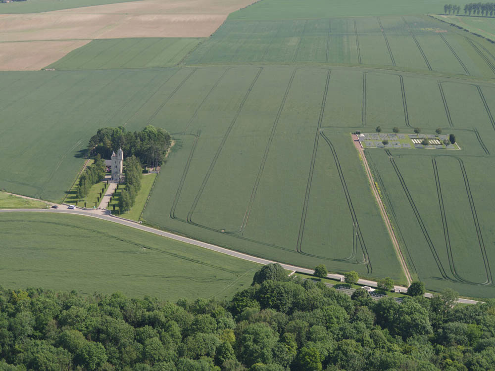
Image: The Ulster Memorial Tower is seen in the bottom left. Notice its close proximity to Mill Road Cemetery
- Suggested visit: 30 minutes, including a refreshment break
- Location: ///monotype.tens.overhear
The Ulster Memorial Tower commemorates the men of the 36th (Ulster) Division and other servicemen from Ulster who died during the First World War. It stands near the position of the formidable Schwaben Redoubt and opposite Thiepval Wood, from which the division advanced on 1 July 1916.
The tower was the first official memorial erected on the Western Front. Dedicated in 1921, its design was based on Helen’s Tower in County Down, close to where many men of the division had trained before leaving for war.
The division advanced deeply into the German positions during its attack but became isolated and was eventually forced back. The view from the area around the tower helps demonstrate both the scale of the advance and the difficulty of holding captured ground without support on either flank.
This is the most convenient planned refreshment and facilities stop on the itinerary. Current access and opening arrangements should be checked before setting out, and at the time of writing, the café at the Ulster Tower is cash only.
Stop 5: Thiepval Memorial to the Missing of the Somme
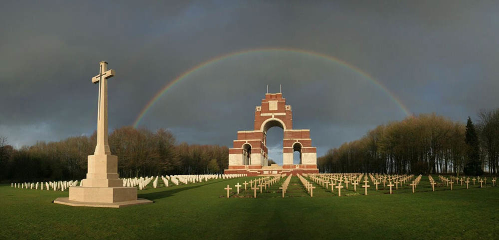
Image: A rainbow shines over Thiepval
- Suggested visit: 45 to 60 minutes
- Memorial and visitor centre: ///paper.ordeals.forts
- View of the former German front line: ///unfair.maritime.unclaimed
The Thiepval Memorial is the largest CWGC memorial to the missing in the world. Its vast arches bear the names of more than 72,000 British and South African servicemen who died on the Somme and who have no known grave.
Beside it, the Anglo-French Cemetery contains equal numbers of Commonwealth and French graves, representing the alliance at the heart of the 1916 offensive.
Designed by Sir Edwin Lutyens, the memorial dominates the surrounding landscape. Its scale becomes most apparent as you walk beneath the interlocking arches and encounter thousands of names arranged by regiment.
After visiting the memorial, walk beyond the Cross of Sacrifice towards the viewpoint indicated above.
From here, you can begin to trace the line of the former German positions and understand the commanding nature of the Thiepval ridge.
This is also an appropriate point at which to consider the difference between a cemetery and a memorial to the missing.
Cemeteries contain burials, while memorials record the names of servicemen whose bodies were never identified or whose graves were subsequently lost.

Want more stories like this delivered directly to your inbox? Sign up for our newsletter for regular updates on the work of Commonwealth War Graves, blogs, event news, and more.
Sign UpStop 6: Lochnagar Crater, La Boisselle
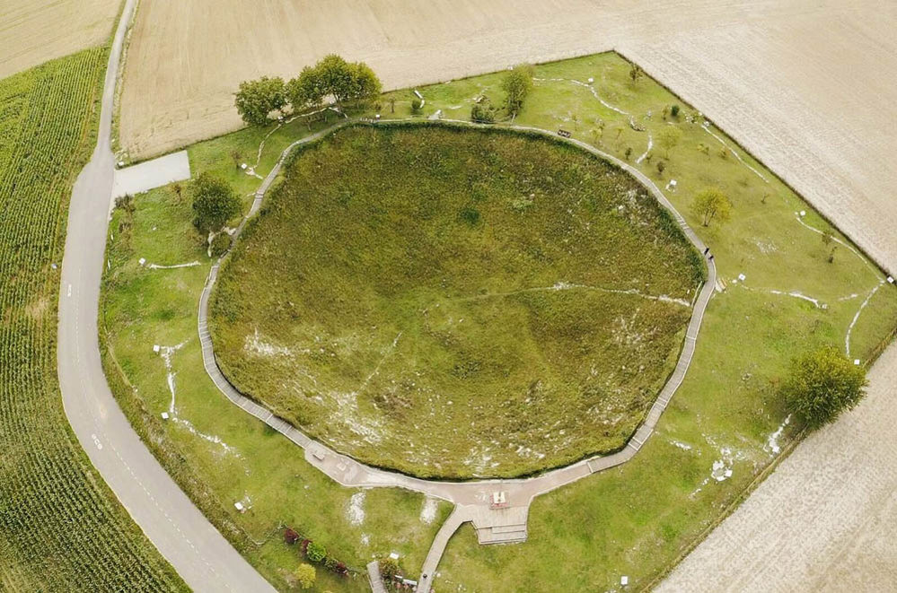
Image: The substantial Lochnagar Crater
- Suggested visit: 30 to 40 minutes
- Location: ///mobster.hazelnut.princesses
Lochnagar Crater is one of the most dramatic surviving physical traces of the Battle of the Somme. It was created when a mine beneath the German positions near La Boisselle was detonated shortly before the infantry assault began on 1 July 1916.
The crater is approximately 100 metres across and 30 metres deep. Its huge scale reflects the extensive underground war fought by specialist tunnelling units beneath the front lines.
Walk around the designated route and look out across the rolling ground towards La Boisselle and the surrounding ridges.
The crater provides an immediate sense of the destructive force released before the attack, but it also illustrates an important truth about the Somme: even immense bombardments and underground explosions could not guarantee that the infantry would break through the German defences.
Lochnagar is privately owned and maintained as a place of remembrance. Remain on the paths and respect any local access instructions.
Stop 7: Devonshire Cemetery
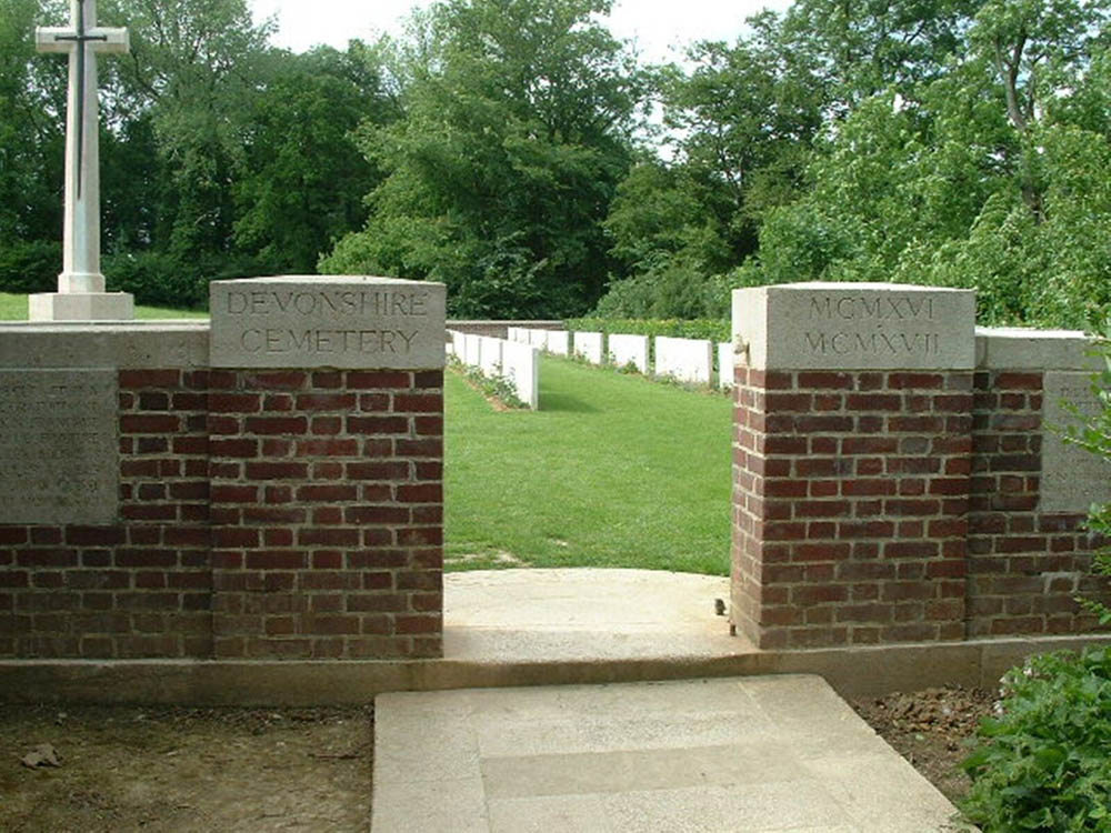
Image: The entrance to Devonshire Cemetery, one of the most moving sites on the Somme
- Suggested visit: 25 to 30 minutes
- Parking and cemetery: ///rewinds.progressive.mingle
Devonshire Cemetery is one of the most intimate and affecting cemeteries on the Somme. It marks the trench from which men of the 8th and 9th Battalions of the Devonshire Regiment attacked towards Mametz on 1 July 1916.
Many of those killed were brought back and buried in their former front-line trench. At the entrance, the stone inscription reads:
“The Devonshires held this trench. The Devonshires hold it still.”
Most of the graves belong to men of the Devonshire Regiment, arranged in two simple rows. Among them is Lieutenant William Noel Hodgson, a soldier and poet who wrote under the name Edward Melbourne. His poem Before Action was published shortly before his death on 1 July 1916.
The simplicity of the cemetery makes the relationship between the battlefield and the burials especially clear. Here, the commemorative landscape sits directly upon the soldiers’ wartime position.
Stop 8: Caterpillar Valley Cemetery and the New Zealand Memorial
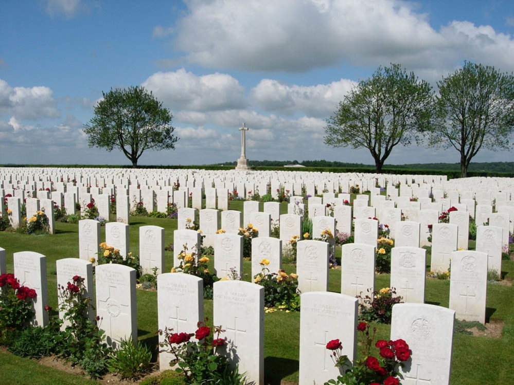
Image: A sunny day at Caterpillar Valley Cemetery
- Suggested visit: 35 to 45 minutes
- Location: ///portrayed.competitions.splinters
Caterpillar Valley Cemetery stands within the landscape of the later Somme fighting. From here, the surrounding woods and high ground help reveal how the battle changed after 1 July.
The opening attack did not end the offensive. For months, Commonwealth forces fought through a succession of villages, ridges, trenches and woods. Progress was often measured in metres, while German counterattacks and artillery fire repeatedly contested any gains.
The cemetery contains more than 5,500 burials and the Caterpillar Valley New Zealand Memorial to the Missing bears the names of 1,200 missing New Zealand servicemen. In 2004, an unidentified New Zealand serviceman was exhumed from the cemetery and reinterred at the National War Memorial in Wellington. His former grave is marked by a special headstone.
From the cemetery, study the horseshoe of woodland around Longueval and the high ground to the east. This was part of the landscape fought over during the prolonged struggle of July, August and September 1916.
Tanks were first used on the Somme on 15 September, introducing a new form of warfare, although their initial battlefield impact was limited.
Stop 9: Delville Wood Cemetery and the South African Memorial
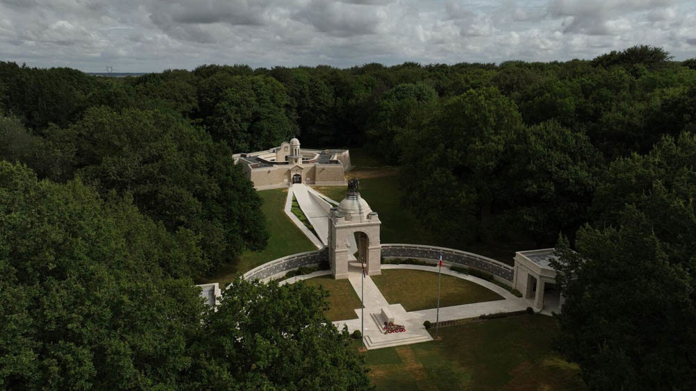
Image: The Delville Wood Memorial nestled in its namesake woods
- Suggested visit: 45 to 60 minutes
- Parking and toilets: ///wools.shade.hello
- Delville Wood Cemetery: ///starlet.gates.tolerating
- South African Memorial: ///directions.unjust.partner
- Woodland walk: ///surveyor.jammer.bamboo
Delville Wood became one of the most fiercely contested places on the Somme. In July 1916, the South African Brigade was ordered to capture and hold the wood as part of the effort to secure Longueval and open the way towards the German positions beyond.
Woodland fighting was especially difficult. Shellfire shattered trees, destroyed landmarks and filled the ground with fallen branches and debris. Trenches were damaged repeatedly, while visibility and communication were severely restricted.
Delville Wood Cemetery was created after the Armistice by bringing together graves from the surrounding battlefield and smaller burial grounds. Designed by Sir Herbert Baker, it contains more than 5,500 burials, many of them unidentified.
Visit the cemetery first, then cross to the South African National Memorial and walk through the reconstructed woodland. The contrast between the quiet forest today and the devastated battlefield of 1916 is central to understanding the site.
Check the posted closing time when you arrive. Do not leave your car in the car park beyond the permitted access period.
Stop 10: The Butte de Warlencourt and Warlencourt British Cemetery

Image: The many headstones of Warlencourt British Cemetery
- Suggested visit: 35 to 45 minutes
- Parking for the Butte: ///couch.hairdresser.debased
- Warlencourt British Cemetery: ///walnut.excuse.tonally
Finish at the Butte de Warlencourt, close to the furthest extent of the British advance during the 1916 Somme offensive.
The Butte is an ancient artificial mound beside the former road towards Bapaume. In the autumn of 1916 it formed part of a heavily defended German position. British forces repeatedly attacked the surrounding trenches, but deteriorating weather, mud, and determined resistance made further progress increasingly difficult.
Warlencourt British Cemetery was constructed on ground associated with some of the final bitter fighting of the offensive. Many of those buried there were recovered from the surrounding battlefield after the war.
From the Butte, reflect on the distance covered since Serre. The route has followed the opening front line and then moved eastwards through the landscape of the subsequent 141-day battle.
The relatively modest geographical advance provides a stark contrast with the immense human effort and loss required to achieve it.
Planning your one-day Somme battlefield driving tour
This route is best undertaken by car. It is deliberately full, so begin early and be prepared to shorten individual visits if daylight, weather or site access requires it.
A practical order is:
- Serre and Sheffield Memorial Park
- Beaumont-Hamel and Hawthorn Crater
- Beaumont-Hamel Newfoundland Memorial
- Ulster Memorial Tower
- Thiepval Memorial
- Lochnagar Crater
- Devonshire Cemetery
- Caterpillar Valley Cemetery
- Delville Wood
- Butte de Warlencourt
The wider Somme Remembrance Trail is a signposted circuit between Albert and Péronne covering preserved battlefield landscapes, museums, cemeteries and memorials. The official trail can be explored by car, bicycle or on foot.
Why visiting The Somme Battlefields matters
A visit to the Somme is not simply a journey between famous battlefield sites.
It is an opportunity to follow the soldiers' experience through the landscape itself: from the trench lines of 1 July, across exposed fields and defended ridges, to the woods and villages fought over during the long months that followed.
The cemeteries and memorials ensure that this vast military history remains rooted in individual lives. Take time to read the names, ages, regiments and personal inscriptions.
Behind every headstone and every name on a memorial is a person whose story forms part of the history of the Somme.
Somme Cemeteries and Memorials - Frequently Asked Questions
Casualties of the Somme who were recovered are commemorated with individual war graves in CWGC cemeteries. If identified, they will have a CWGC headstone bearing their name, regiment, and other pertinent information. If recovered but unidentified, the headstone will bear the inscription "Known unto God".
Casualties with no known war grave, or unidentified casualties in CWGC cemeteries, are commemorated by name on CWGC war memorials across the Somme.
A casualty may have been unidentifiable on recovery or simply never recovered. These are known as "missing" casualties with no known war grave. A casualty with no known war grave will be commemorated by name on an appropriate war memorial.
Somme cemeteries are permanent places of commemoration for the victims of the Battle of the Somme. They help us understand the scale of loss on the Somme, while providing a starting point to better understand commemoration by linking real people and names to places.
CWGC Somme War memorials are the permanent places of commemoration for casualties of the Battle of the Somme with no known war grave. Not only do they provide a physical location for us to commemorate and remember these servicemen, they are a physical reminder of the scale of loss resulting from the Battle of the Somme.
Yes, all of our Somme cemeteries and memorials are open to the public. Use the Find War Dead tool to find them. Read each cemetery page for visiting information, including directions and opening hours.
Author acknowledgements
Written By Max Dutton, CWGC Senior Interpretation and Visitor Experience Manager.
Max has worked for the CWGC since 2014. He began as a researcher and historian and now leads visitor experience and interpretation. Having spent many years exploring the battlefields of the Western Front and beyond, he understands the value of discovering CWGC sites, whether as a first-time visitor or an experienced battlefield explorer.